


A road well-travelled
Cycling along the Christchurch Northern Corridor

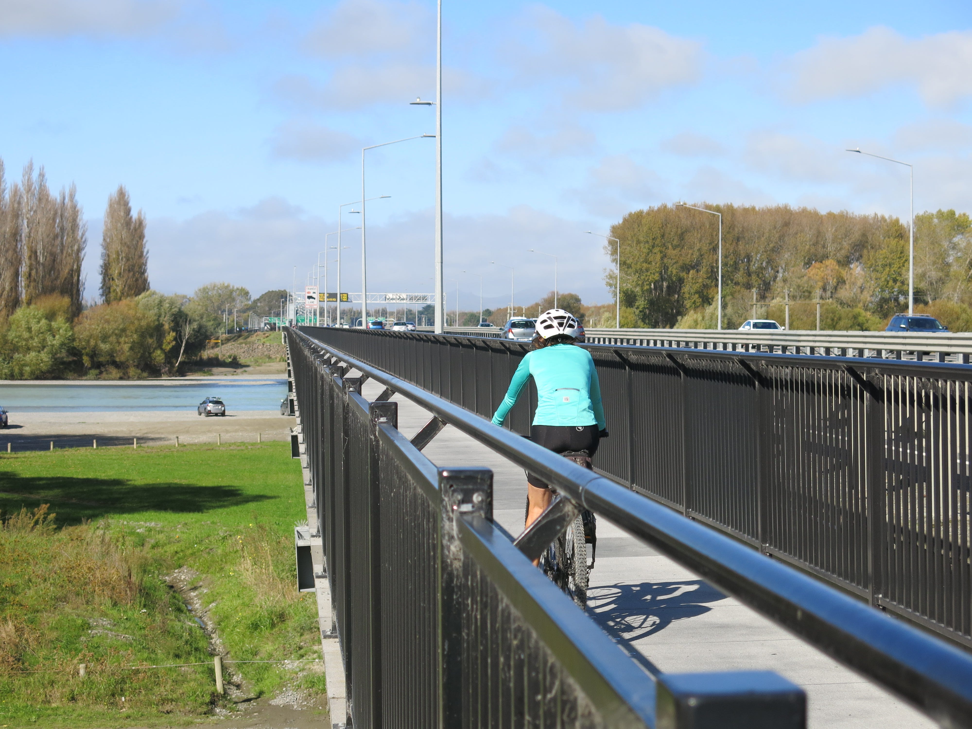
One of the roads I cycle most often is the shared pathway that runs alongside the Christchurch Northern Corridor. The path starts on the edge of the city at Cranford Street and was built at the same time as the motorway was extended (via the Northern Corridor) to speed up traffic heading out of city.
It’s been open since December 2020 and has become my ‘go-to’ for an easy fast-paced training ride or to connect to other rides in northern Christchurch and North Canterbury.
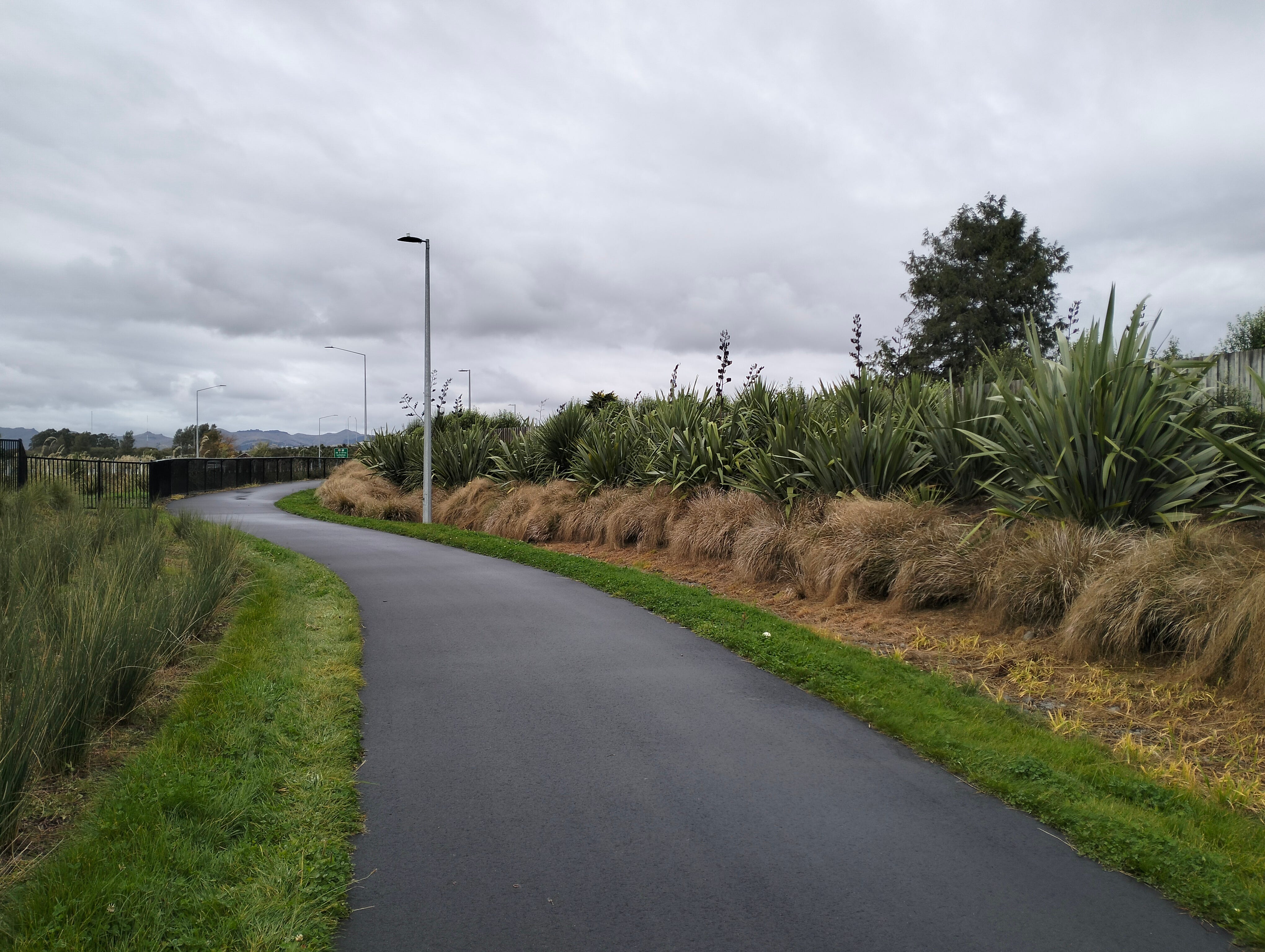
One of things I love about this pathway is that it is smooth tarseal all the way. In post-earthquake Christchurch, it’s rare to find a section of road that hasn’t been patched up (multiple times) and isn’t sporting a fine selection of potholes along with a scattering of gravel, broken glass and other debris. (That’s one of the reasons I stopped riding my narrow-tyred hybrid and will only ride a mountain bike around the city.)
The Northern Corridor pathway, on the other hand, is 12 kilometres of largely uninterrupted and blemish-free paving. There’s a couple of road crossings, but you barely have to pause for those. And there’s no debris. Does someone clean it regularly? I don’t know.
Being a long, smooth and wide pathway, it attracts a range of cyclists. The road cyclists love it for obvious reasons. It’s ideal for a good fast-paced ride.
Part of the pathway skirts behind suburban areas so it’s well used during the week by commuters and school children. It’s also popular with older people going for a midweek ride - alone, in pairs, or in groups. And in the weekends, it attracts families with children on bikes, as well as dog walkers, runners, and an increasing number of people who are new to cycling, often on e-bikes.
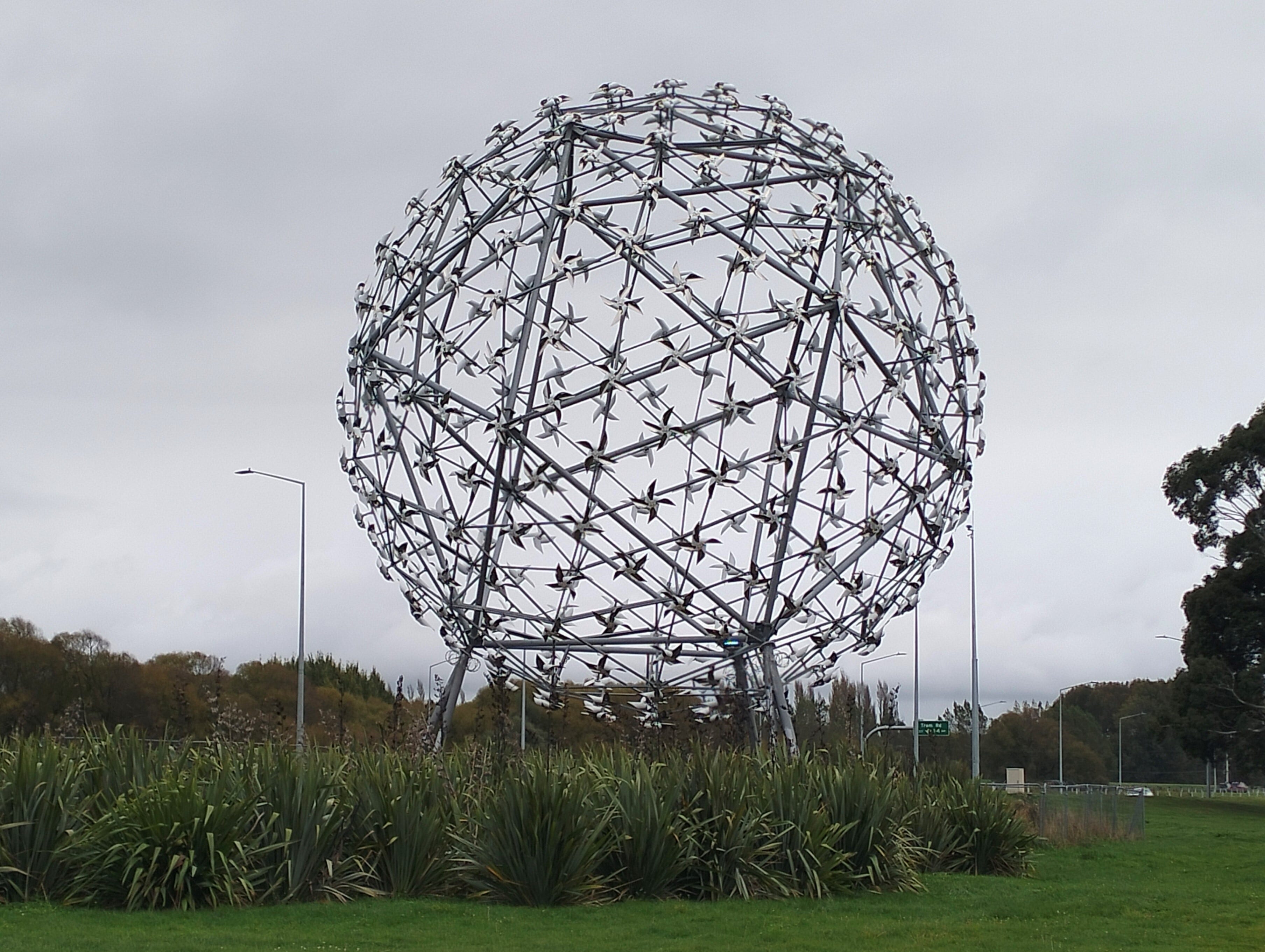
It’s not the most scenic ride around Christchurch (the hills or the river are better for that). But there are some points of interest along the way. It passes by several green spaces, including a football field, a reserve, a cemetery and a wetland. There’s the enormous Neil Dawson sculpture, Fanfare, which consists of lots of little windmills and is lit up in different colours at night. And if you’re out late (or up early), you can check out the rainbow lighting that moves across each of the three motorway overbridges.
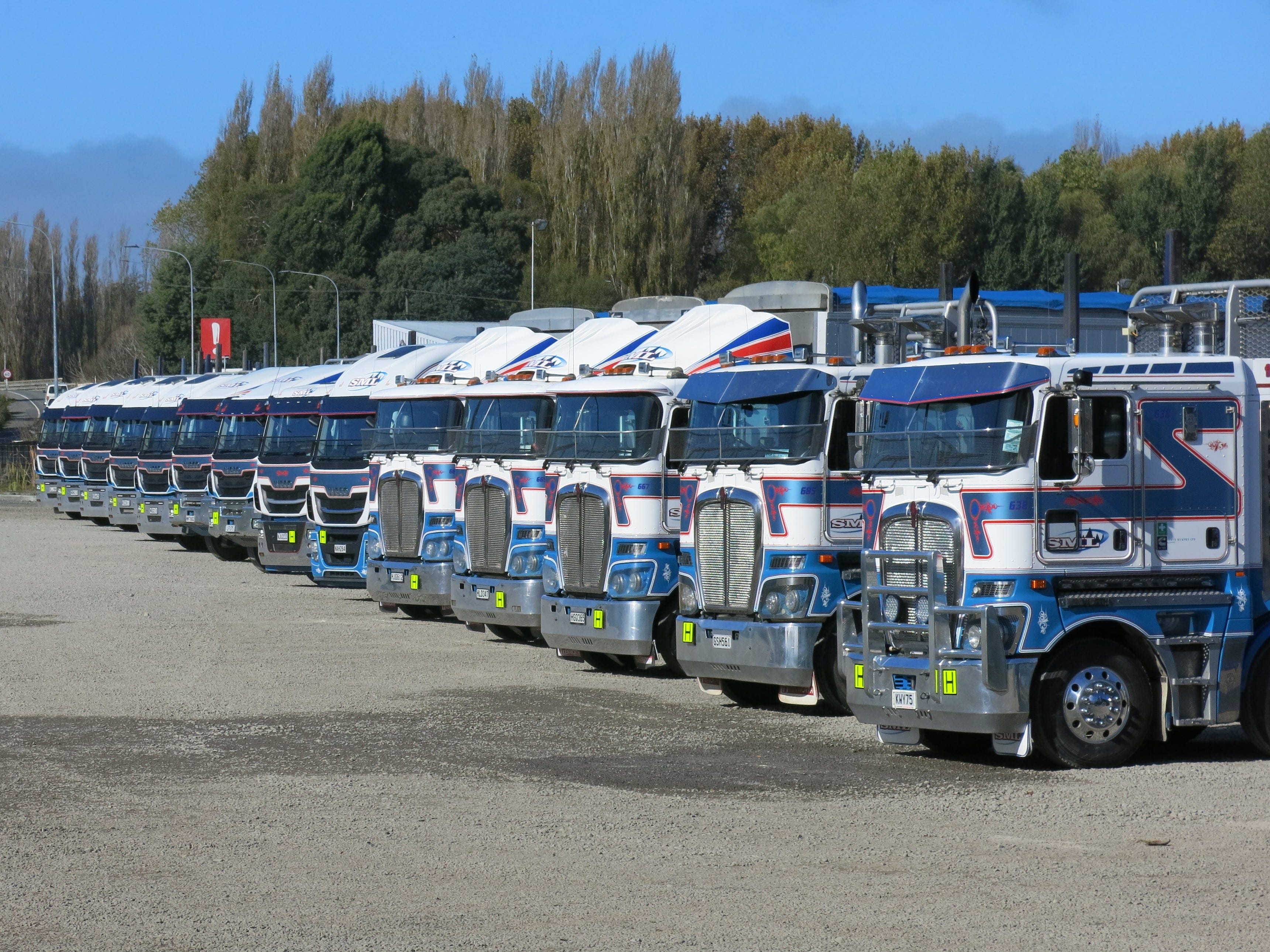
And I’m a sucker for all the gleaming trucks perfectly lined up at Steve Murphy Limited. They fan out in a shiny and well-ordered arc and always seem to be equidistant apart. (It reminds me of days living in Waikari, and Dad taking particular care to ensure his truck was parked exactly perpendicular to the back fence - and getting frustrated when it wasn’t and having to start all over again.)
The pathway is mostly flat but there’s a short climb up an overpass crossing the railway line. Heading out of the city, there are views from here to the Southern Alps (on the west) and to Mount Grey (looking ahead) in North Canterbury. Going back the other way, there are views of the Port Hills.
There’s lots of native planting alongside the pathway, including some very healthy toetoe and flax. (There’s also plenty of weeds and I often see a grounds crew out during the week with their sprays and weedeaters.)
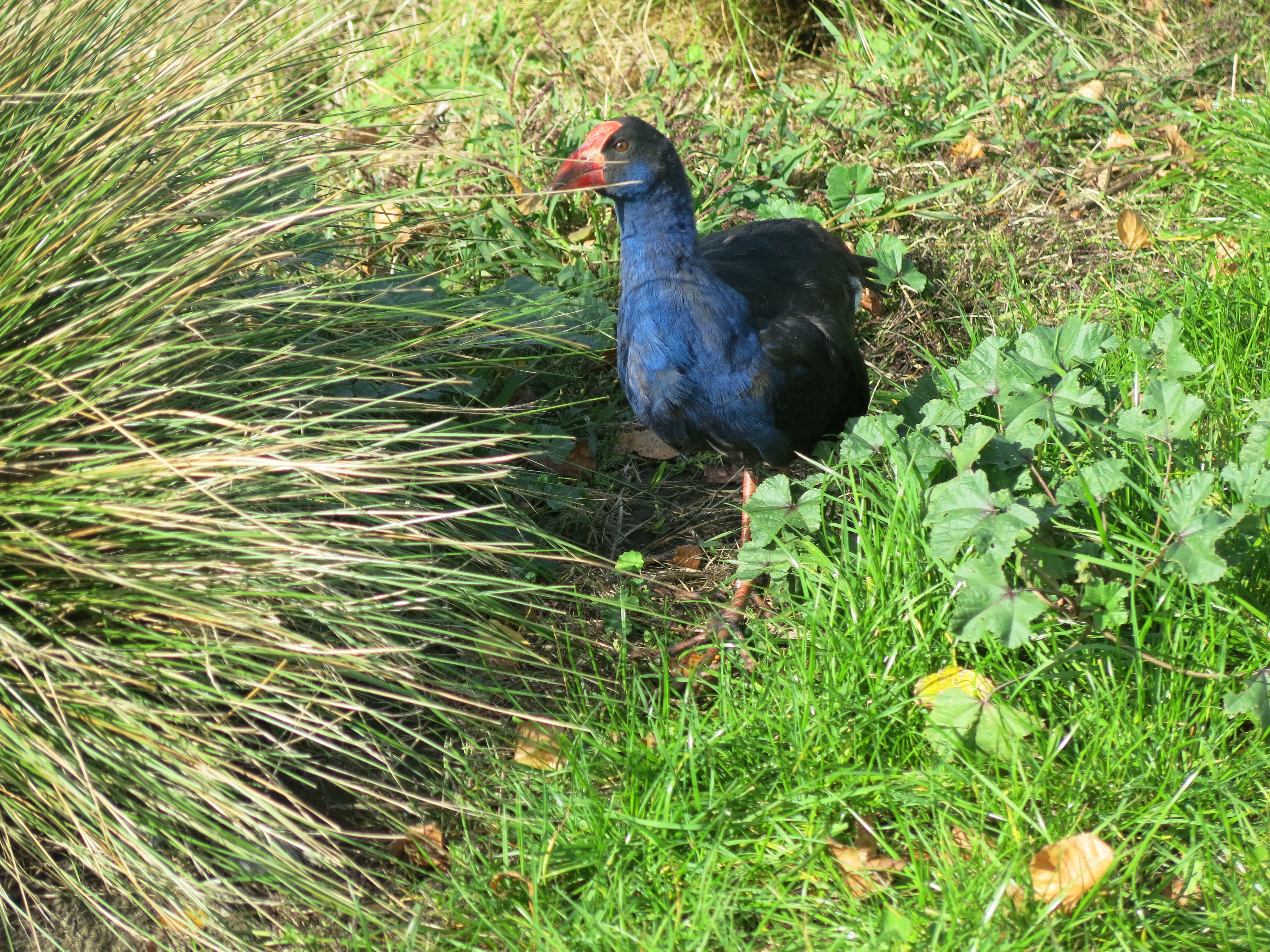
Pūkeko have made their home along the pathway, and I’ve noticed lots of new chicks this year. The adult pūkeko are very protective of their young and will hiss and call as you cycle by.
There’s a couple of sections of the pathway that flood after heavy rain. The pathway drops underway the motorway at one point, which happens to be right next to a stream. But it’s not too deep and if you take it slowly, you can usually get away without wet feet.
The other flood-prone section is just over the Chaneys off-ramp and is frustrating because the engineers could have diverted the path to higher ground. Every winter, cyclists create a big muddy mess by riding over the nearby grass. But, again, the ponding is not that deep and riding through slowly is the easier (and less slippery) option.
The best bit about the pathway is that it continues past the point where the Northern Corridor joins the existing motorway. When the motorway extension was built, Waka Kotahi (New Zealand’s transport agency) helpfully added a cycle bridge to the Waimakariri River bridge and continued the pathway all the way to Tram Road, where it connects to a new cycleway through to the Kaiapoi township. There are also connections from the pathway to recreational tracks along both sides of the Waimakariri river.
The pathway is super-convenient for me. I happen to live close to a connecting cycleway, so I only have to cycle a few hundred metres on-road before I join up to the Northern Corridor pathway. From here, I can cycle out to Kaiapoi to visit my parents, who happen to live close to the cycleway at the other end. Or I can carry on along the Passchendaele Memorial Path to Rangiora. That’s one of my regular mid-week training rides.
Alternatively, I can follow the Kaiapoi riverbank around to Pines Beach and head north along the coastal track to Pegasus and Waikuku Beach. From there, I can follow the Ashley River (on off-road tracks) all the way to Rangiora and then loop back to Kaiapoi and Christchurch. That’s a good weekend ride, with a mix of gravel, tarseal and mountain bike track.
I also use the Northern Corridor pathway to get to a nearby shopping centre, or to loop back home if I’ve been to the mountain bike track at McLeans Island and am returning along the Waimakariri River. And I cycle a short section of the pathway if I’m going for a ride to or from eastern Christchurch.
It’s a very handy pathway. Thanks Waka Kotahi.
Well done superwoman. Great pics.