


A sunny Hawke's Bay getaway

Chris and I recently found ourselves in Napier after treating ourselves to an Air New Zealand mystery escape for our wedding anniversary. With beautiful calm and sunny weather, it provided the perfect opportunity to cycle the Hawke’s Bay Trails.
The Hawke’s Bay Trails are a network of scenic cycle trails that cover the best of the region’s rivers, coast, farmland, wineries, orchards and settlements. The network provides about 200 kilometres of cycling, most of which is off-road on smooth sealed or unsealed pathways. The trails are grade 1-2 (easy) and, with plenty of food and accommodation options nearby, are ideal for day rides.
We first cycled the trails in 2020 after Covid-19 dashed our overseas travel plans and we hired a camper van to travel around the North Island instead. Cycling the trails was an early highlight of that trip so we ended up returning to Hawke’s Bay for more cycling before we went home.
On that trip, we covered most of the trail network in two rides:
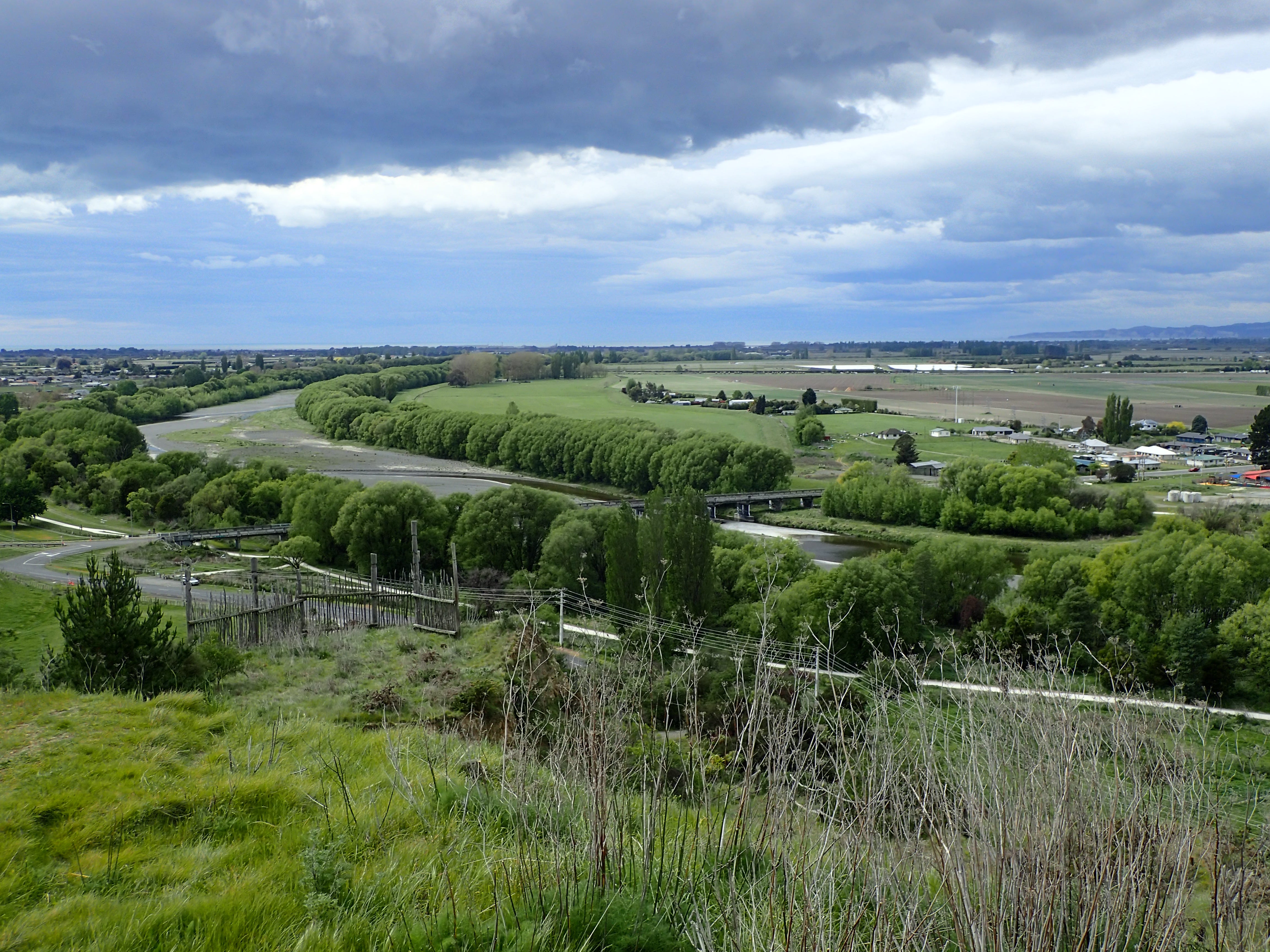
The Water Ride - this is a 78 kilometre loop that runs around the waterfront from Napier city and up the coast before winding back through wetlands and around the airport, and along one of the main rivers in the area (the Tutaekuri river) to the settlement of Puketapu and back to the coast. It’s easy relaxing cycling and there are enormous scones waiting for you at the Puketapu pub.
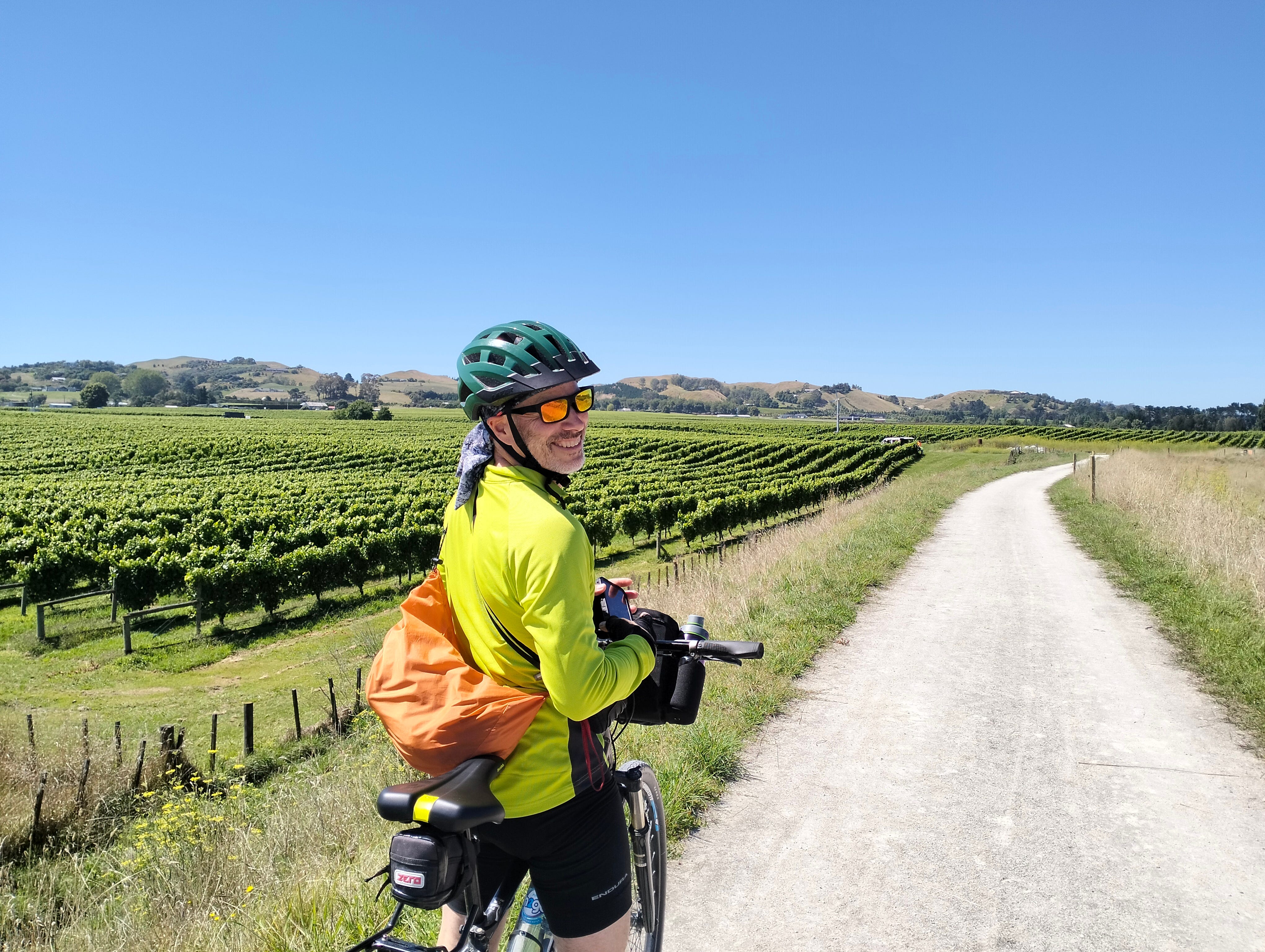
The Wineries and Landscape Rides - we combined parts of these two routes with on-road cycle lanes to create a loop of similar distance to the Water Ride. This involved riding through small coastal settlements, along the banks of two rivers (the Ngaruroro and Tukituki rivers), past wineries and orchards, and through the bustling centres of Hastings and Havelock North.
We were a bit disappointed with the Wineries Ride because much of it runs alongside busy roads with fast-moving traffic. There’s a separate path for cyclists but it was noisy, and we didn’t find it very relaxing. We preferred cycling along the much quieter river stopbanks on the Landscapes Ride, looking out over the many apple and stone fruit orchards in the area.
Fast forward to 2024, and Hawke’s Bay is still recovering from the effects of last year’s cyclone. Cyclone Gabrielle had a devasting impact on the region, with extensive flooding and damage to people’s homes, businesses, farmland and infrastructure. The cyclone also affected the Hawke’s Bay trail network, and a few paths have yet to reopen (mainly in the Puketapu area).
So, for our latest visit, we opted to forgo the enormous scones and cycle the complete Landscapes ride, including a long stretch along the Tukituki River that we had missed on our previous visit.
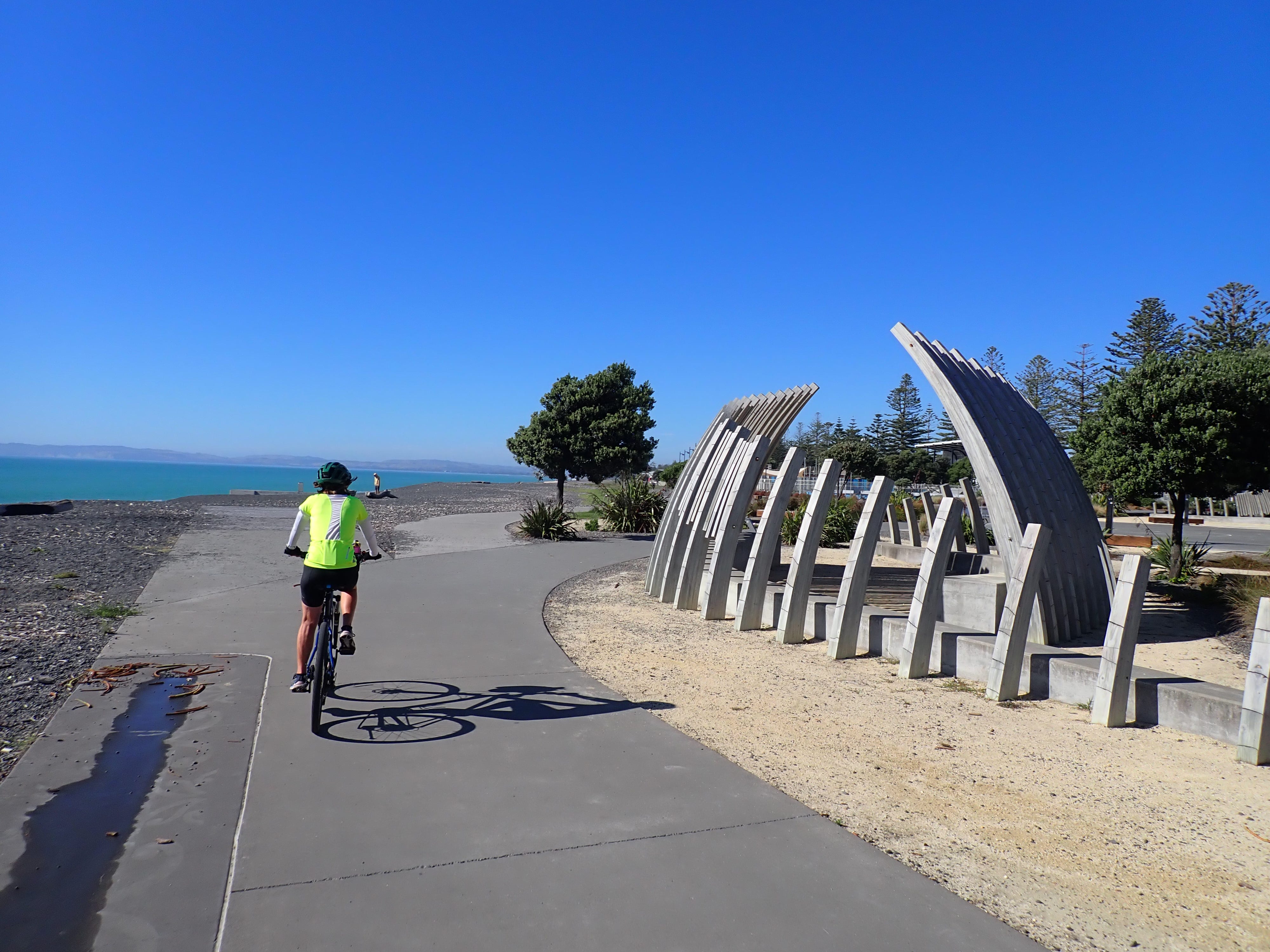
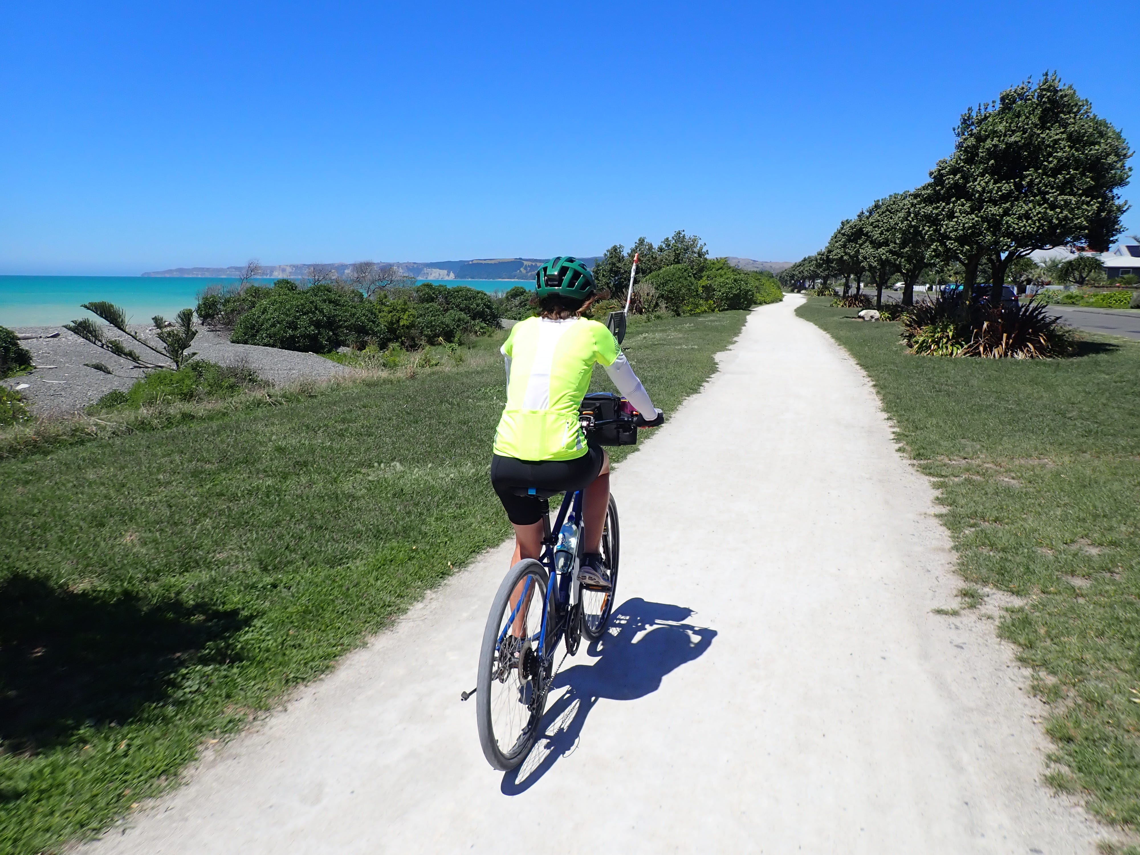
We started our ride in the centre of Napier (on hired bikes), heading south along the waterfront pathway to connect with the Landscapes Ride at the small town of Clive. The route passes by many points of interest along the way. At the Napier end, there’s gardens, sculptures, a national aquarium, and activities designed with children in mind (including a skate park, playground and junior bike track).
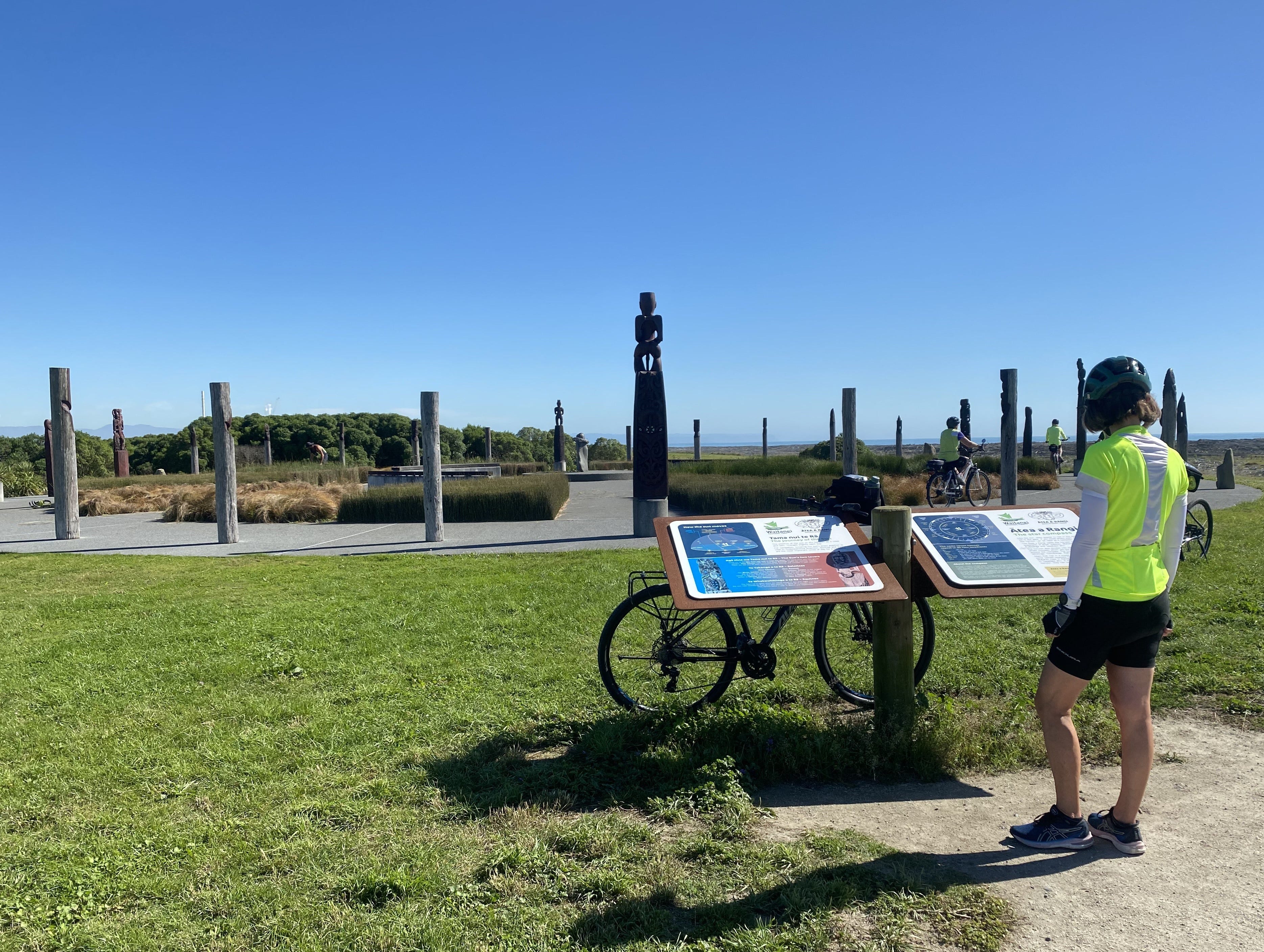
Further along, away from the city, you reach Waitangi Regional Park, home to Ātea a Rangi Star Compass. The compass was built as a resource for passing on traditional knowledge about how to navigate the Pacific by using the stars and the horizon. The carved pou (poles) of the compass represent the rising and setting points of the sun, moon and stars, which are memorised by navigators before they take to the sea.
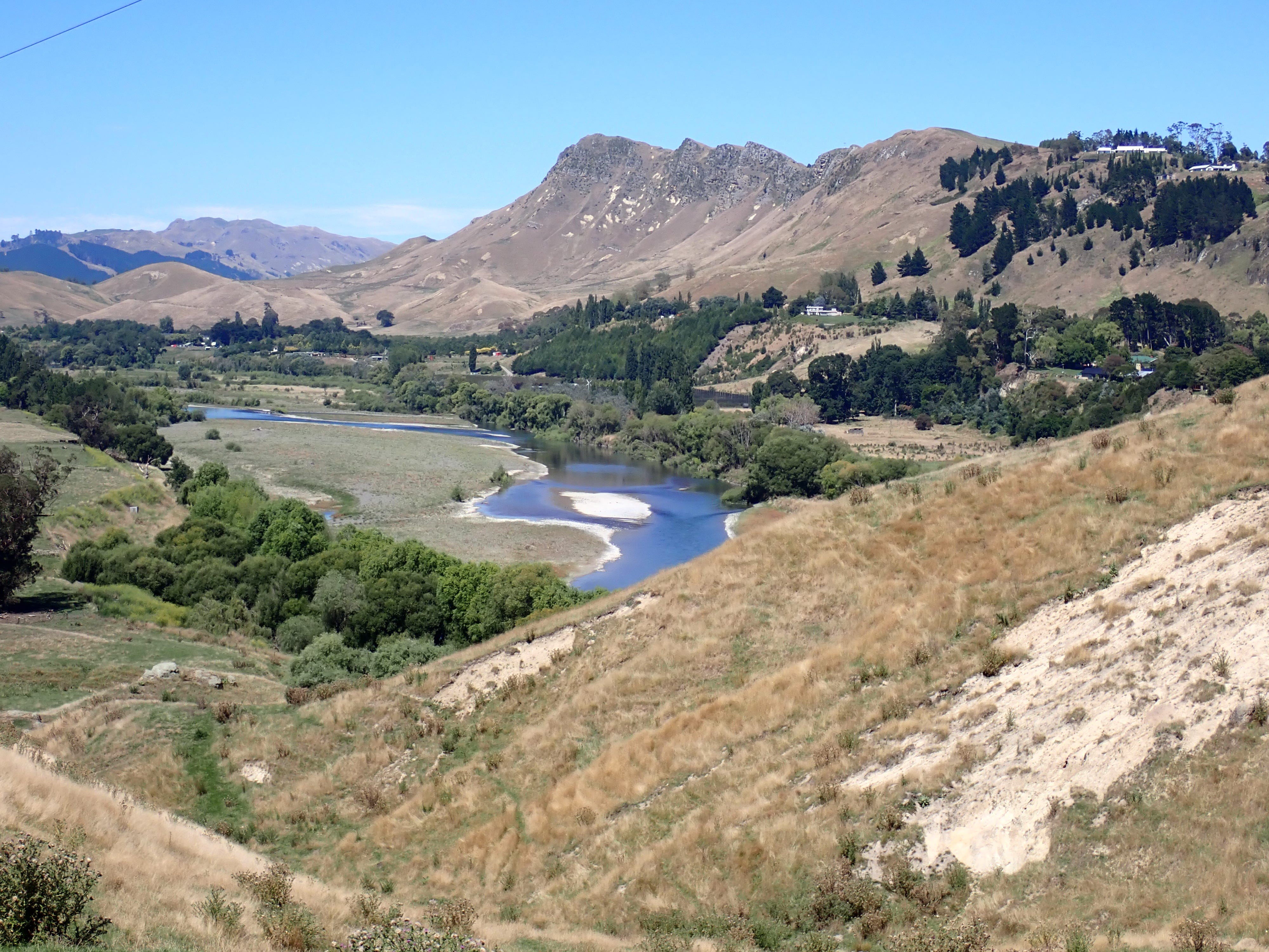
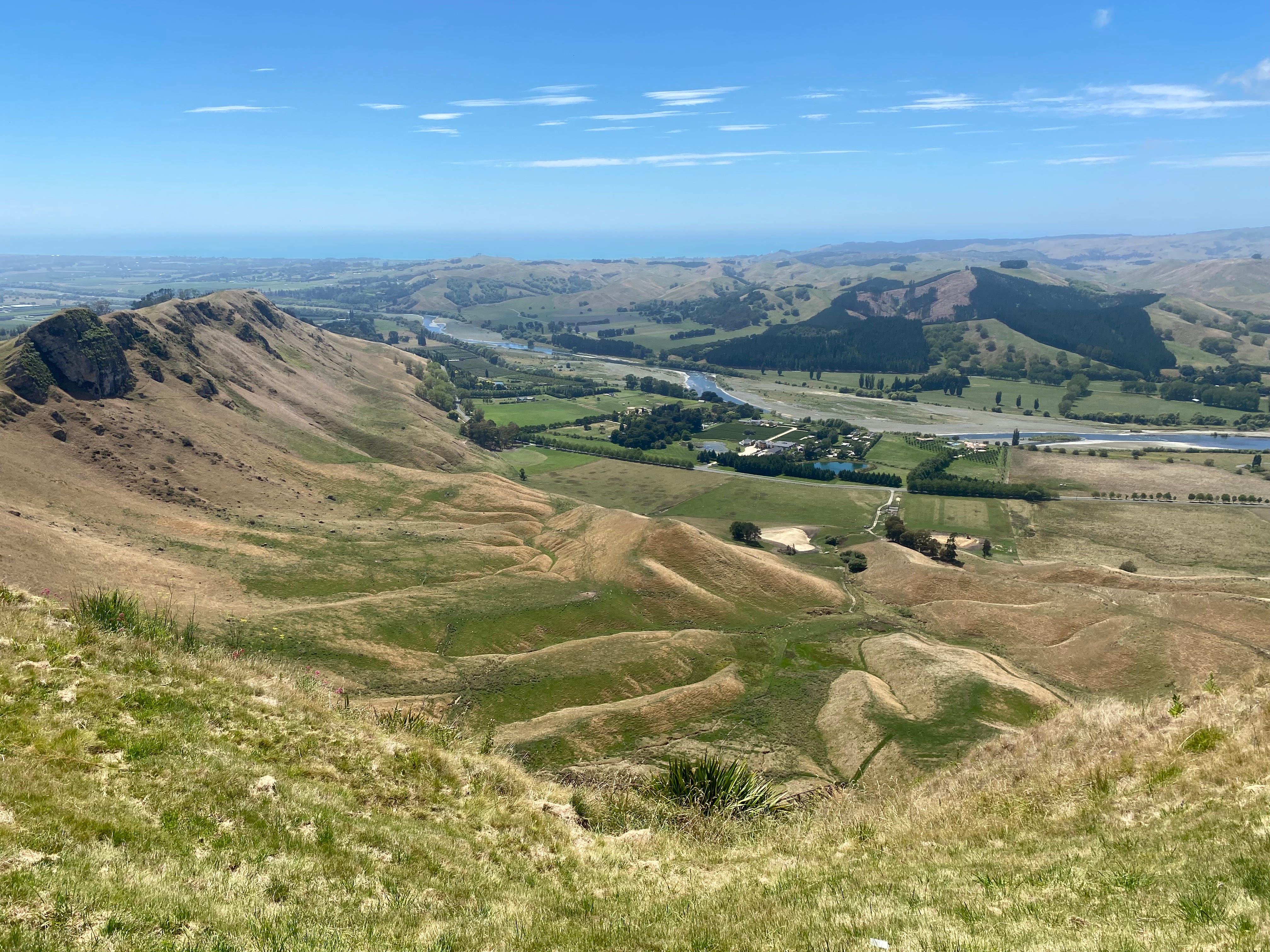
From Clive, the trail winds around the coast to the lovely Tukituki River, meandering along one side for some way before coming back down the other. Most of this river section was new to us, and I suspect we skipped it on our earlier visit because there are a few hills. But they weren’t particularly steep or particularly long so even our well-worn rental bikes handled them just fine. And, as always, hills mean views.
There’s an on-road section on one side of the river but it’s a quiet rural area with very little traffic until you reach the bridge (the Red Bridge) crossing to the other side. Temperatures were up around 30 degrees by the time we reached the bridge, so we were happy to find a cafe operating from an old container there. It’s obviously a popular spot and there was a surprising number of police officers stopping in (and lingering) when we were there - it must have been an important meeting!
Traffic was a bit more frantic on the other side of river, but there is a separate path for cyclists and it’s not long until the cycle path heads away from the road. The trail back to the coast runs along the top of stopbanks, which is where you get the lovely views looking out over orchards and vineyards.
Back at the coast, we made yet another bridge crossing (the Black Bridge) and cycled through small coastal settlements to Clifton. There are a lot of very cute cottages and holiday houses along this stretch of coast but, unfortunately, they are very vulnerable to sea level rise and storm surges. We passed one empty section on the seafront that was going to auction with a $1 reserve. Despite half the section having washed away in a previous storm, the section attracted a lot of interest and sold a few days later for about $100,000.
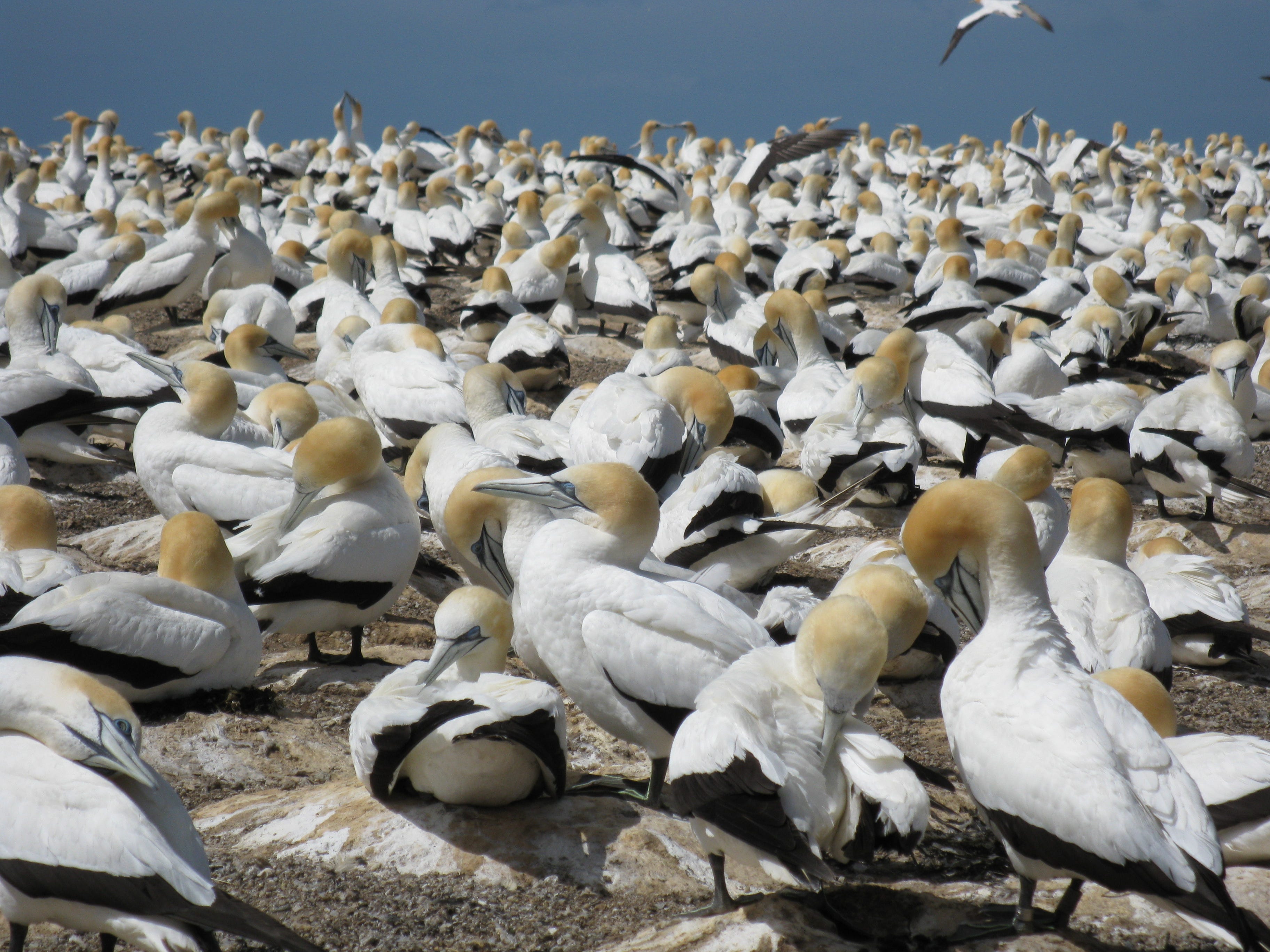
Clifton is the access point for visiting the gannet colony at Cape Kidnappers. We have visited the colony before - back in the days when you could sit on a big trailer towed by a tractor around the coast. The gannets are an impressive site and worth a visit, but these days you have to take an air-conditioned van overland to get there (or take your chances on the seaside track that can only be attempted at low tide and is subject to significant rockfall and landslide risk).
While we didn’t have time for the gannets on this visit, we did have a lovely lunch in the garden at the local cafe/restaurant before summoning up the energy to cycle back along the coast to Napier. Overall, we cycled close to 90 kilometres (making good progress towards our Aotearoa Bike Challenge goals for the month) and had an awesome day out.
The Hawke’s Bay Trails are in good condition and are well-signposted - as long as you know where you are going next. Unlike other trails, most signage points to specific destinations rather than the name of the trail. So, while we did see a few markers for the Landscape Ride, it’s the places along the way that you need to look out for. (There’s a good map on the trail website and we picked up a printed copy in Napier.)
Being a network of trails, there are lots of connections between the three suggested rides so you can make up your own route. And you don’t need to do the Wineries Ride to find great wine - the Water and Landscape Rides will also deliver you to several very good cellar doors.
Non-cycling highlights
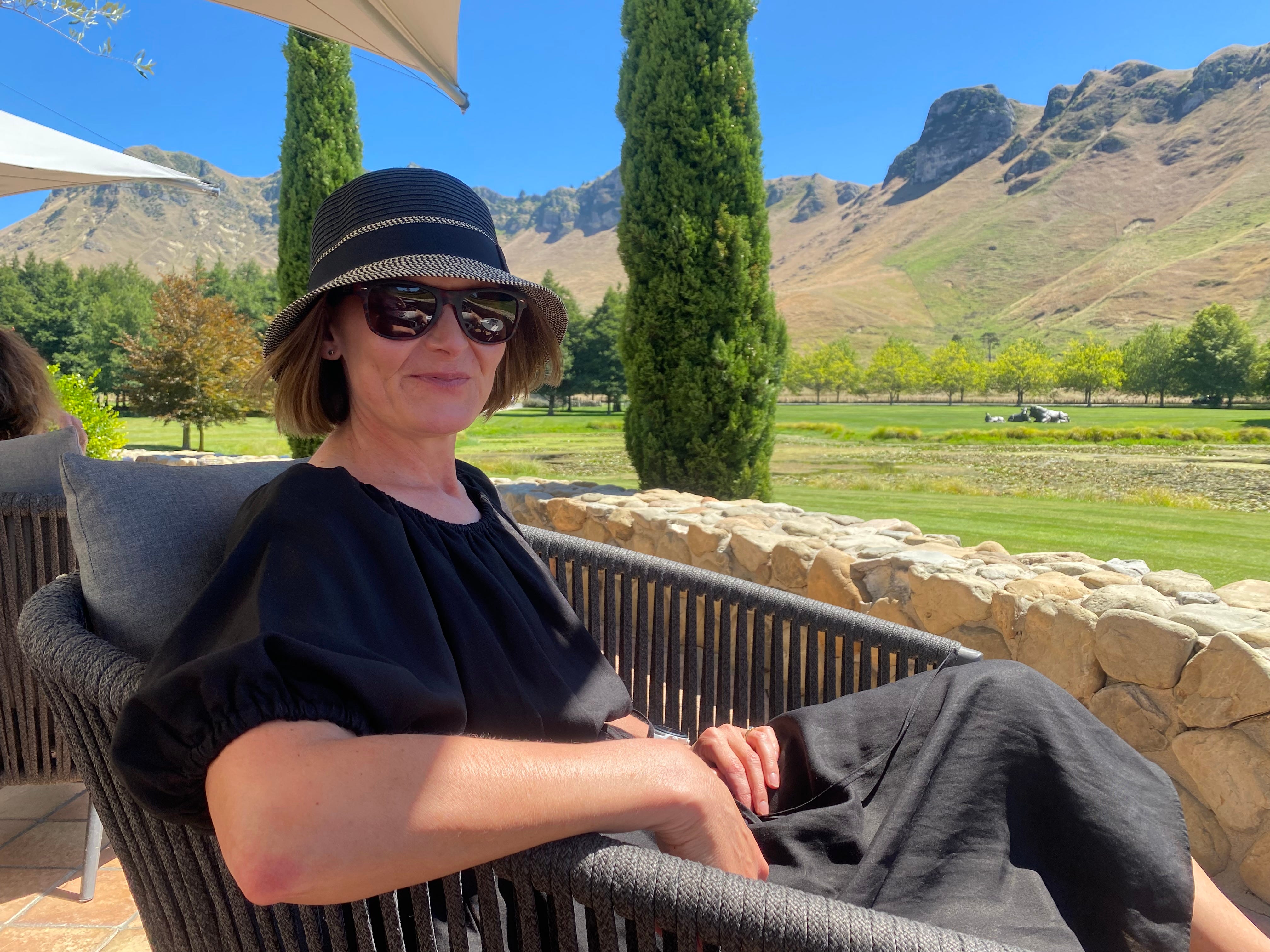
Of course, cycling was not the primary purpose of our trip, and the real highlight would have to be our anniversary lunch at Craggy Range Winery. We enjoyed beautiful food, good wine, impeccable service and a lovely outlook over the vineyard and across to the dramatic rocky range around Te Mata Peak. I highly recommend booking a table if you’re in the area (it opens for lunch and dinner).
Other highlights include:
Te Mata Peak - Te Mata Peak is a prominent landmark in Hawke’s Bay and protected by the local council as an outstanding natural landscape. There are walking and biking tracks in the park surrounding the peak (accessible from Havelock North), or you can drive to the top for spectacular views all around. We arrived at the hottest time of day, so settled for a short walk before carrying on to the summit by car.
Art deco Napier - Napier is known for its many art deco buildings, built after fires destroyed most of the city centre following a large earthquake in 1931. We did an organised walking tour on a previous visit, which provided a great introduction to the different art deco motifs used in the buildings. But it’s just as easy to soak up the atmosphere and admire the buildings on a self-guided walk around town. If you time it right, the city hosts a colourful art deco festival in mid-February every year.