


Along the river to the sea
One of Christchurch's best recreational rides

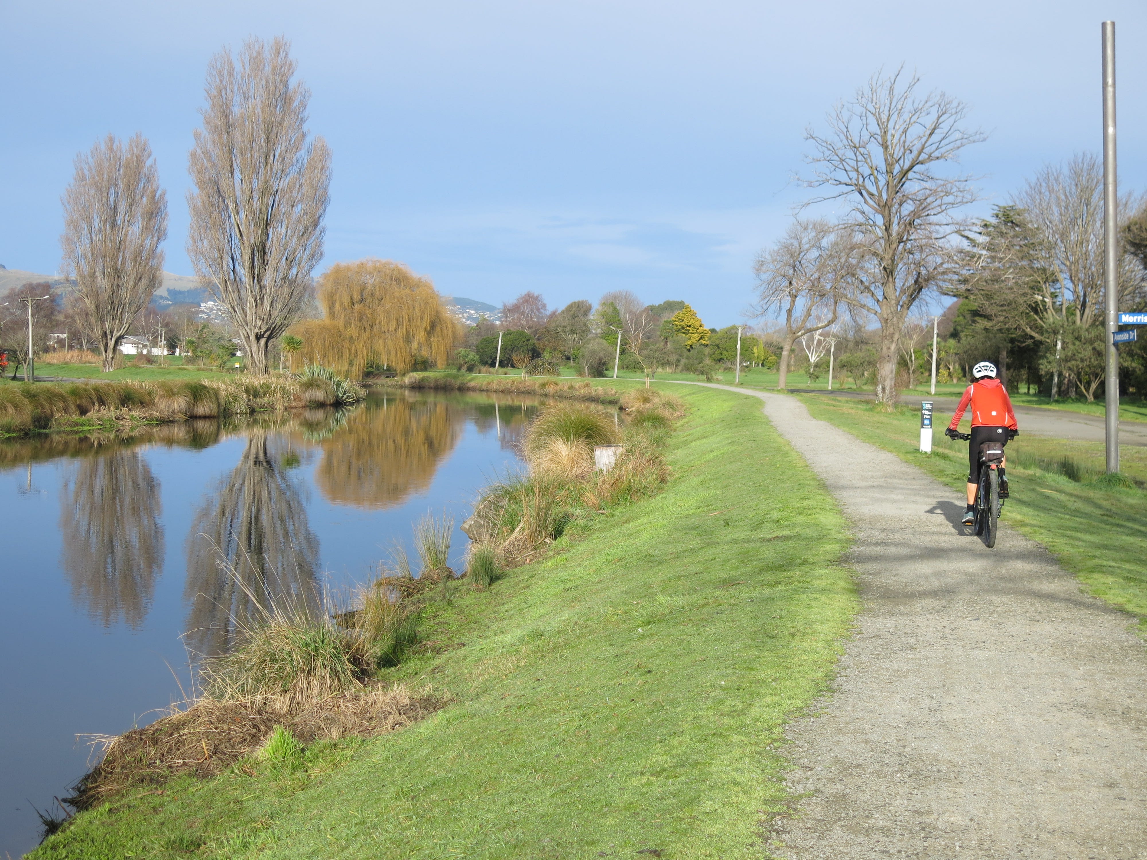
Most weeks, one of my rides will take me along the Ōtākaro Avon River to the sea. I think it’s one of the best recreational rides in Christchurch.
It’s a peaceful ride away from the traffic, and there’s lots of open space and great views of the estuary, hills and river. And it’s accessible to cyclists of all abilities. You can have a gentle ride meandering beside the river. Or, provided you’re watching out for dogs and pedestrians, you can go flying along the gravel-topped stopbanks, or what remains of the pre-earthquake sealed roads, and get a decent workout.
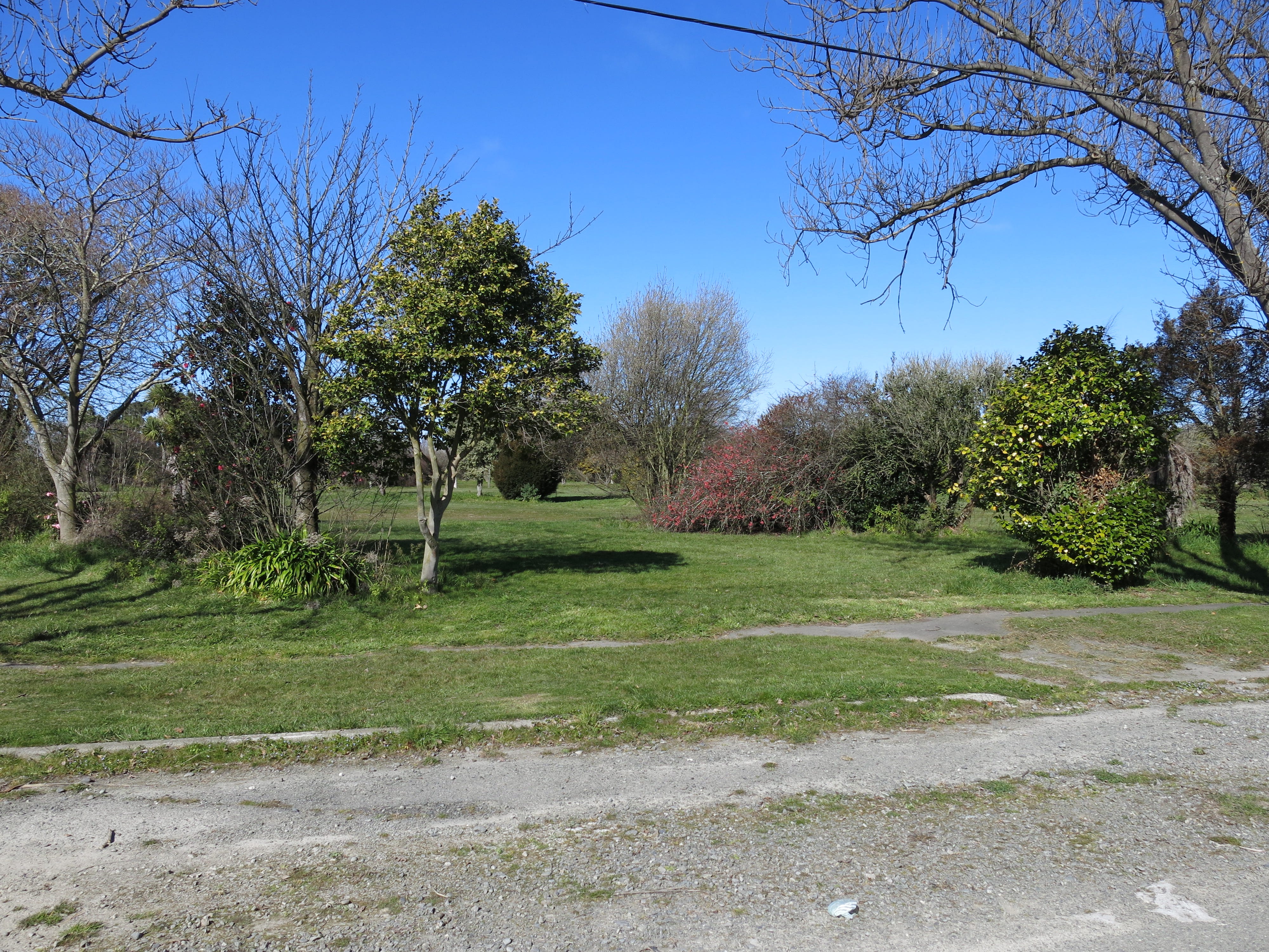
Much of my route takes me through what was known as the residential red zone. This is a large area of land along the river corridor that was so badly damaged following the Canterbury earthquakes of 2010 and 2011 that the Government decided to buy and demolish more than 5,000 houses in the area. The area was grassed over but established trees have been left in place, so there are diverse plantings and it’s not hard to work out where property boundaries used to lie.
There’s a regeneration plan for the Ōtākaro Avon River Corridor but it’s a huge space – 602 hectares – so is expected to take 30-50 years to fully develop. In the meantime, it has become a popular recreational area for walkers and cyclists, as well as host to temporary activities and projects such as community gardens, beekeeping, community festivals and sports events like orienteering and mountain biking. There’s even a temporary track for radio-controlled trucks and diggers.
Over the next few years, work will begin on developing a shared path, the City to Sea Pathway, all the way from the central city to the seaside suburb of New Brighton (11 kilometres away, as the river flows). Some supporting infrastructure is already in place, including three new walking and cycling bridges over the river, and a new riverside landing and picnic area. And a transitional trail, the Te Ara Ōtākaro Avon River Trail, has been created to make the area more accessible to people in the interim.
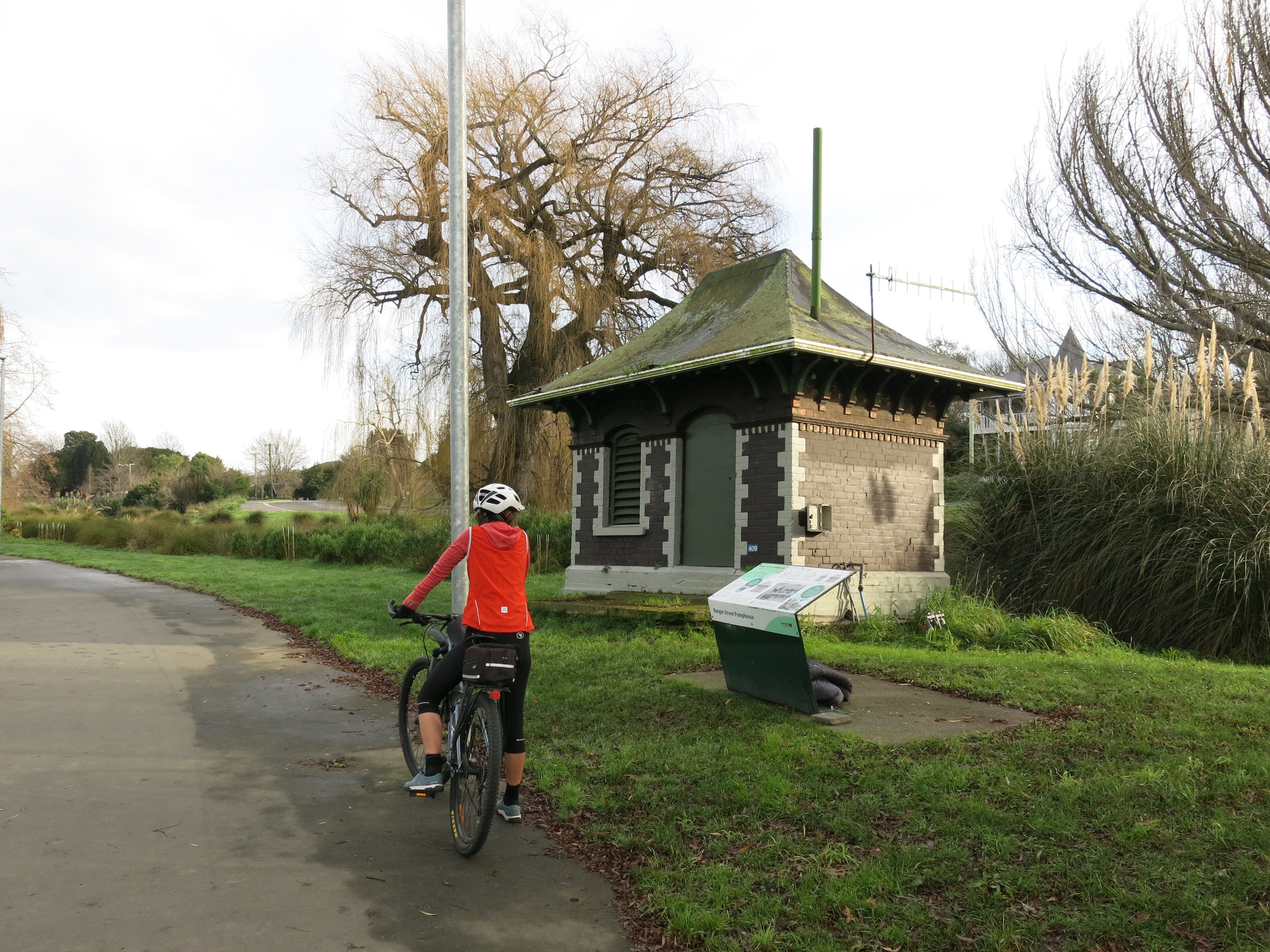
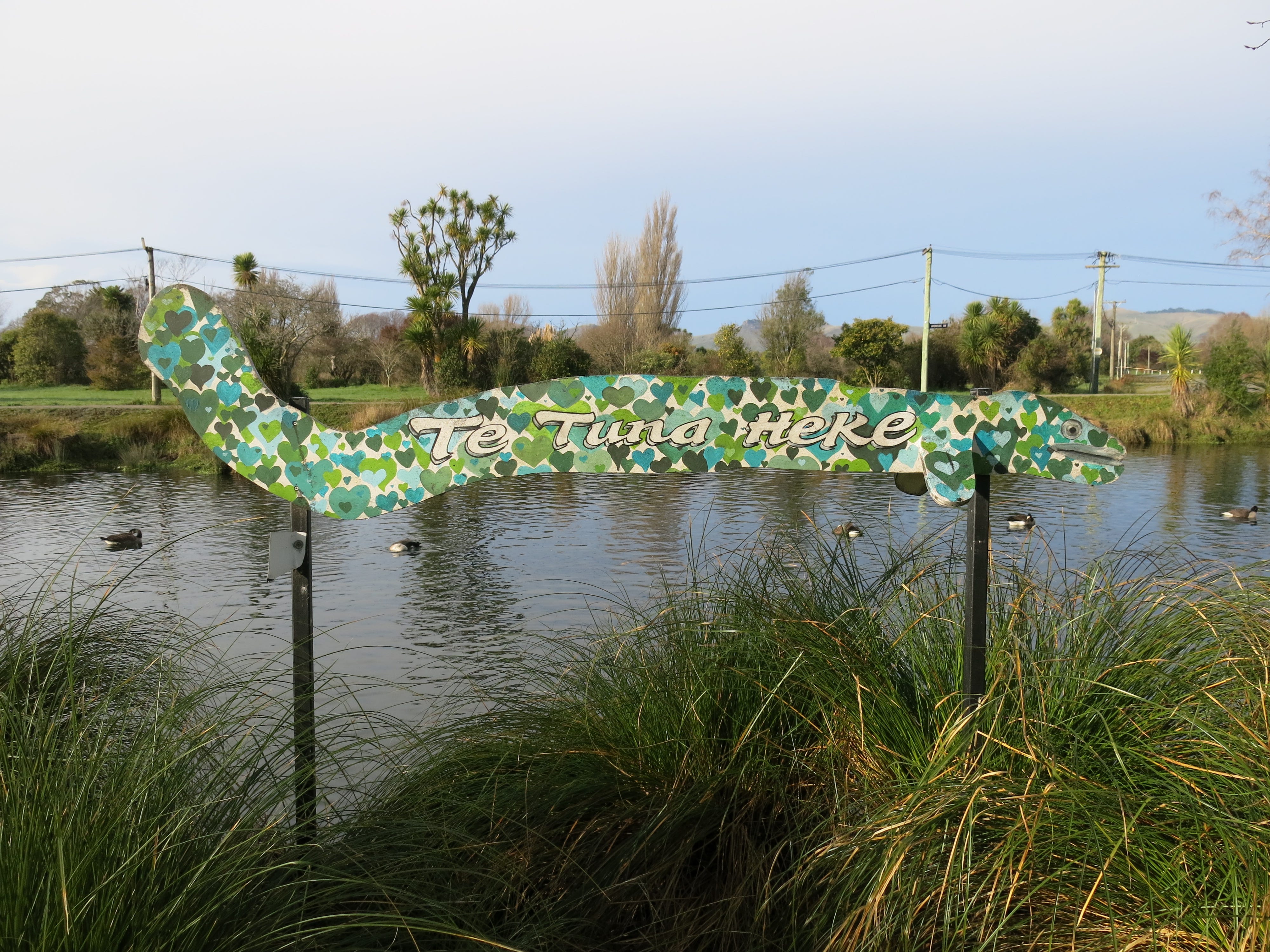
The trail officially starts on the edge of the central city (the corner of Barbadoes Street and Cambridge Terrace). The first section has new seal and has been re-landscaped with native plantings all along the riverbanks, and a small landing where you can search for eels in the river. It also hosts the first of several old pumphouses that somehow avoided sliding into the river during the earthquakes.
From Fitzgerald Avenue, the ride gets bumpier, with a mix of old unrepaired roads that are full of potholes (and closed to traffic), gravel-topped stopbanks and dirt tracks (depending on what side of the river you’re on). Being a transitional trail, only limited attention has been given to track surfacing and road crossings – but it is well-signposted and there aren't too many busy roads to contend with.
For much of the way, you can cycle on either side of the river, but there are some places where roads are open to traffic on one side. Over time, I’ve worked out a route that suits me – usually crossing the river several times to avoid the open roads and find the smoothest gravel. The new pedestrian/cycle bridges (as well as existing road bridges) provide plenty of options.
There are a few points of interest along the way. The trail passes by the Richmond Community Gardens, which were revived after the earthquakes and have become a bit of an eco-hub. The gardens are full of garden beds, food forests and native plantings, and include a fungi farm and sustainability features (such as a rain garden).
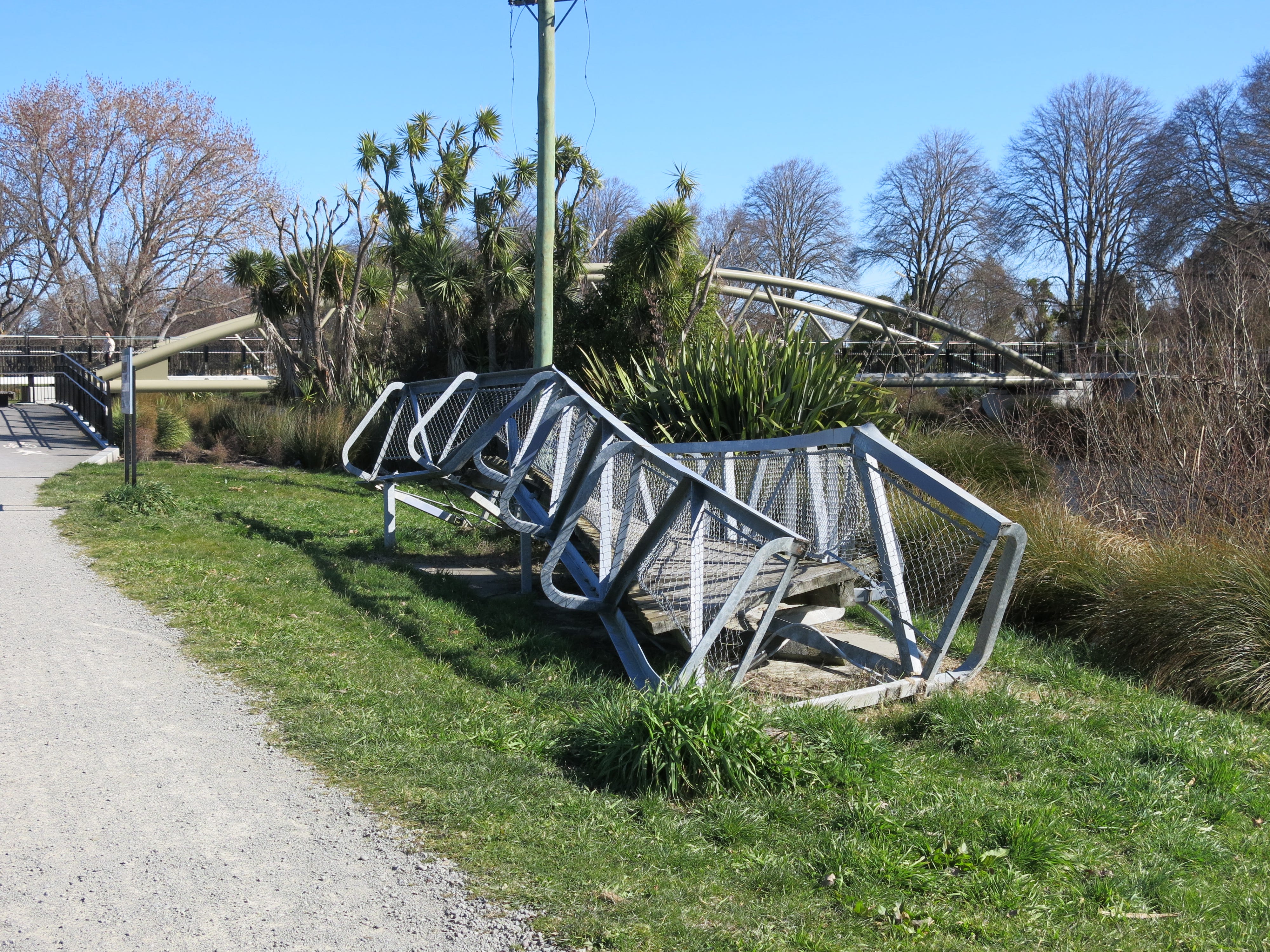
Not far from here is the first of the impressive new walking and cycling bridges. Lying next to it on the riverbank is the twisted remnants of the old bridge (the Medway Street bridge), which demonstrates well the force of the earthquakes.
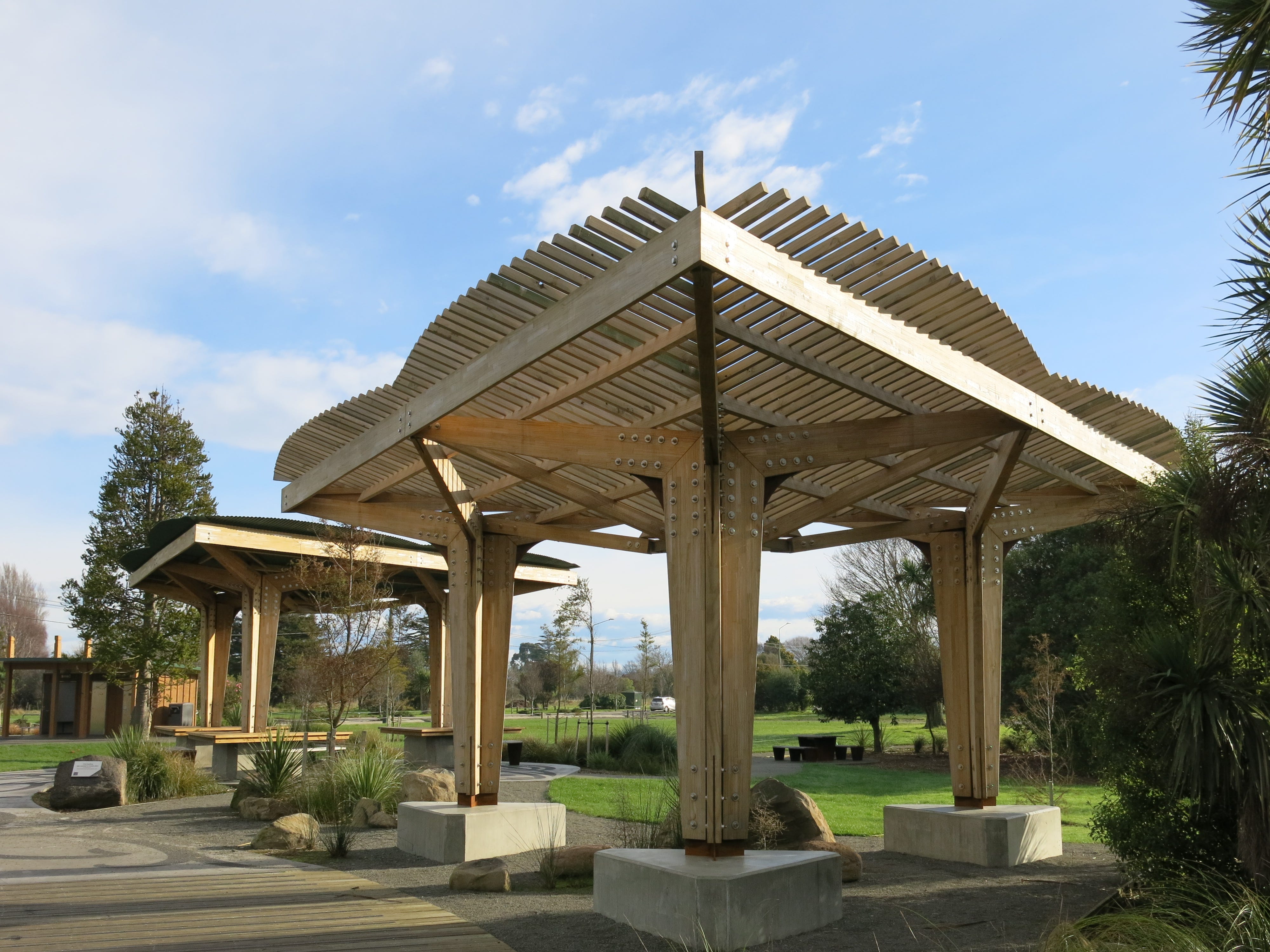
There are plenty of places to stop along the river (and on a nice day, any old piece of grass will do). The standout spot would have to be new Dallington Landing, which has been beautifully landscaped and includes shelters, public toilets and picnic tables. Suprisingly, I hardly ever see people here, but I guess that will change with summer on the way.
Further on, the trail passes through the city's rowing facility at Kerr’s Reach. There are plans to substantially upgrade this part of the river corridor with a bigger and better flatwater sports hub (relocated to the other side of the river), and a new landing with more space for recreation and community events.
Closer to the coast, work is already underway to construct new stormwater basins and a new wetland area. Like many parts of the city, land in the already low-lying eastern suburbs dropped during the earthquakes, becoming even more prone to flooding. Combine that with anticipated sea level rise and storm surges, and you can see why these areas will never be residential suburbs again.
There's a section of the trail that passes under a major arterial route close to river level. Not surprisingly, it floods after heavy rain or a king tide. There are alternative routes but more than once I’ve underestimated the depth of the water and ended up with very wet feet. That’s just one more improvement that will be made when the City to Sea Pathway is constructed.
The transitional trail officially ends (at Pages Road) a few blocks from the coast. However, it is possible to carry on cycling by the river and around the estuary. So that's what I usually do. It’s an easy gravel ride along the stopbank and connects to a walkway around the estuary.
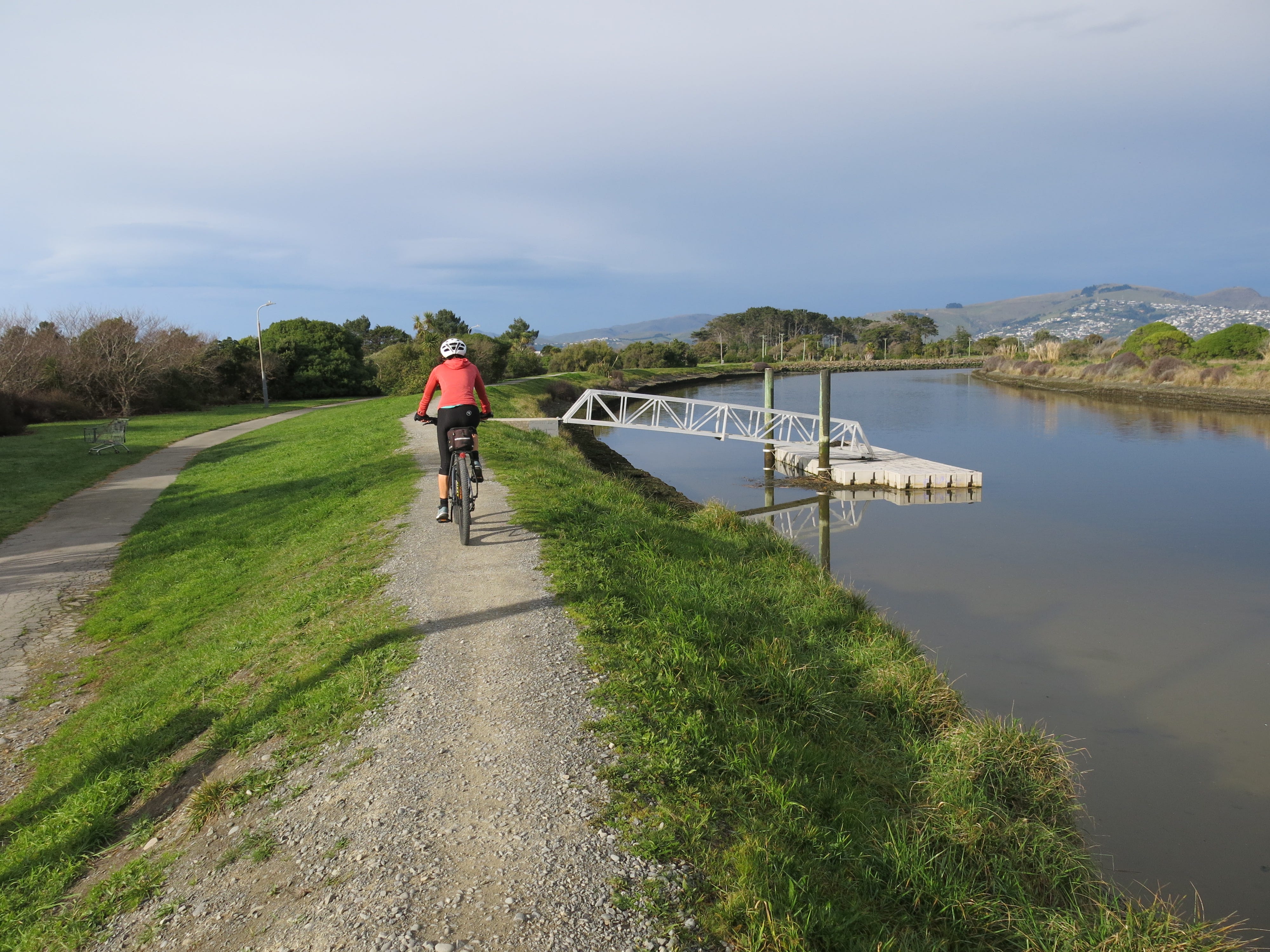
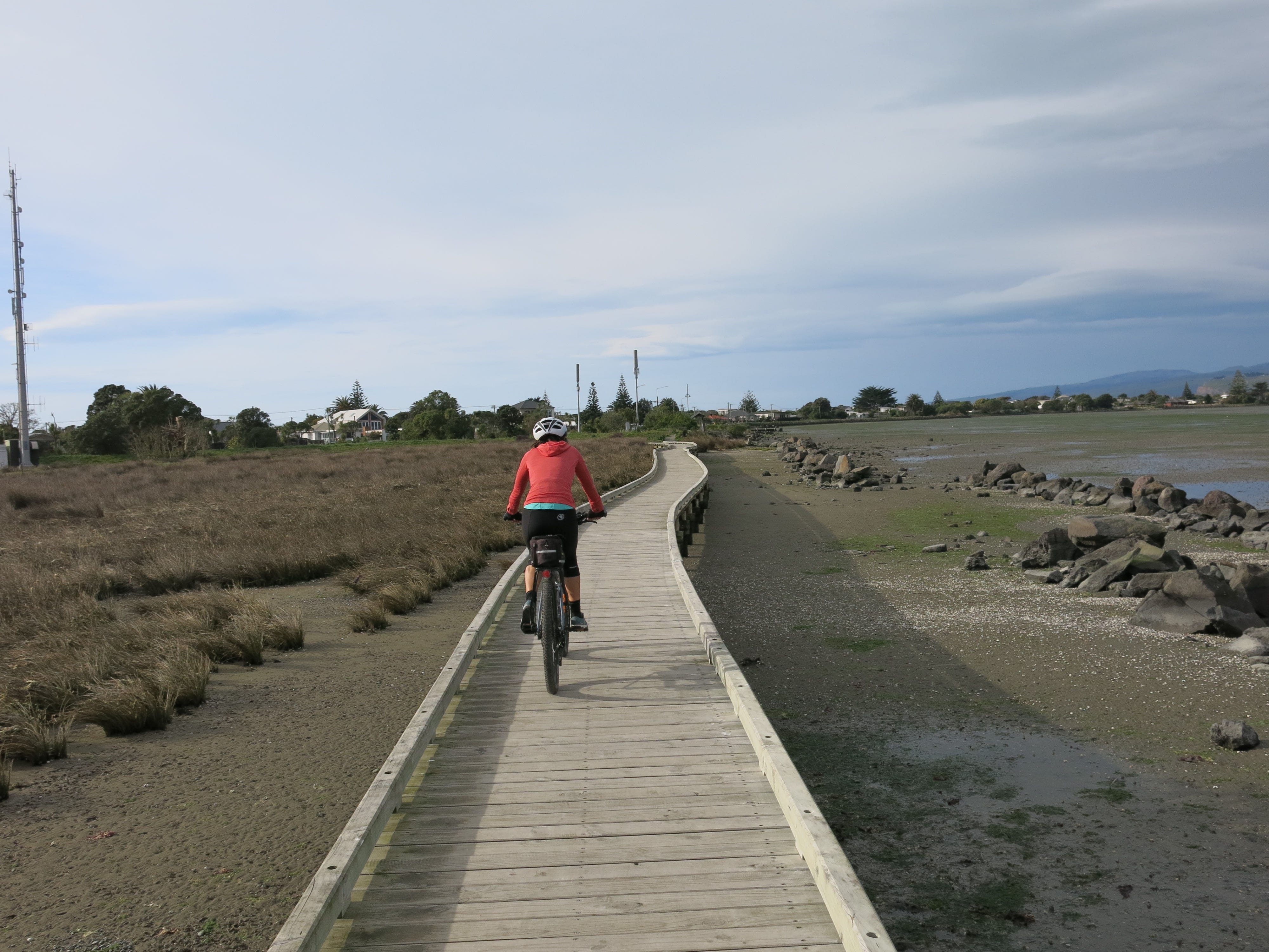
The first section of the walkway is gravel and has been nicely landscaped with lots of native planting. Then it’s a mix of dirt and gravel track, past a small pier and yacht club, and on to a short boardwalk section at the end.
From here, you can continue along a dirt track around the western side of the estuary toward the spit. But I normally switch to cycling on the road at this stage and cut through to the eastern (sea) side.
I like to do a big loop back home, so I’ll cycle north past several beaches before turning inland at Waimairi Beach and continuing along a gravel track next to Bottle Lake Forest. For the final stretch, I’m back on the road, connecting up to the shared path by the Christchurch Northern Corridor to take me home.
Thank you for the postings Angela, interesting reading even though I haven't a glue where these places are, the pictures says it all.
Thanks Angela. Just arrived. En route to the start point tomorrow and start riding Monday. xx