


Autumn cycling on the Queenstown Trail

After our Around the Mountains adventure, we headed to Lake Hayes for a few days to enjoy more cycling in the Queenstown area. We didn’t have time to cycle the full Queenstown Trail, which is actually several trails, but we made a good start.
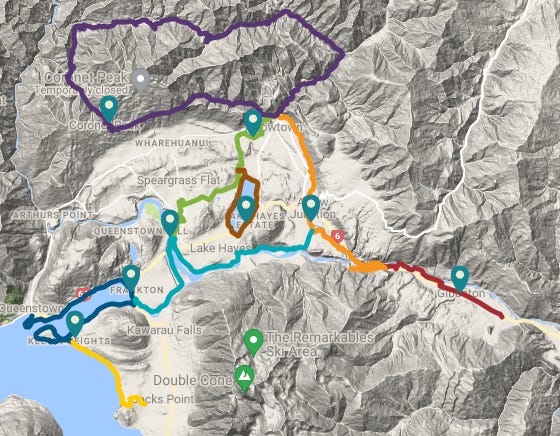
Here's the full map of trails to help make sense of my description.
Lake Hayes-Arrowtown-Kawarau Bungy-Shotover Bridge loop
For our first ride, we decided to create our own loop by linking up several trails:
the Lake Hayes trail (the brown line on the map) - this is an eight kilometre track around, you guessed it, Lake Hayes. It is popular with walkers and, if you’re cycling, it’s a grade 3 (intermediate) track.
the Countryside Trail (green) - this 13.5km grade 3 track starts at the Shotover Bridge and heads up past Lake Hayes to Arrowtown.
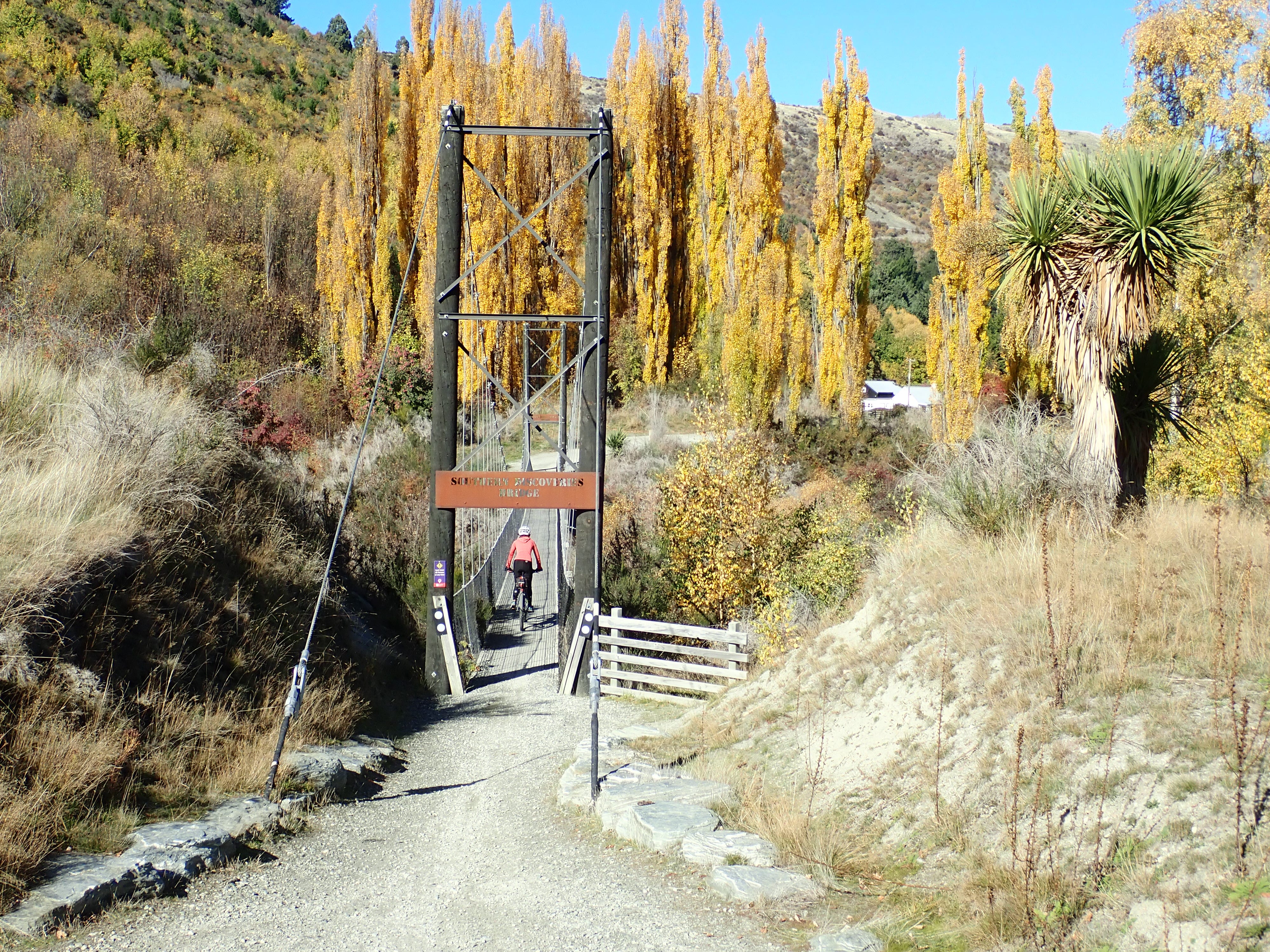
the Arrow River Bridges Trail (orange) - this is an easy grade 2 trail that goes from Arrowtown to the bungy operation at the Kawarau Suspension Bridge. It’s 13.7km long and one of the most popular trails for recreational cyclists.
the Twin Rivers Trail (pale blue) - this 18.5km grade 3 track follows the Kawarau River from Arrow Bridge (halfway along the Arrow River Bridges Trail) to the Shotover Bridge and on to the Kawarau Falls Bridge if you’re heading back to Queenstown. (We only went as far as the Shotover Bridge so we could link up with the Countryside Trail.)
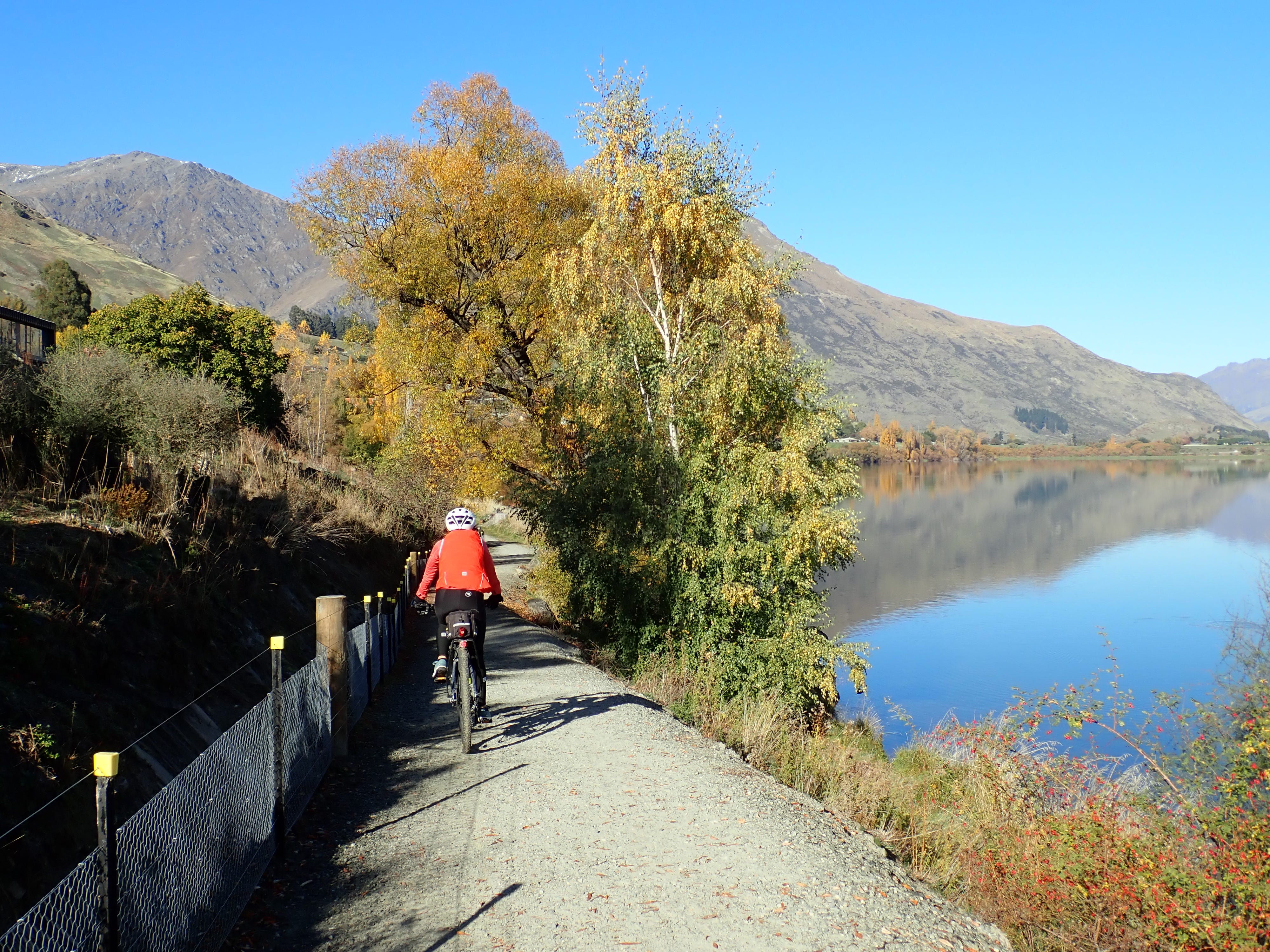
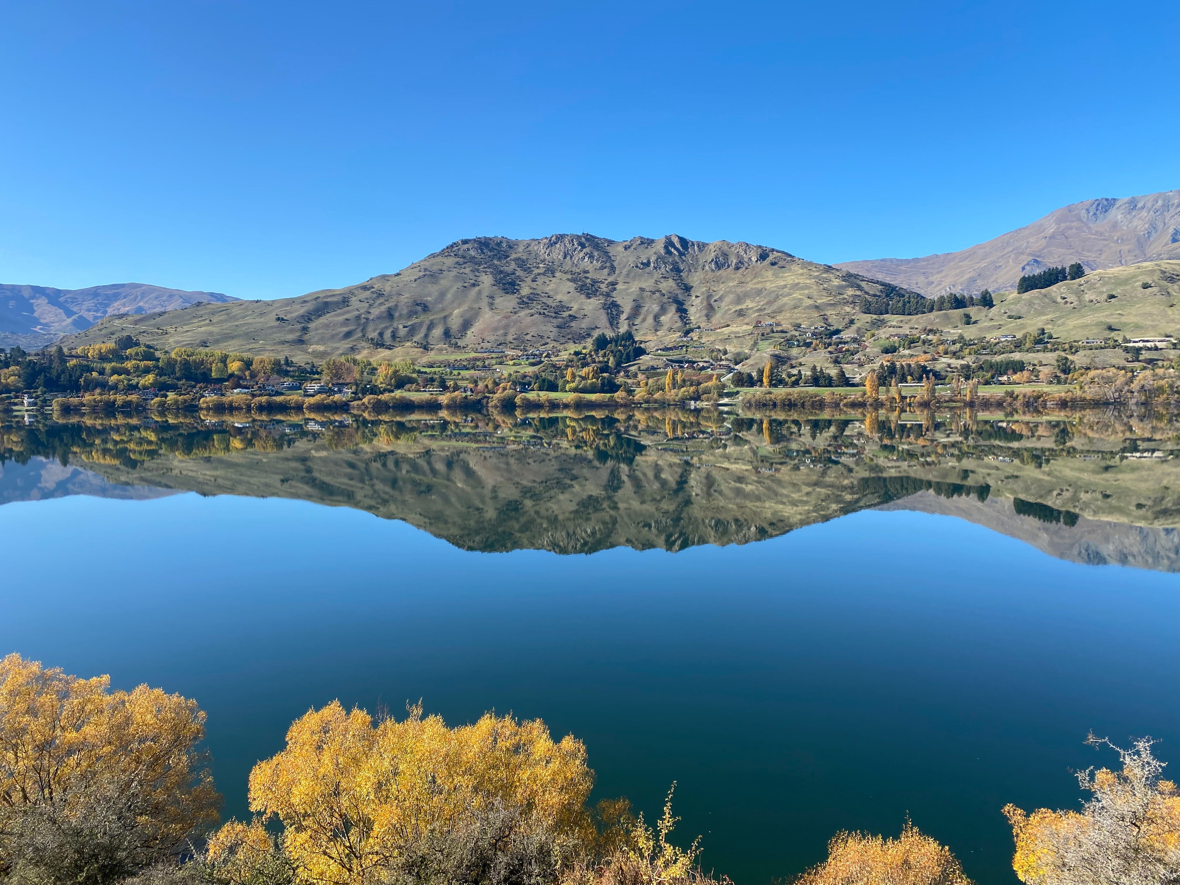
We started our ride with a clockwise loop around the picturesque Lake Hayes. As you can see from the photos, it was a beautiful calm and sunny day, which really highlighted the autumn colours and provided great reflections on the lake.
From there, we connected to the Countryside Trail and had a (very) steep climb up the hill to Millbrook Resort (a sprawling property with accommodation, restaurants, spa and golf course). The trail meanders through the resort before heading on to Arrowtown.
We had intended to take our time and look around Arrowtown but it was unpleasantly crowded with tourists and we struggled to find somewhere to park our bikes. Yet somehow we managed to score an outdoor table at a café for lunch, and then quickly retreated to the peacefulness of the Arrow River Bridges Trail.
I can see why this trail is popular. It runs along the Arrow River, there’s great views of the mountains, the trees are very pretty at this time of year, and there are a couple of big swing bridges to cross before you get to the bungy operation at the old Kawarau Suspension Bridge. It’s also an easy ride, with a few ups and downs to keep it interesting.
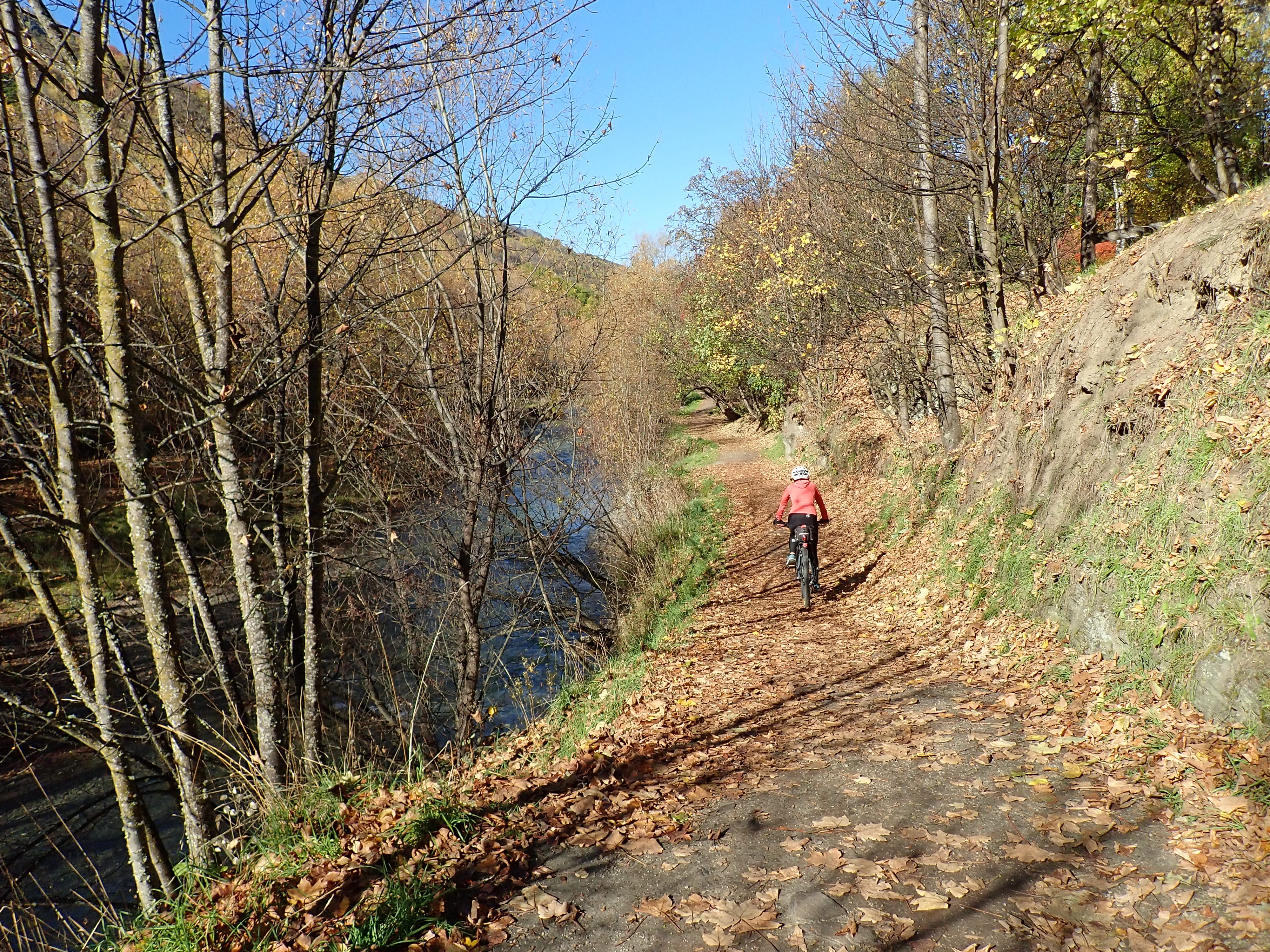
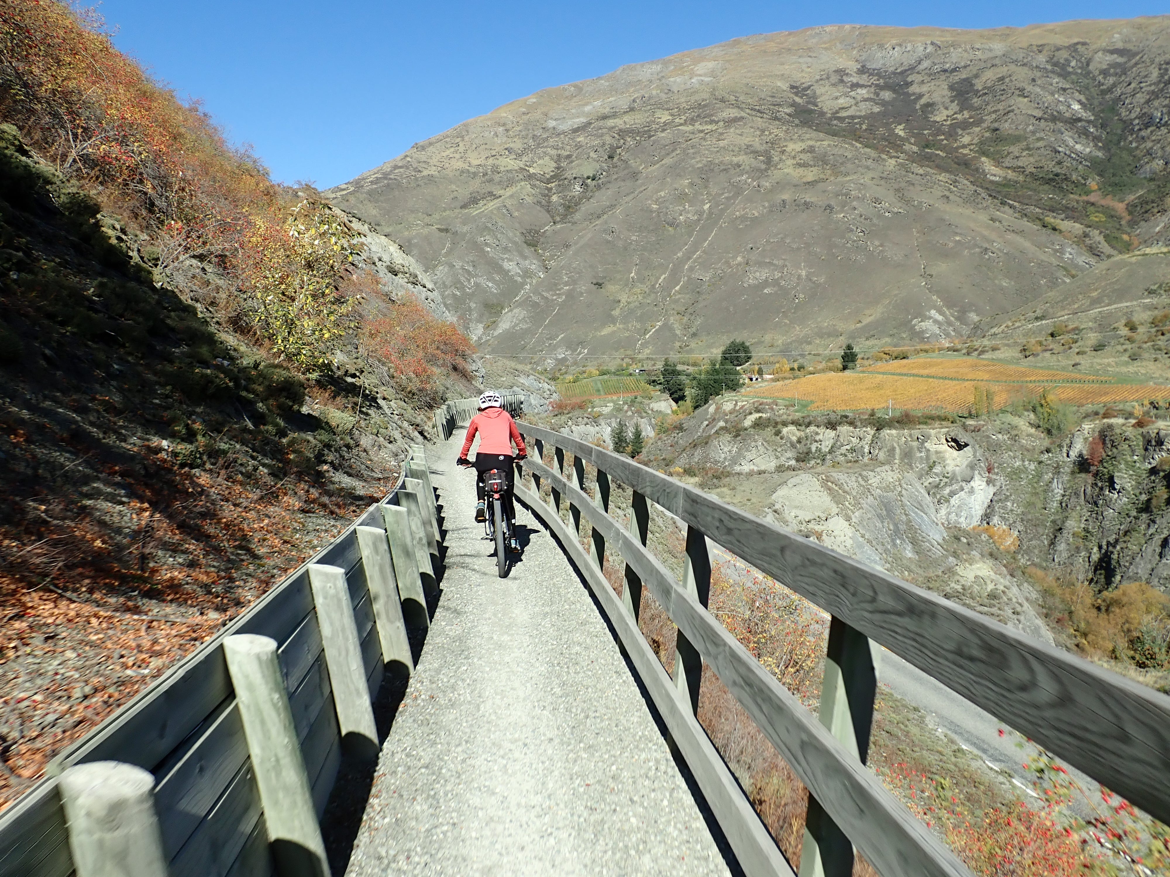
After a short break at the bungy bridge (where we saw a couple of people leaping off), we backtracked to the Arrow Bridge to connect up to the Twin Rivers Trail. This trail was a little shady (with the sun being so low at this time of year) but had nice views over the Kawarau River and was also easy to ride despite its grade 3 rating. (Likewise, the Lake Hayes Trail - both trails had a couple of narrow bits with steep drop-offs, but otherwise were more akin to a grade 2 trail.)
At the Shotover Bridge, we switched to the Countryside Trail to complete our loop back to Lake Hayes. Apart from another steep hill climb (which Chris managed but I ended up walking), it was a leisurely ride back along pretty and quiet country roads. All up, we cycled 54 kilometres that day.
We cycled these trails on a weekday so there weren't too many other cyclists about. But when we returned to Arrowtown the next day (a Saturday), I noticed some really big groups gearing up for a ride. Best avoid weekends I think.
Coronet Loop Trail
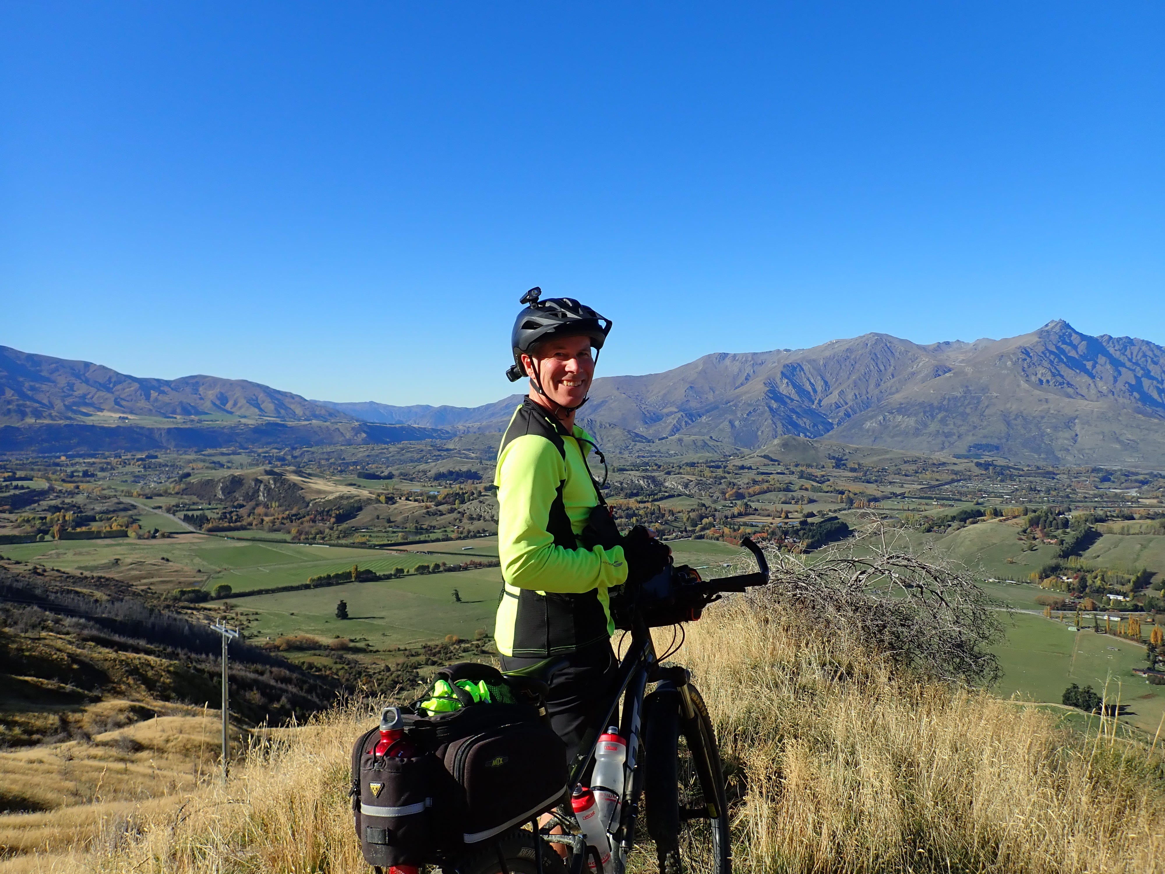
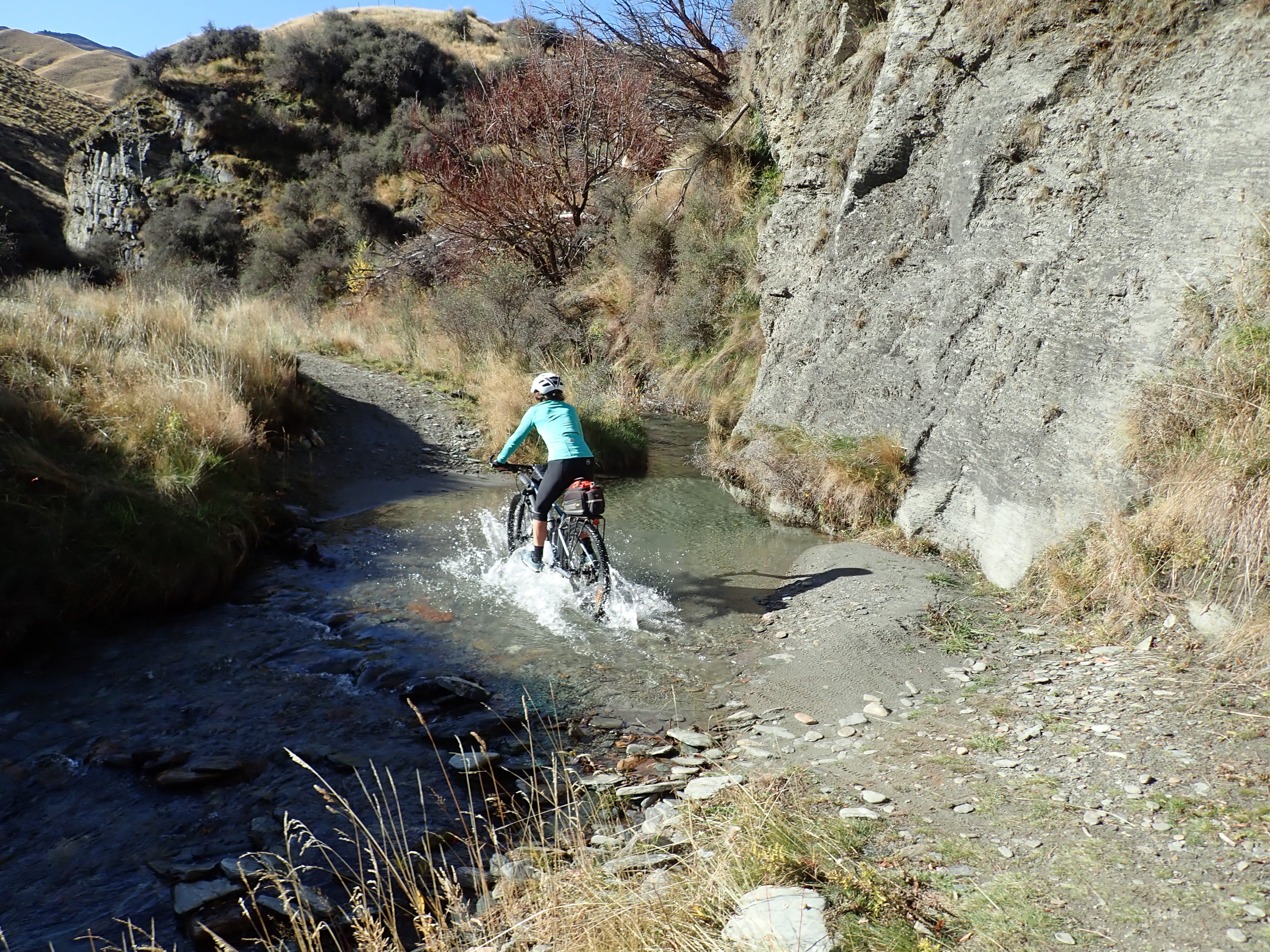
The Coronet Loop Trail (purple line on the map) is the newest addition to the Queenstown Trail and is a 50 kilometre circuit around Coronet Peak from Arrowtown. It’s a grade 3 mountain bike track and the most challenging of the trails. There is lots of climbing (1700 metres in total), some fairly steep downhills, and multiple stream and river crossings.
We knew we would be pushing ourselves (and our bikes) with this trail. But we really enjoyed our experience on the Around the Mountains Trail and wanted to do some more back country cycling.
The ride is apparently best done in a clockwise direction so we started by heading up the Bush Creek track. It was another beautiful clear day but also cold and frosty so the track was a bit slippery underneath, particularly on the steeper sections. With loose gravel and rock underfoot (or wheel), we found it easier to get off the bikes and walk the steepest bits. (We had earlier agreed that we would turn back if the track was too much for us but, on the day, decided it would be much tougher to go back downhill.)
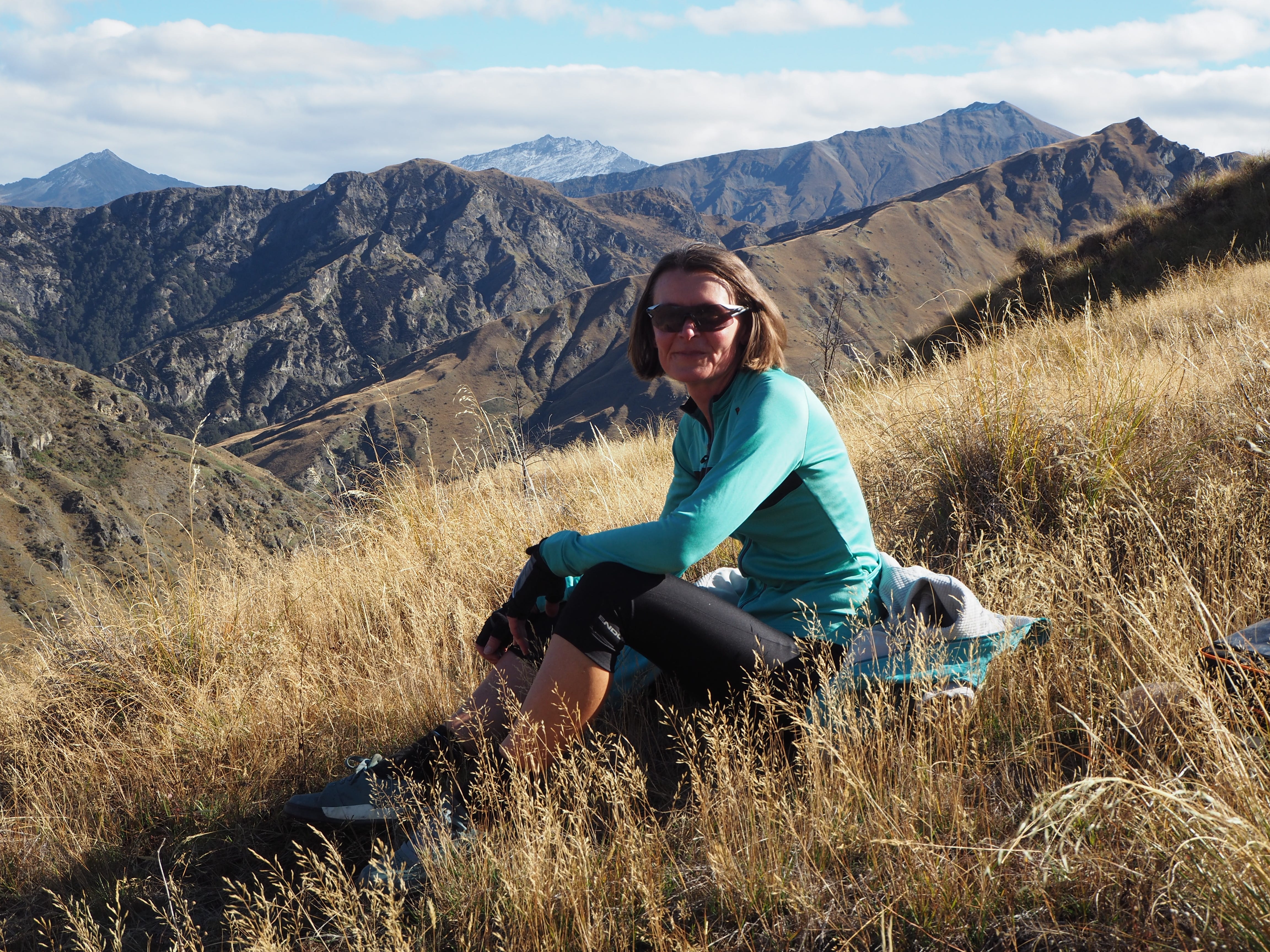
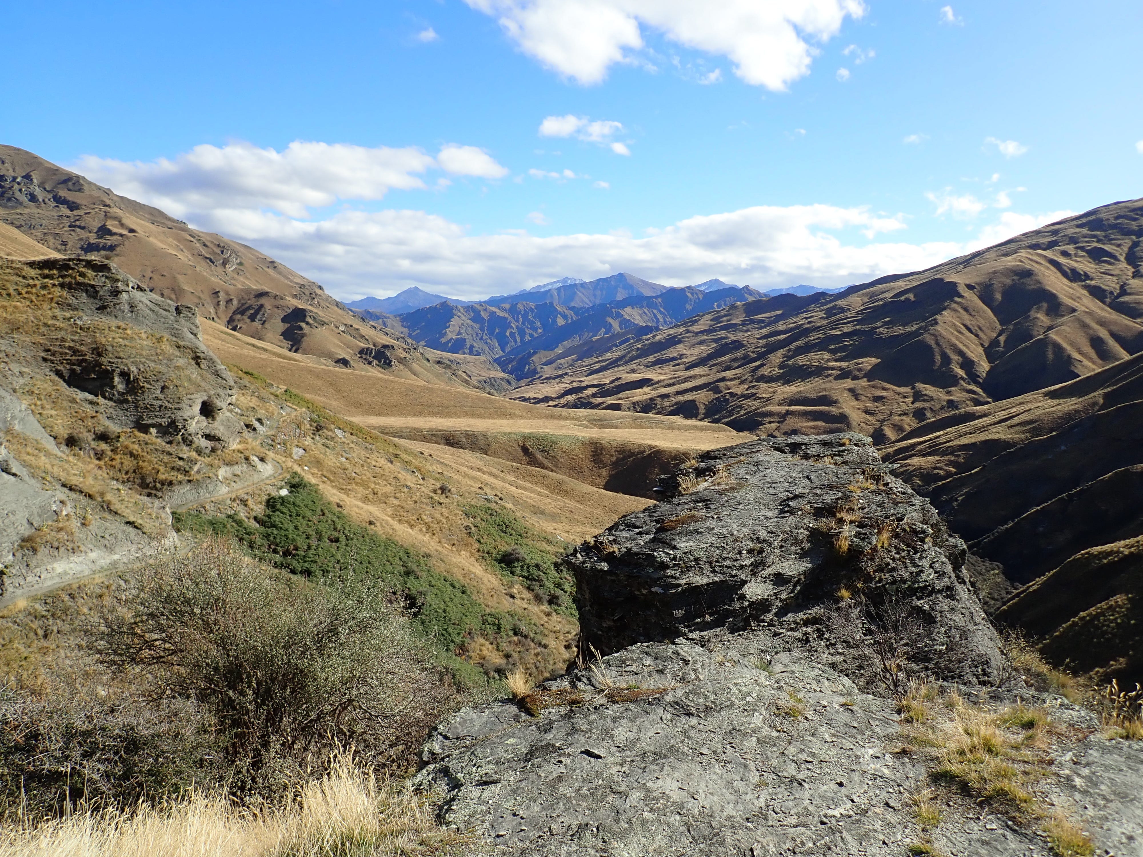
The track runs alongside a creek and through forest (with lots of rocks and bumpy tree routes to navigate). It eventually opens up (and levels off) into a tussock area and we found the cycling easier from here. And it wasn't much further until we reached the first saddle and could enjoy glorious views across the Wakatipu basin and over to the Remarkables.
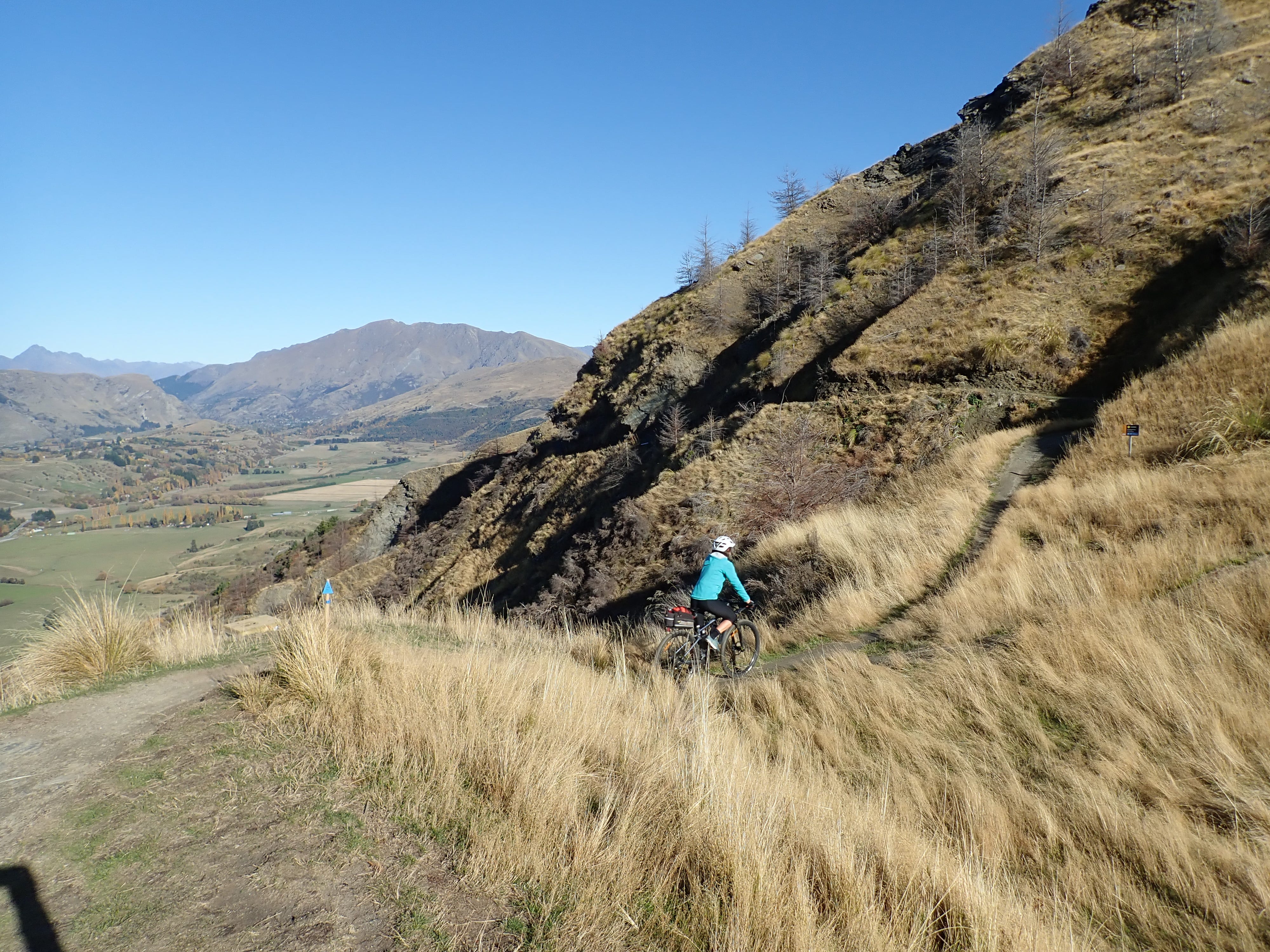
Moving on, we had another climb around the edge of the mountain and up a series of switchbacks to Skippers Road. We had a choice of tracks here - we avoided a short grade 4 (advanced) section and rejoined the trail shortly after for a steep and rocky descent through a gully. There were a few other mountain bikers on the trail and they absolutely loved it. But I was terrified and made it down very carefully with a mix of walking and heavy use of my brakes. (We could have opted for a slightly less steep gravel road instead but it was longer route and shared with cars.)
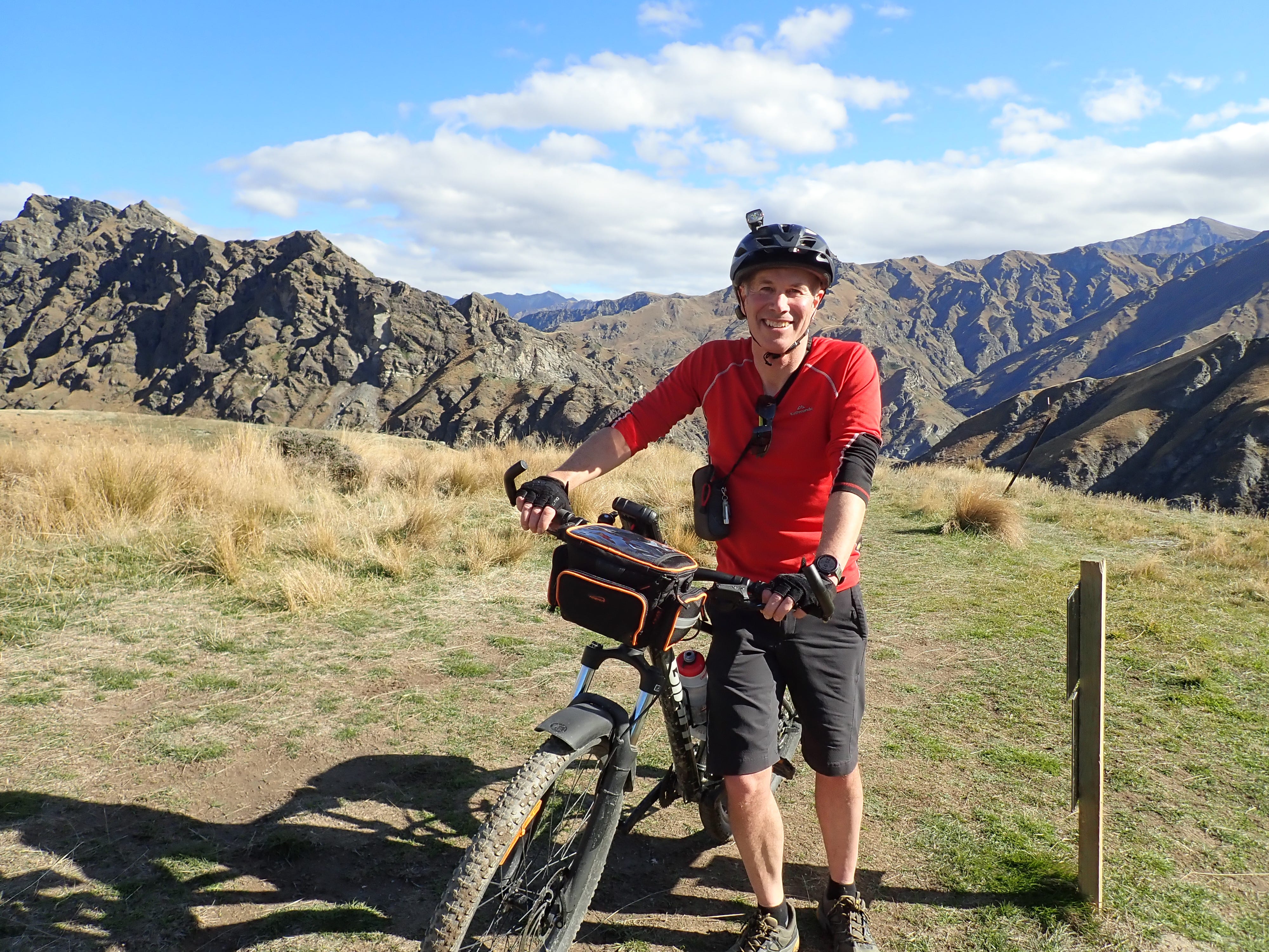
I was very happy to get to the end of the gully and start the next climb - a long and slow grind, but nothing we haven't done before, and the reward was lunch looking out over Skippers Canyon.
Not long after, we reached an old miner's hut, which is where we first encountered a group of five local tradies. They were real gung-ho mountain bikers and having an absolute ball, especially on the downhills. Despite being in the back of beyond, they were all in t-shirts, without any extra layers of clothing, or bike gear (like tools and spare tube in case of puncture) or food, or even much in the way of water. But they were having fun, and were fun to watch.
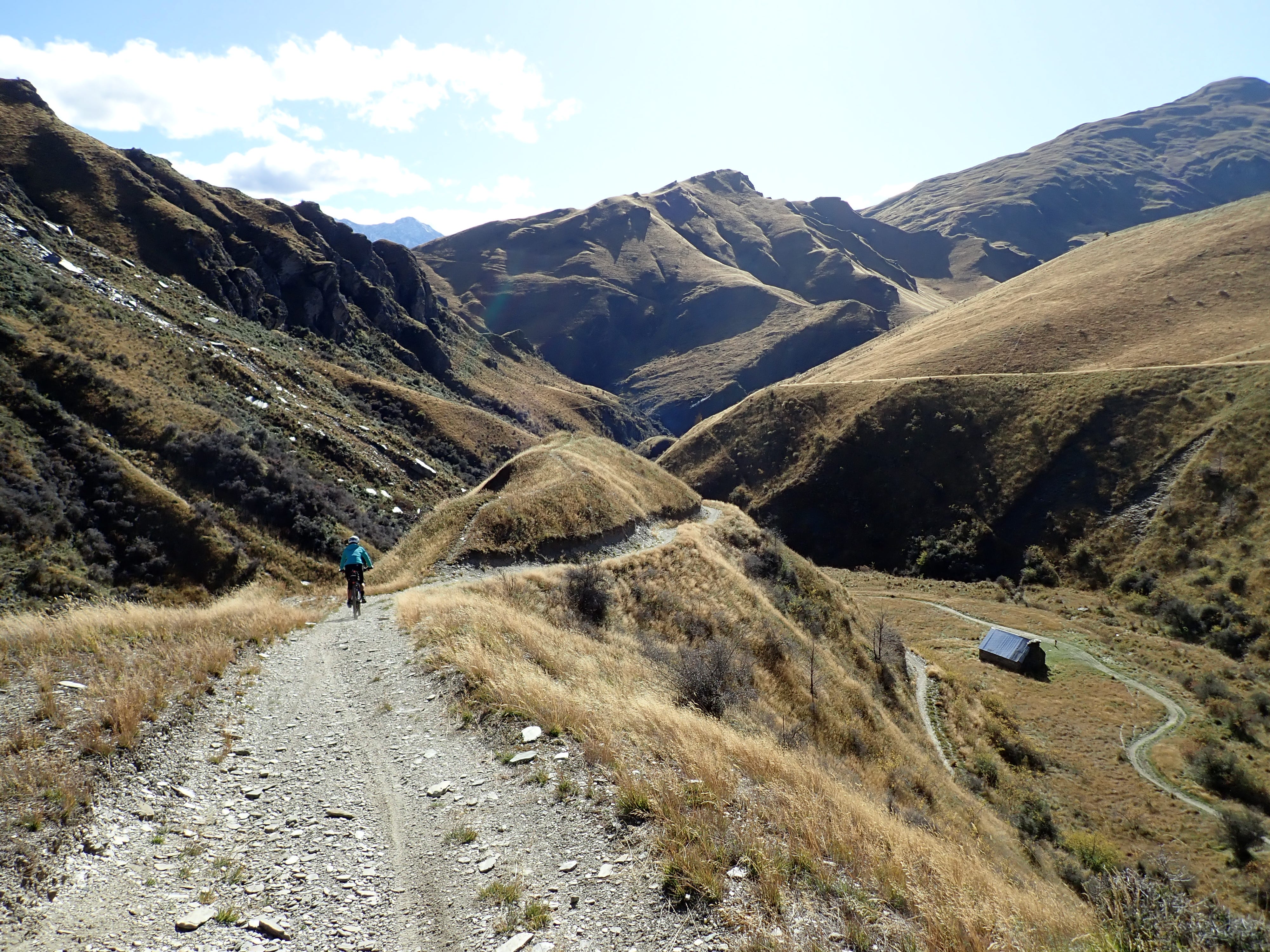
From here, we had the first of many stream crossings and some more (but less terrifying) downhill before settling in for the final climb of the ride over a six kilometre stretch.
The last 15 kilometres of the trail is mostly downhill, with the final ten kilometres following a four-wheel drive track along (and through) the Arrow River.
Chris was unlucky to get a puncture while fording a small stream and then his chain came off while crossing the Arrow River (and again several times afterwards). There was no avoiding wet feet for either of us.
We had another choice for the final 1.5km - carry our bikes up some steep steps to connect to a walking path back to Arrowtown, or continue down what remained of the road with several more river crossings. We chose the steps, which proved to be the right choice as we got back well before other cyclists taking the river route.
Fifty kilometres doesn't sound like a long ride but it is when you are doing this type of cycling. We were out on the trail for seven hours (with about five and a half hours of riding time) and we had lost the sun by the time we finally made it back to Arrowtown.
It wasn't an easy ride but we thoroughly enjoyed it - the scenery was spectacular, there were few other cyclists on the trail, and we got a real sense of achievement in pushing ourselves to complete a harder ride than we were used to.
The ride would be even better on mountain bikes with full suspension. We were the only ones riding hardtail mountain bikes, and they made for quite a bumpy ride. Ideally we would have different bikes for different purposes, but Chris is adamant there is no room in the garage!
Other available trails
There are several other trails that form part of the Queenstown Trail, which we didn’t have time to do on this trip:
Gibbston River Trail (red line on the map) - this is a 8.7km grade 2 track from the Kawarau Suspension Bridge to the Gibbston Back Road. It passes by numerous local wineries so it’s the one to do if you’re up for some wine tasting (or lunch).
Frankton Track and Kelvin Peninsula Trail (dark blue) - this is an easy grade 2 trail that starts at the Queenstown Gardens and follows the lake edge around to Frankton and on to the Kelvin Peninsula. It passes by the Kawarau Falls Bridge so you can connect here to the Twin Rivers Trail.
Jack’s Point Trail (yellow) - this is an advanced (grade 4) trail that starts at Kelvin Heights (near the end of the Kelvin Peninsula Trail) and goes to Jack’s Point. The track is a narrower and more technical track than the other trails but the reward is sweeping views of Lake Wakatipu and the mountains. It’s 7.1km long and doesn’t connect to any more trails so you need to ride both ways or get a lift back.
Amazing adventure Angela, some of the tracks are quite steep, how you manage them, quite incredible, superwoman you are. Pics are unbelievable, whoever took them, fabulous. take care bike on girl.