Cycling in Marlborough
And a reminder that cycle trips don't always turn out as planned

I am making good progress on my cycling goals for the year. I’ve kept up my bike fitness with regular cycling and weekly spin classes, I exceeded my target of 700 kilometres in the Aotearoa Bike Challenge (924 kilometres in the end), and I’ve booked a trip to Japan later in the year. And last week, Chris and I set off on what should have been a full week cycling at the top of the South Island.
The plan was to spend the first half of the week in the Marlborough region and the second half in the Nelson area for a three-day loop of Tasman’s Great Taste Trail. Six glorious days of cycling in a wonderful sunny part of the country.
The week started with lovely warm days and so things (mostly) went to plan for the Marlborough leg of our trip. But the second half of the week coincided with stormy weather that affected the whole country. Initially, we hoped rain forecast for Nelson would not eventuate (New Zealand weather is very unpredictable and forecasts often do change). However, forecasts for rain became forecasts for heavy rain and then talk turned to an “atmospheric river” for the nearby West Coast.
We considered toughing it out and accepting that we would just get wet (or catching a shuttle to avoid the worst of the bad weather). But, when a series of heavy rain and strong wind watches were issued, and later became severe weather warnings, we knew it was time to pull out. It was disappointing but it would have been foolhardy, as well as downright miserable, to continue.
We’ve been incredibly lucky with weather on previous trips and I guess it was inevitable our luck would run out eventually. However, we did get three days cycling in Marlborough, and will try again for Tasman's Great Taste Trail another time.
Queen Charlotte Track
The Queen Charlotte Track is a 73.5 kilometre trail that stretches through native forest, past beaches and along ridgelines in the stunning Marlborough Sounds. The track is shared with walkers and starts at Meretoto/Ship Cove in the north (where Captain Cook landed in 1770) and finishes at Anakiwa in the south. Boats can carry your bags and drop you off (or pick you up) at various points along the track, and lodges provide comfortable accommodation and meals along the way.
The track is not for beginners with a mix of grade 3, 4 and 5 sections (intermediate, advanced and expert). It covers steep and rocky terrain and can be slippery after wet weather. Most cyclists take two or three days to cycle the full trail.
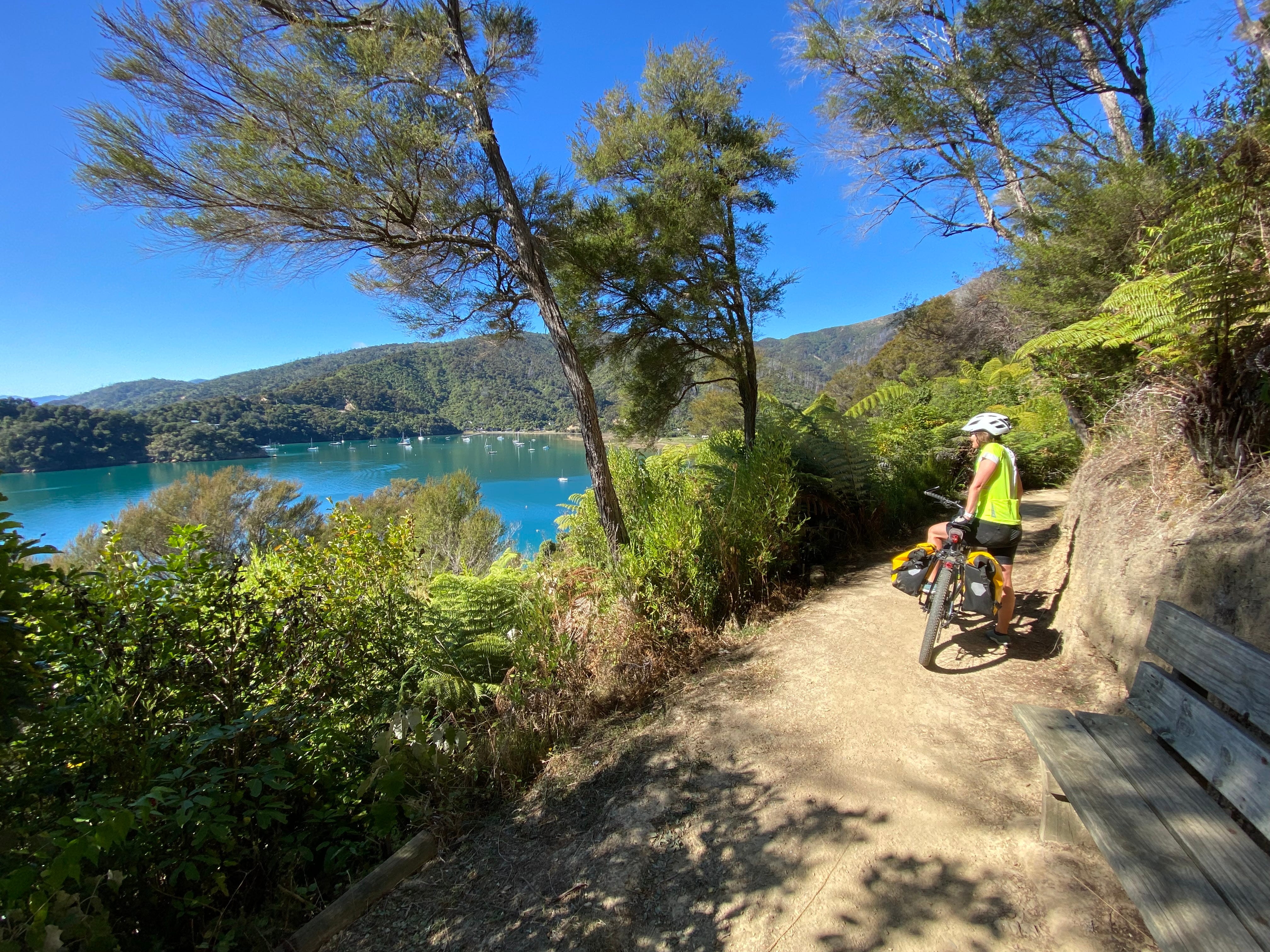
We originally planned to cycle the grade 3 sections of the track, switching to the nearby gravel road for the harder bits, so we could (sort of) complete the whole trail. But Kenepuru Road remains closed to the public after storm damage a few years ago, so we decided to just do the final 12.5km from Mistletoe Bay to Anakiwa.
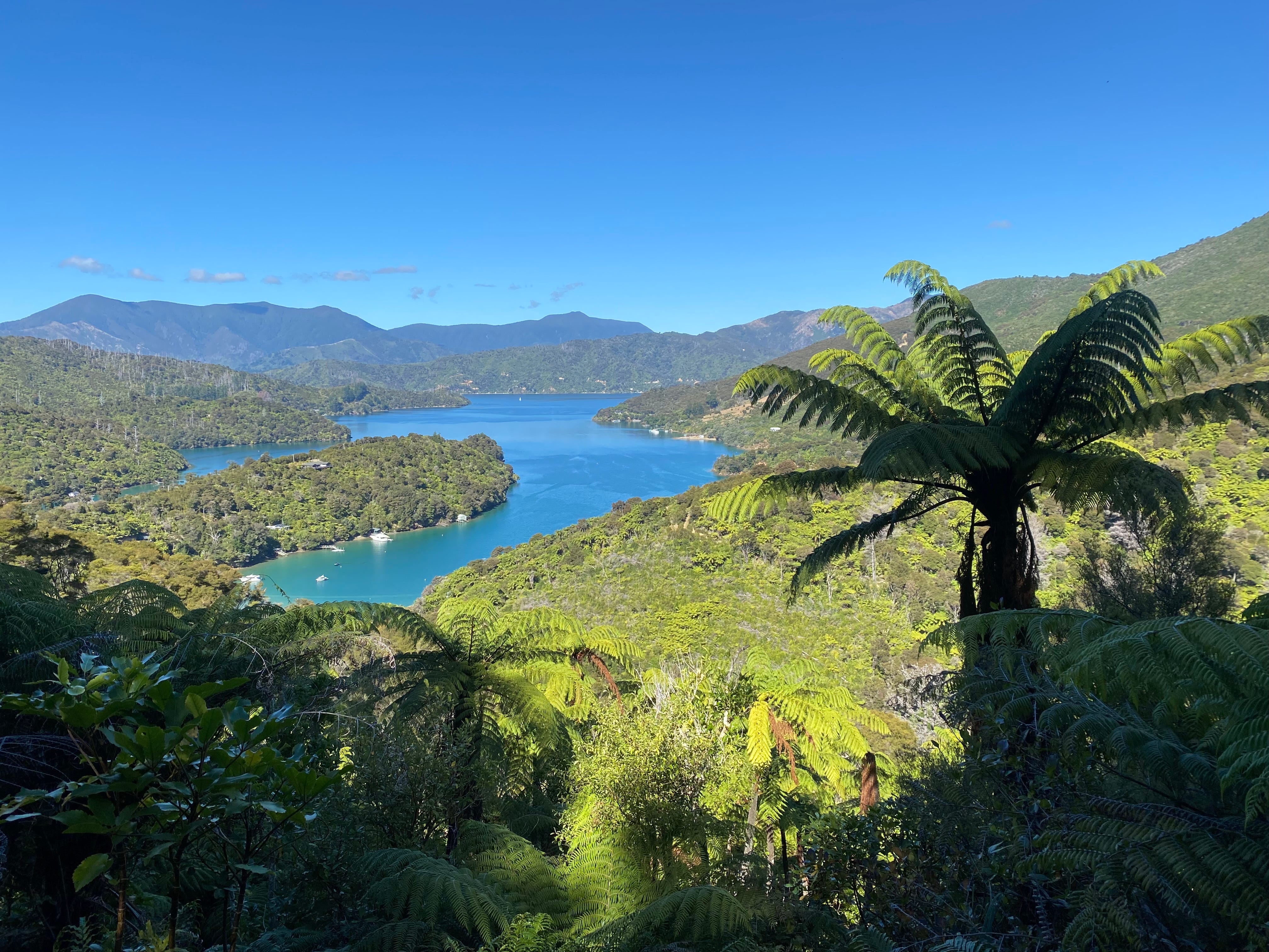
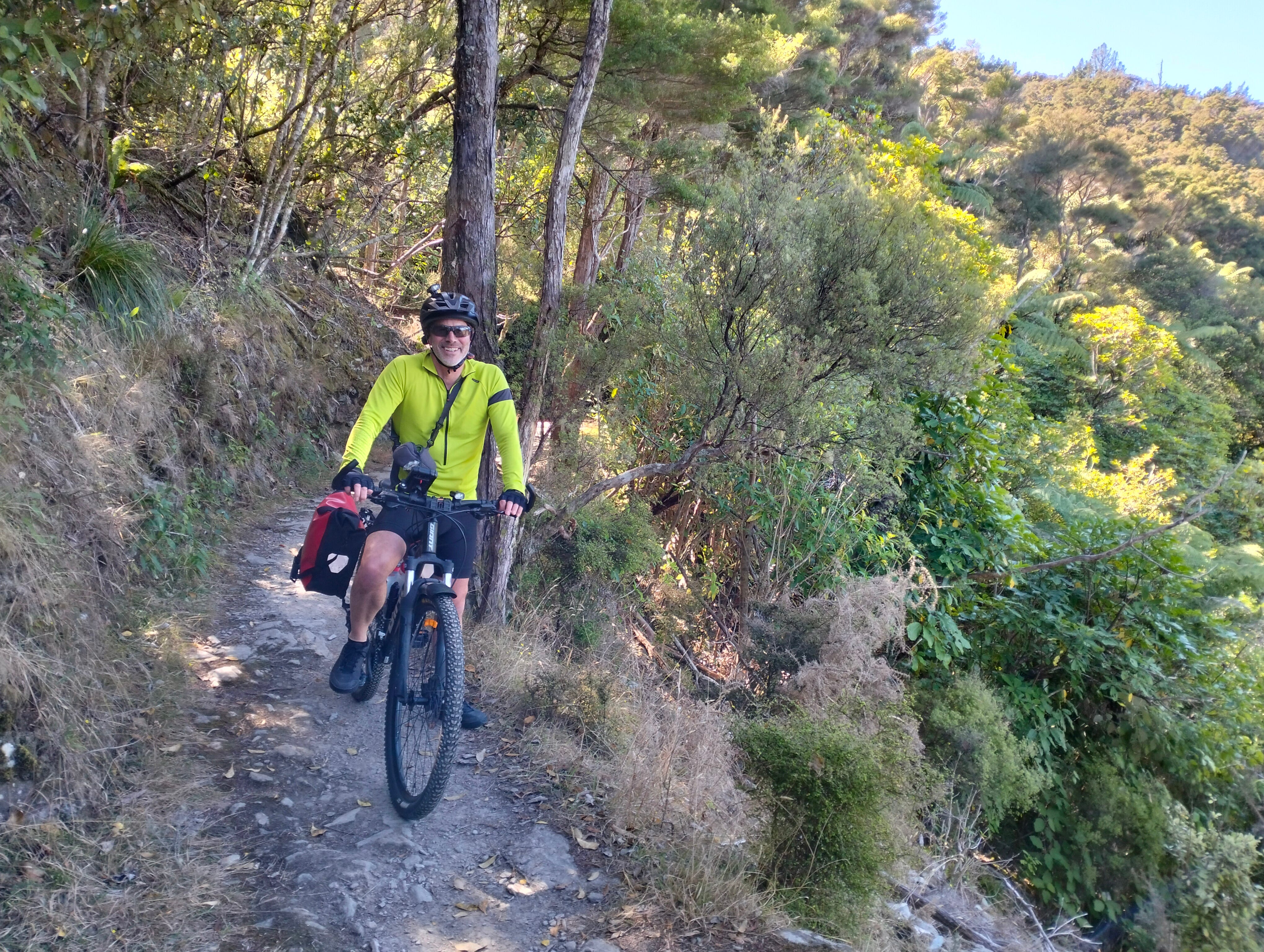
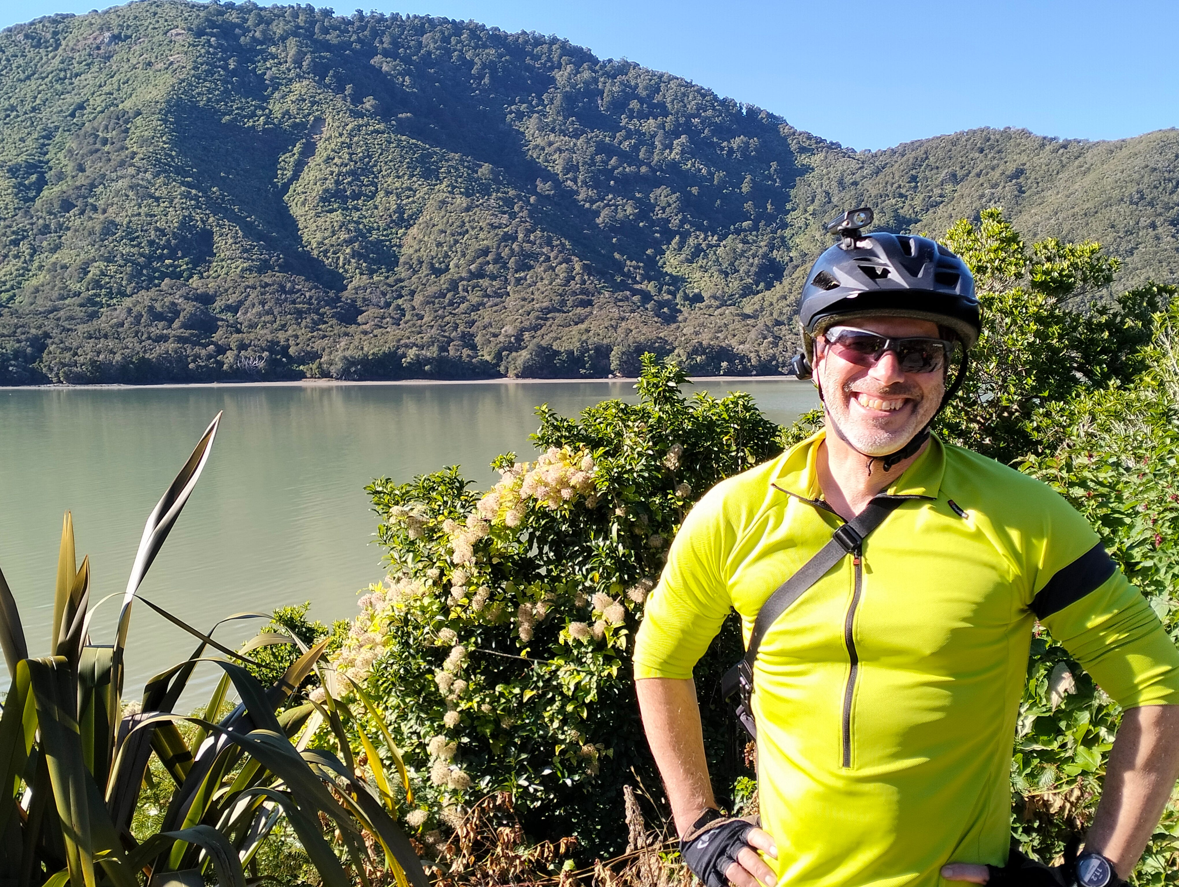
We started our day in Picton, getting a boat to drop us (and our bikes) at Mistletoe Bay. Accessing the Queen Charlotte Track from there requires a fairly steep climb up a rutted gravel road for about a kilometre. Then the track itself is an undulating mountain bike track, with lots of rocks and tree roots to negotiate. The track winds around the edge of the hill through native bush, with lots of glimpses of the sea and places to look out over the Marlborough Sounds.
I was glad we opted to just cycle this one section. It's hard work on a bike and even harder if you're carrying panniers (as we were). We found the extra bulk and weight of our panniers really altered our balance and manoeuvrability on such a narrow, winding and rocky trail (and they were only half full). It was a bit of a learning exercise for us and we vowed to never take panniers on a mountain bike track again.
We got talking to a big group of mountain bikers who were completing the full track. They confirmed that other parts of the track were much tougher, with steeper climbs, steeper descents and some slippery surfaces. They were clearly experienced mountain bikers, travelling light on full-suspension bikes, but even they had to walk some bits, and several had fallen off their bikes at some point.
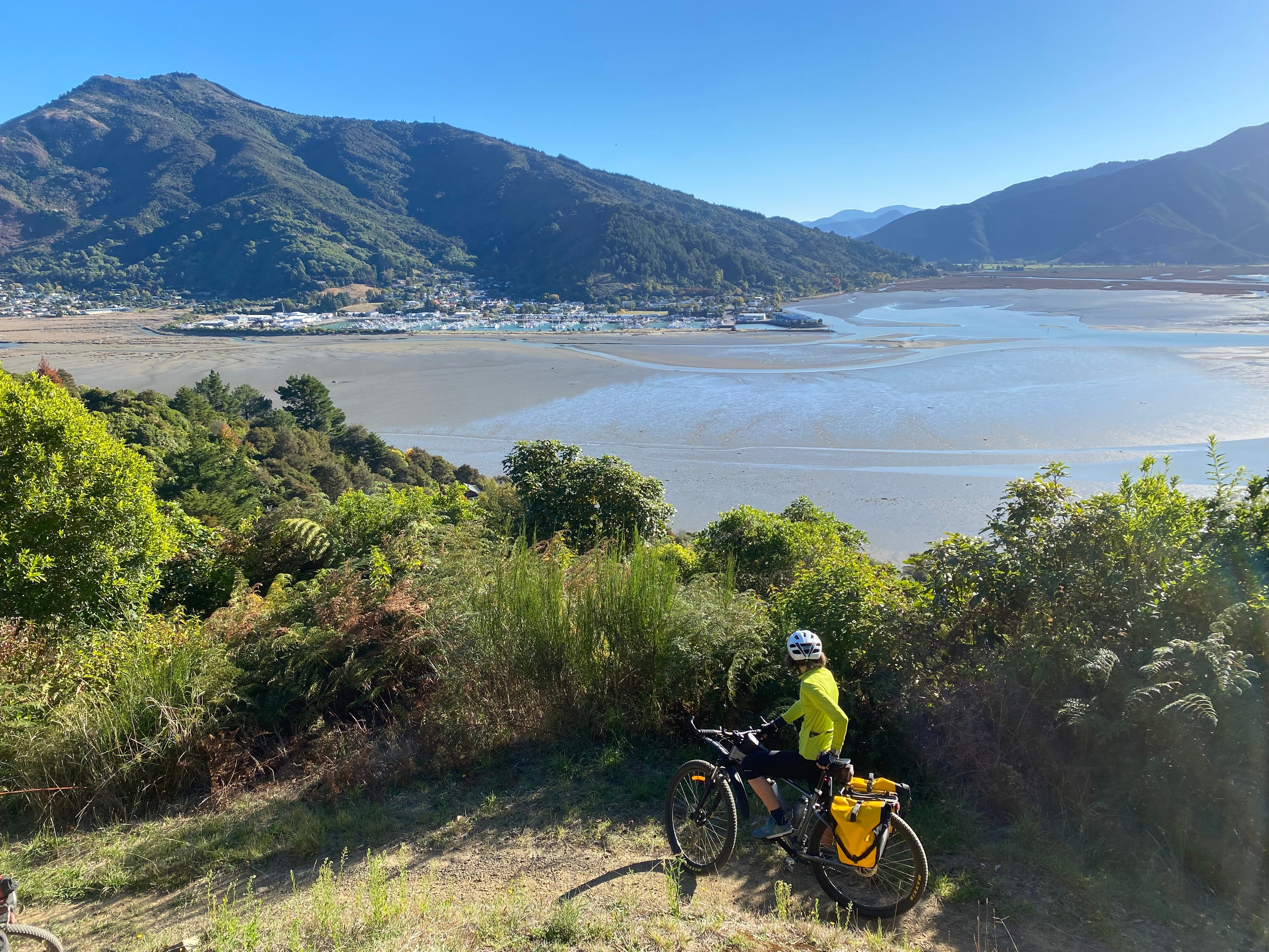
After a while, the track is predominantly downhill and winds back down to sea level, passing by a large reserve and camping spot at Davies Bay. The final few kilometres are largely flat, with a wider gravel path winding through the bush and around the coastline to the end of the track at Anakiwa.
Anakiwa is a lovely spot - home to Outward Bound New Zealand’s outdoor education programmes and a scattering of holiday homes - and most people get a boat back to Picton from here. We stopped a short while to refuel and catch our breath, and then cycled on to find the Link Pathway.
We found the Queen Charlotte Track incredibly peaceful, and the scenery is stunning. It was a tough bike ride, and we really had to concentrate, but we coped and I am pleased we did it. Next time, though, I think I might walk and try to do the whole track over several days.
Link Pathway
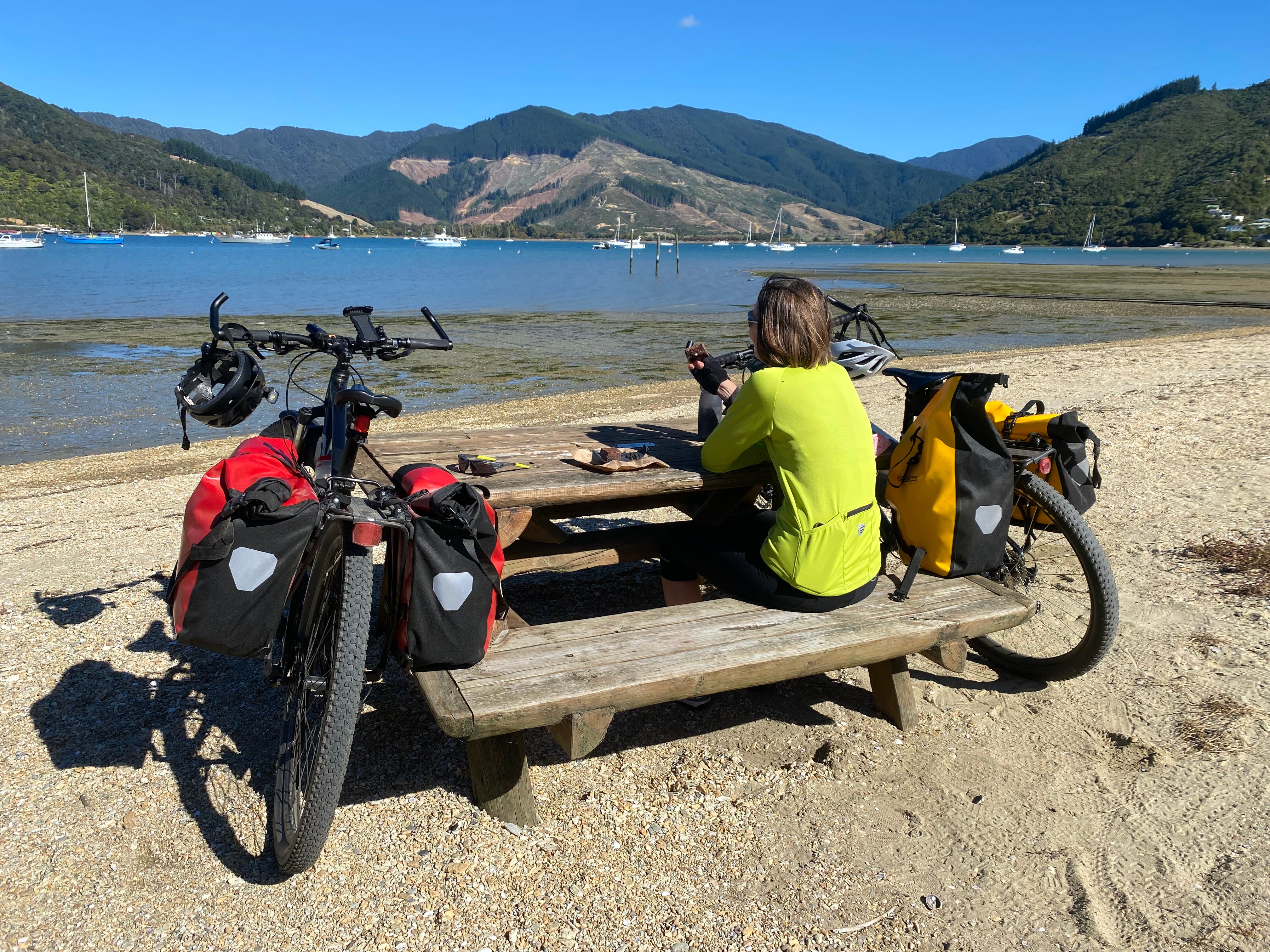
Te Ara Tuhono Link Pathway is a 42 kilometre trail that runs between the port towns of Picton and Havelock, with a connecting path through to Anakiwa. That means you can finish the Queen Charlotte Track and then make your own way back to Picton (or Havelock) without having to get another boat.
So, that is pretty much what we did. We wanted to cycle the full trail so we decided to go to Havelock first and then ride back to Picton the next day.
There isn't yet a lot of information available on the trail so we weren't entirely sure what to expect, other than it being an off-road grade 3+ (intermediate) trail. The route roughly follows the scenic Queen Charlotte Drive - sometimes right next to (or on) the road, other times looping away on trails up above (or down below) it.
Starting at Anakiwa, the trail runs alongside the road for about four kilometres until it meets Queen Charlotte Drive. It's a bit narrow in places but not particularly difficult.
Heading west towards Havelock, the trail continues alongside the road through flat, open grassland. At first, I was thinking it was a bit of an anticlimax after the beautiful bush setting and sea views of the Queen Charlotte Track. But the terrain gradually changes and it's not long until you are back to the coast and cycling through native bush.
The trail itself is a bit of a mixed bag. Some parts have been done well, with nice wee forays into the bush overlooking the sea. Other parts feel unfinished and erosion to the track has resulted in some fairly narrow sections close to the edge (more on this shortly). Sometimes the path simply stops and requires you to ride on the road for a short distance - which is OK if you are travelling on the left side of the road from Havelock to Picton, but not so great in the other direction.
Closer to Havelock, the trail makes use of a couple of walking tracks high up the hill and well away from the road. These are similar to the Queen Charlotte Track in many ways - narrow, winding, bumpy, surrounded by native bush, with some great lookout points over the Marlborough Sounds and, eventually, Havelock. But I found the riding a bit harder going - possibly because I was getting tired of having to concentrate so much after several hours of riding.
I was very happy when we descended again for the final boardwalk section into Havelock. And I faced the unusual situation of not looking forward to the following day’s ride back to Picton.
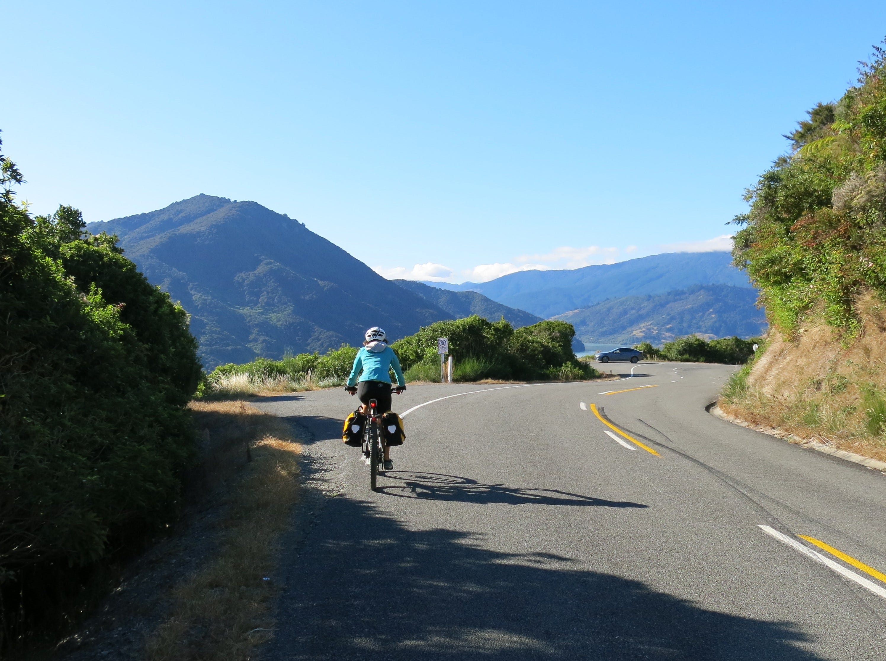
The next morning, we decided to take the road instead - at least as far as the turnoff to Anakiwa and then perhaps return to the Link Pathway for the section through to Picton that we hadn’t yet cycled. So we did, and it was great. Queen Charlotte Drive turned out to be even more scenic than the Link Pathway, and because we didn’t have to focus on negotiating rocks and tight corners the whole way, we were able to relax and enjoy the view.
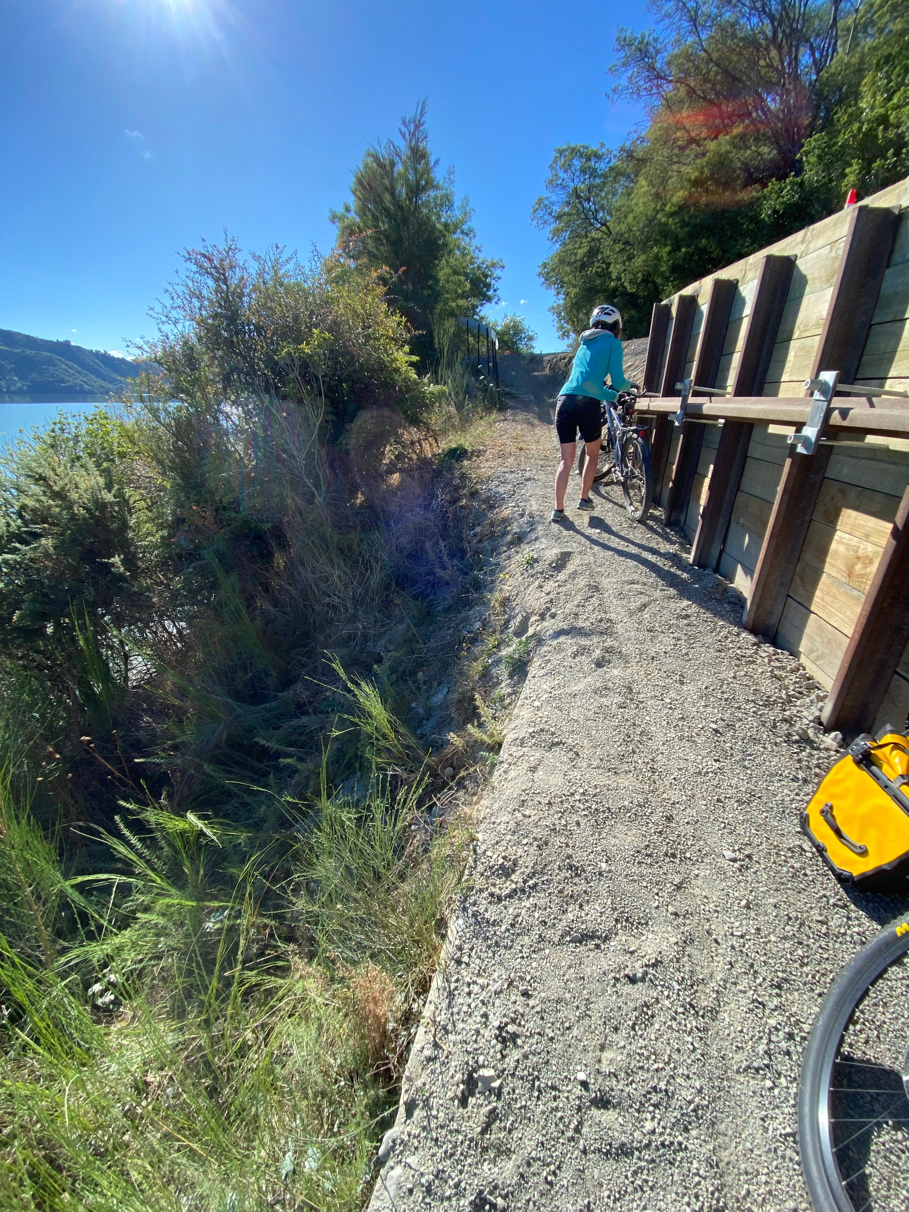
And then I made a silly decision. There were lots of stoppages for road repairs along Queen Charlotte Drive, which were no big deal. But at one point, I decided to divert back onto the Link Pathway, thinking that we might avoid stopping. I should have remembered from the previous day that this particular bit of track was just a small off-road dip (so wouldn’t avoid the roadworks) and, more importantly, that it was quite narrow, with the gravel path having eroded away.
As I rode through, my handlebars clipped a long bolt sticking out the side of a retaining wall, which caused me to overbalance. The combination of a narrow path and the weight of my bike (not helped by the panniers) meant I couldn’t correct my path and ended up tipping over the edge and sliding (with my bike) down the bank towards the sea.
It all happened very quickly but I remember thinking “oh s**t, this is not going to be good”. Fortunately, this particular bit of bank was covered in gorse and gravel (rather than exposed rock), which helped cushion and slow my fall. So, while I received several scrapes and bruises (and lots of little gorse punctures), I was able to get up and keep cycling. On the road.
Arriving at the first of several pretty bays (Momorangi Bay), we had a choice of staying on Queen Charlotte Drive or giving the Link Pathway another go by cycling along a high bush track through to the next bay (Ngākuta Bay). We opted for the path, which again required full concentration, and again we decided we preferred the road. We skipped the next off-road detour into the bush, but returned to the trail one more time (to see the remains of an old WWII signal station) close to Picton.
The trail was more enjoyable on the tracks closest to Picton, but I think it’s unlikely we will ride the Link Pathway again. Cycling along Queen Charlotte Drive is a great ride in itself (it’s a connector route used for the Tour Aotearoa), and much more relaxing. It’s (mostly) a winding road so vehicles tend to avoid it, and the few cars on the road are generally travelling slowly.
Whale Trail
The Whale Trail has its origins in the 2016 Kaikōura earthquake (a magnitude 7.8 event), which temporarily isolated the Kaikōura township and caused significant damage across the district and beyond. Locals were keen to revitalise the regional economy and came up with the idea of developing a world-class walking and biking trail to showcase the region and connect coastal communities between Kaikōura and Picton.
Work has started on building the trail, but it will take a few more years before it is complete. A small section of path is open from Blenheim heading north towards (but still well short of) Picton, and the route between Blenheim and Seddon is complete.
We opted to cycle the return trip from Blenheim to Seddon, which is roughly 65 kilometres. As with the Link Pathway, there isn’t a lot of information available on the trail and we didn’t know what to expect.
We were very happy to discover that the Whale Trail is indeed shaping up to be a world-class trail that will be accessible to many cyclists. I haven’t seen a grading yet, but I’m guessing it will be a grade 2 (easy) trail. It uses a mix of off-road pathway (tarseal or fine well-compacted gravel) and quiet sealed and unsealed roads. And care has been taken to provide safe crossing points, wide turns, rest areas, and plenty of signposting to help people find their way. It is definitely not a mountain bike track.
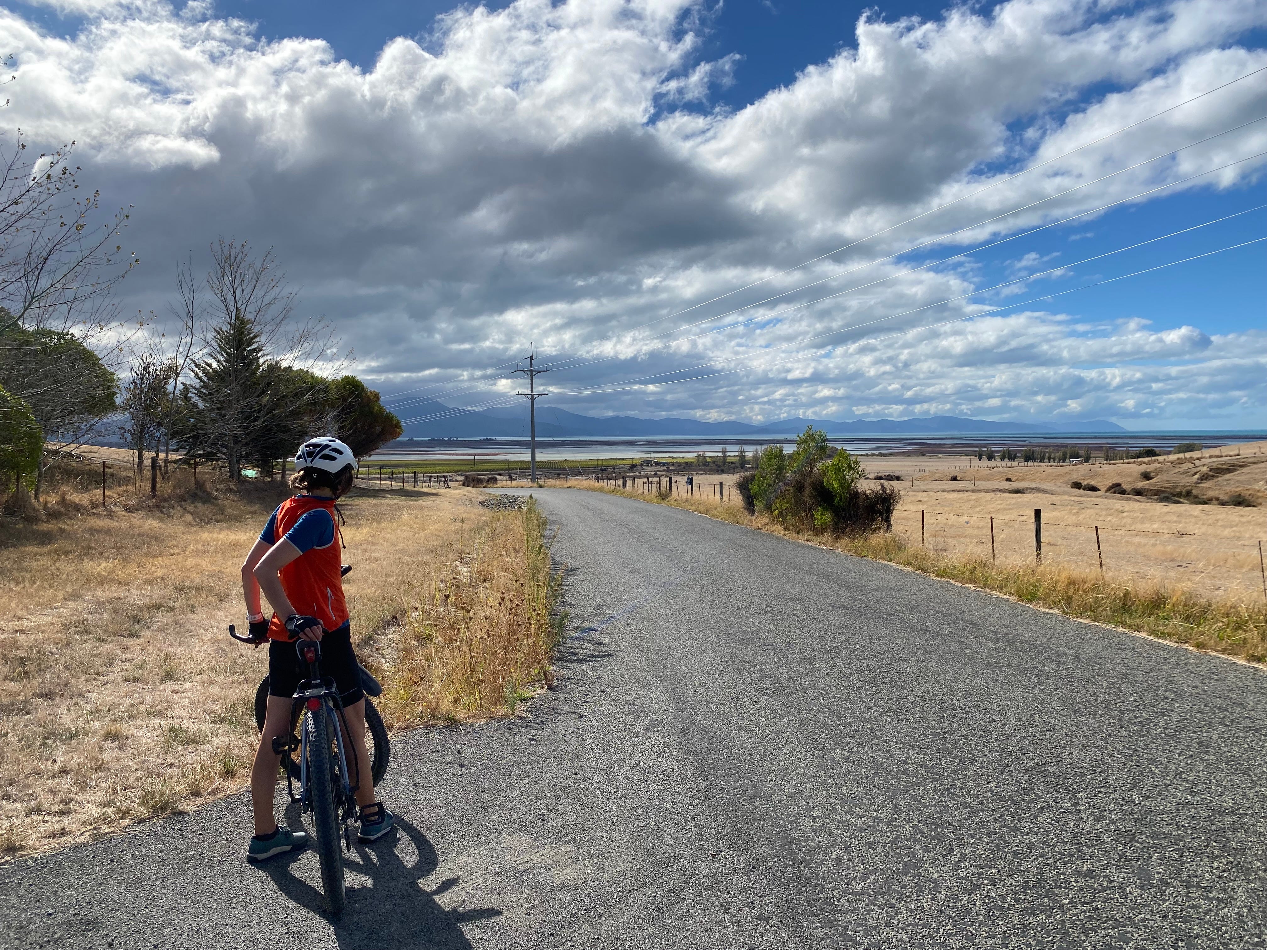
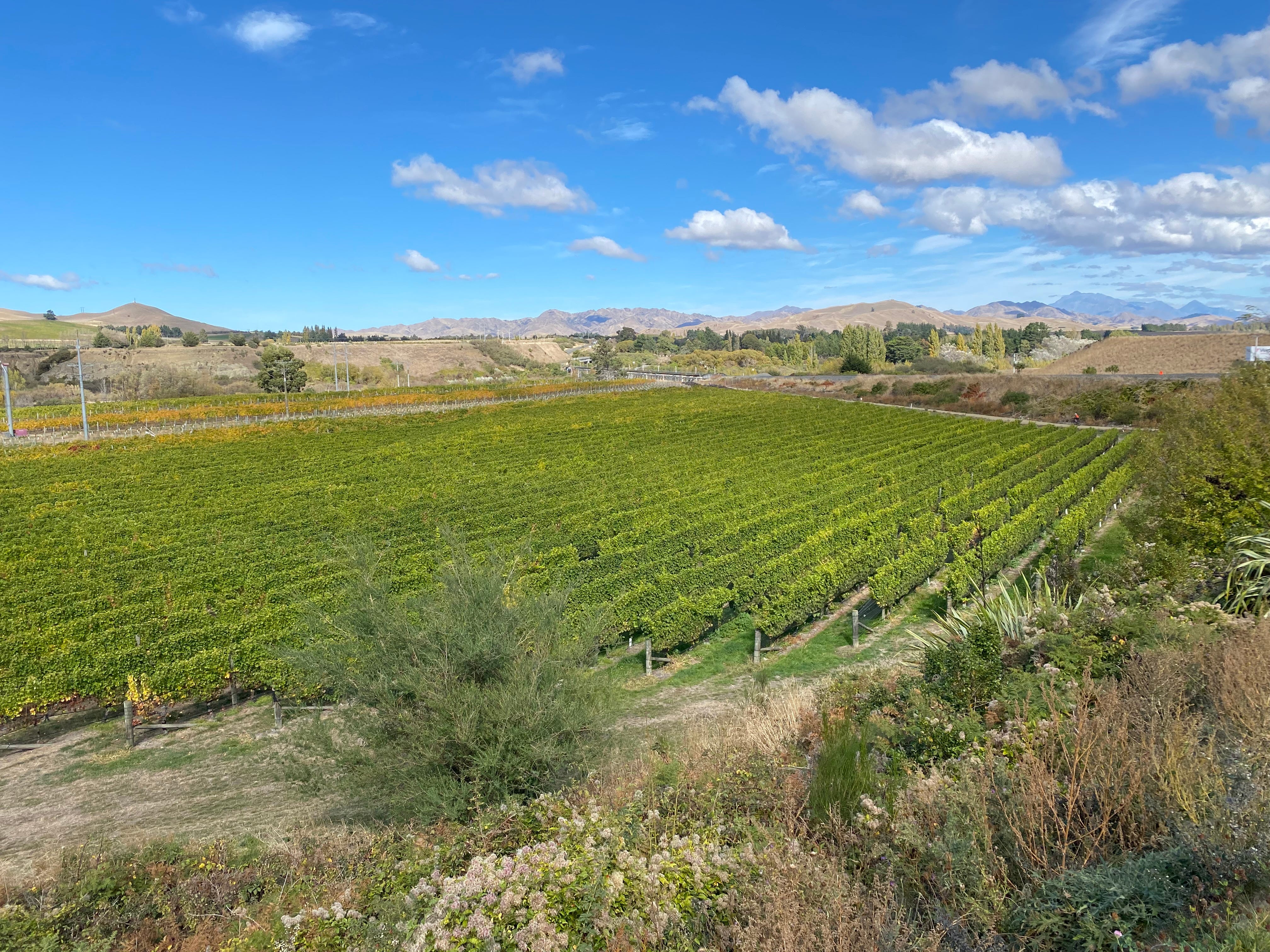
Heading out of Blenheim, the trail follows an existing shared path through the Riverlands industrial estate and then a wide gravel track past vineyards and farmland. It’s not the most salubrious of surroundings, and the trail runs alongside State Highway 1 for several kilometres (with one road crossing) but it’s a safe and easy way to leave the urban area.
From there, the trail follows a quiet back road past vineyards up and over a hill on a completely different route from the main traffic and railway line. The hill requires a bit of effort, especially when the tar seal runs out a few kilometres from the top (in either direction) and you have to wind your way up through chunky gravel. But the reward is a wonderful soaring descent through to more vineyards and big views of the surrounding hills. You even get a glimpse of the sea.
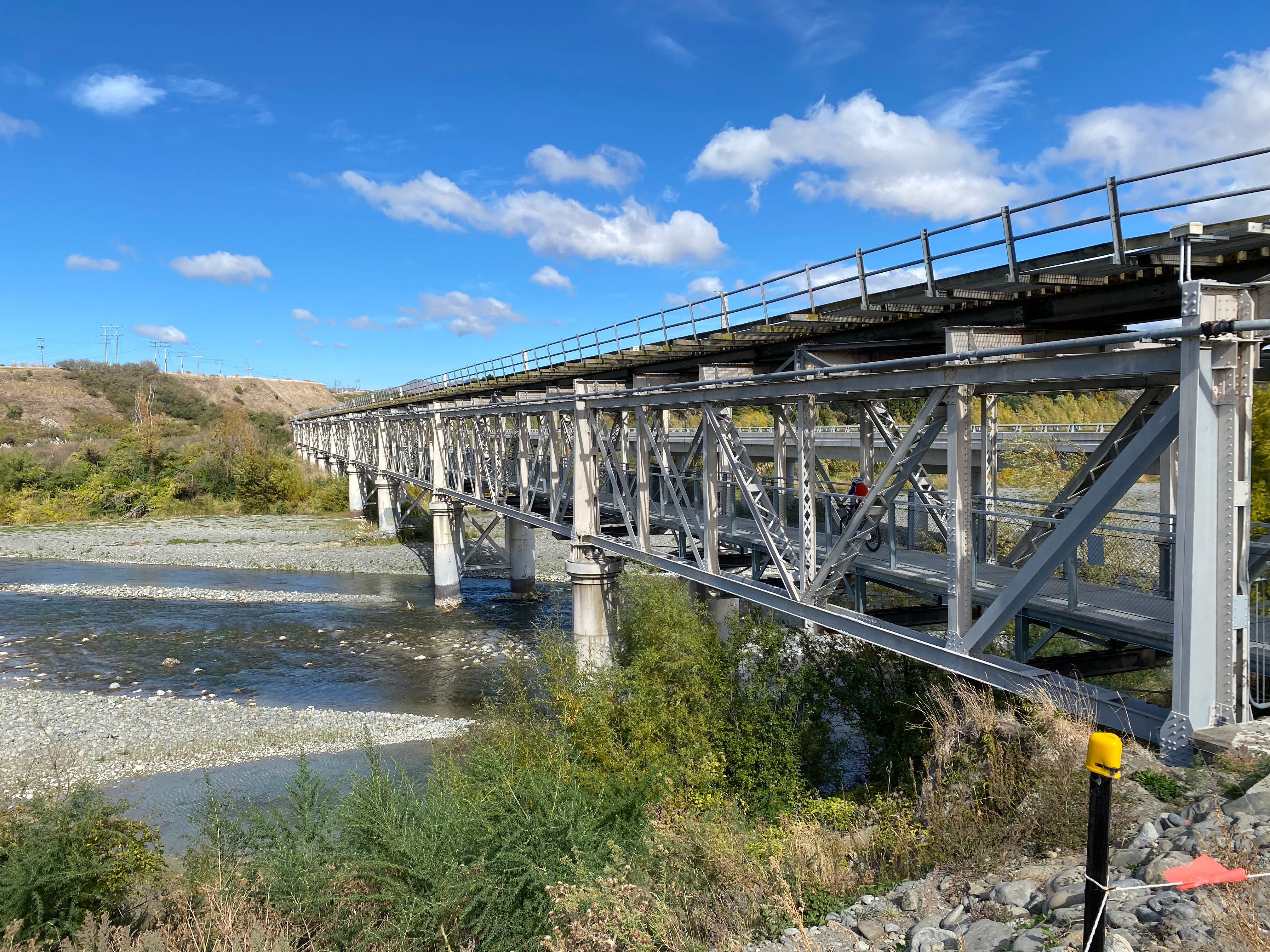
The rest of the way to Seddon is largely flat, with a long scenic ride past the vineyards to connect back up to the main road and railway line, cycling alongside them on a separate cycle track to the historic Awatere rail bridge. Those of us of a certain age will remember the road used to travel over the bridge underneath the railway line. Now the cars have their own bridge, and a new lower platform has been built just for walkers and cyclists.
In the last few kilometres to Seddon, the trail goes under the road bridge and follows the river a short way before looping around back streets to the town centre. Seddon is just a small town, but there are a few places to get food and coffee, public toilets and a picnic spot. It’s the perfect place to have lunch before turning around and cycling back to Blenheim.
I think the views are even better cycling back to Blenheim. It may have been relief after my eventful day on the Link Pathway, but I found myself singing the Lego Movie theme song at one point (“everything is awesome”). I’m looking forward to cycling the full trail.