


The endless possibilities for cycling in Otago
Testing out the extension to the Clutha Gold Cycle trail and Otago Harbour rides

The network of cycle trails across New Zealand continues to grow as communities look to develop cycle tourism and improve transport connections and recreational opportunities for locals. Nowhere is this more evident than in the Otago region.
The region is already home to five of New Zealand’s 23 Great Rides (Otago Central Rail Trail, Lake Dunstan, Roxburgh Gorge, Clutha Gold and the Queenstown Trails), and the start or end point for two more (Around the Mountains and Alps 2 Ocean). And there are plenty of opportunities for mountain biking in Queenstown, Wanaka, Alexandra and Dunedin.
In central Otago, construction recently started on the Kawarau Gorge Trail, which will connect Queenstown to Cromwell and create a continuous network of off-road Great Rides from Queenstown to Waihola (near Dunedin). There are also plans to connect Wanaka to Cromwell and to close the ‘gap’ in the Roxburgh Gorge Trail (which currently requires a jet boat ride). Longer term, there is the potential for further connections between Wanaka and Queenstown and through to Te Anau, Dunedin and the Alps 2 Ocean Cycle Trail.
Over on the coast, Dunedin city has recently completed Te Aka Ōtākou (The Otago Vine), a 32-kilometre walking and cycling path around the harbour. Work is underway on a trail from the city to nearby Mosgiel, which will pass through old railway tunnels and help pave the way for a future link to Waihola. And plans are advancing for a trail that will connect the small coastal communities north of Dunedin with each other and the city. There is a lot going on.
I’ve written before about the Great Rides centred around Alexandra, the Around the Mountains Trail and the Queenstown Trails - all of which I would happily cycle again and recommend. In our latest visit to Otago, Chris and I went to Lawrence to cycle the recently completed extension to the Clutha Gold Cycle Trail and then Dunedin to try out the new harbour ride.
Clutha Gold extension
The Clutha Gold Trail starts by the Roxburgh hydro dam (where the Roxburgh Gorge Trail ends). When we first cycled it, the trail was 73 kilometres long and finished at Lawrence. The trail has since been extended a further 62 kilometres to Lake Waihola, making it a good two-day ride.
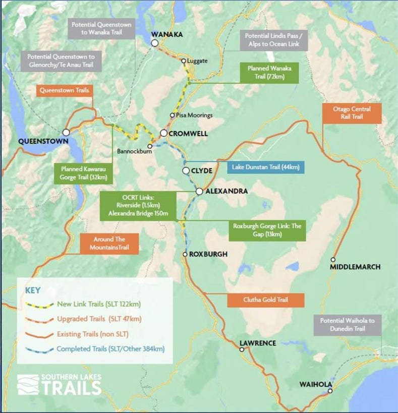
Chris and I started where we left off at Lawrence. It took some time to find the beginning of the new section, because it’s about a kilometre or so before you reach the town. The trail winds around behind Lawrence to avoid the main road, which isn’t immediately obvious when you’re in the town. However, once on the trail, the route is well signposted.
It's a grade 2 (easy) trail with a relatively smooth gravel surface and wide enough to easily pass bikes (or pedestrians) coming the other way. Starting at Lawrence means a bit of a climb initially, but much of the trail follows the old rail route to Milton so the gradient isn't too steep. Roughly a third of the way along, the trail reaches its highest point, and then it's a gradual decline to Milton and mostly flat for the final stretch to Waihola.
On paper, the trail looks to stick fairly closely to the road, with just the odd foray into farmland. I thought this might have been a bit boring. But the trail builders have done a great job in taking the path just far enough away that you don't feel like you are riding next to the road (although sometimes you are).
It's beautiful countryside with lots of rolling hills. There's also a few bush sections and the trail passes through the sleepy settlement of Waitahuna (coffee cart open on weekends) and two old rail tunnels before reaching the town of Milton (the only spot for lunch).
We didn't have to work too hard for most of our ride, but about five kilometres south of Milton, the route reaches State Highway One and veers north - which for us meant a headwind and a bit of a grind through to Waihola.
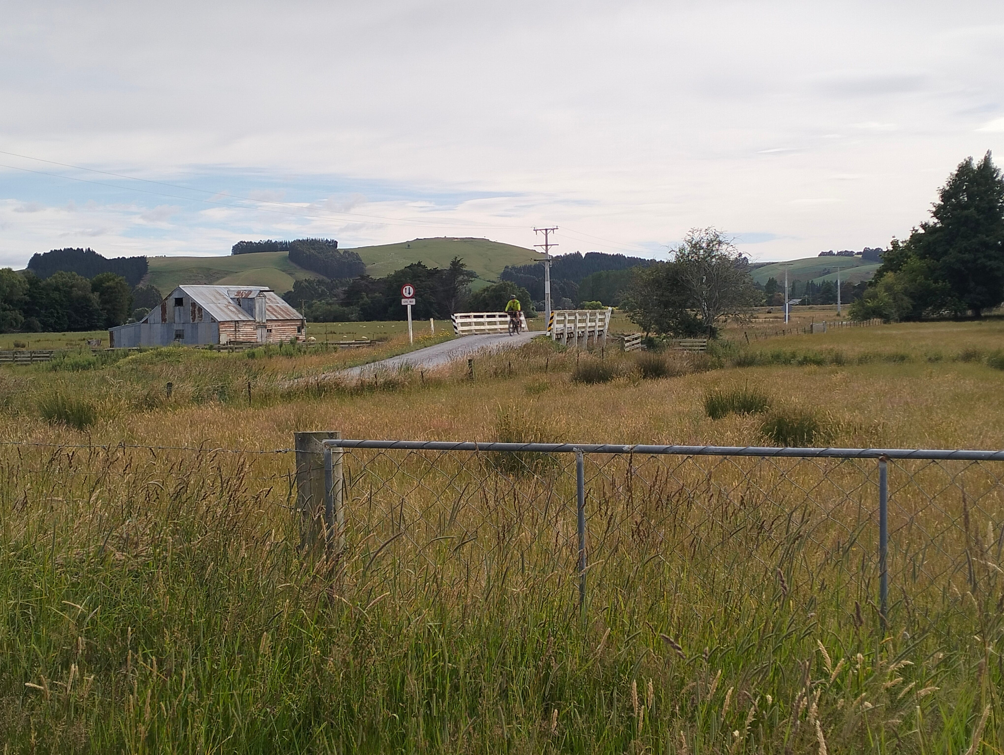
There's lots of new cycle infrastructure in the final section, including several impressive bridges and boardwalk making it easy to cycle around the lake. The trail ends at a reserve by the lake in Waihola. We got a shuttle back to Lawrence, but it’s not far to Dunedin from here.
Overall, we really enjoyed our ride. I think this new section of trail is more scenic than the original, which makes doing the Roxburgh Gorge and Clutha Gold trails back-to-back more worthwhile.
Otago Harbour rides
In Dunedin, we chose to stay on the Otago Peninsula rather than in the city, which meant we only needed to cross the road to join the cycleway. We ended up doing three rides - a loop around the harbour on Te Aka Ōtākou, a ride out to the albatross colony at Taiaroa Head, and a loop around the Otago Peninsula to take us up the hills.
Te Aka Ōtākou
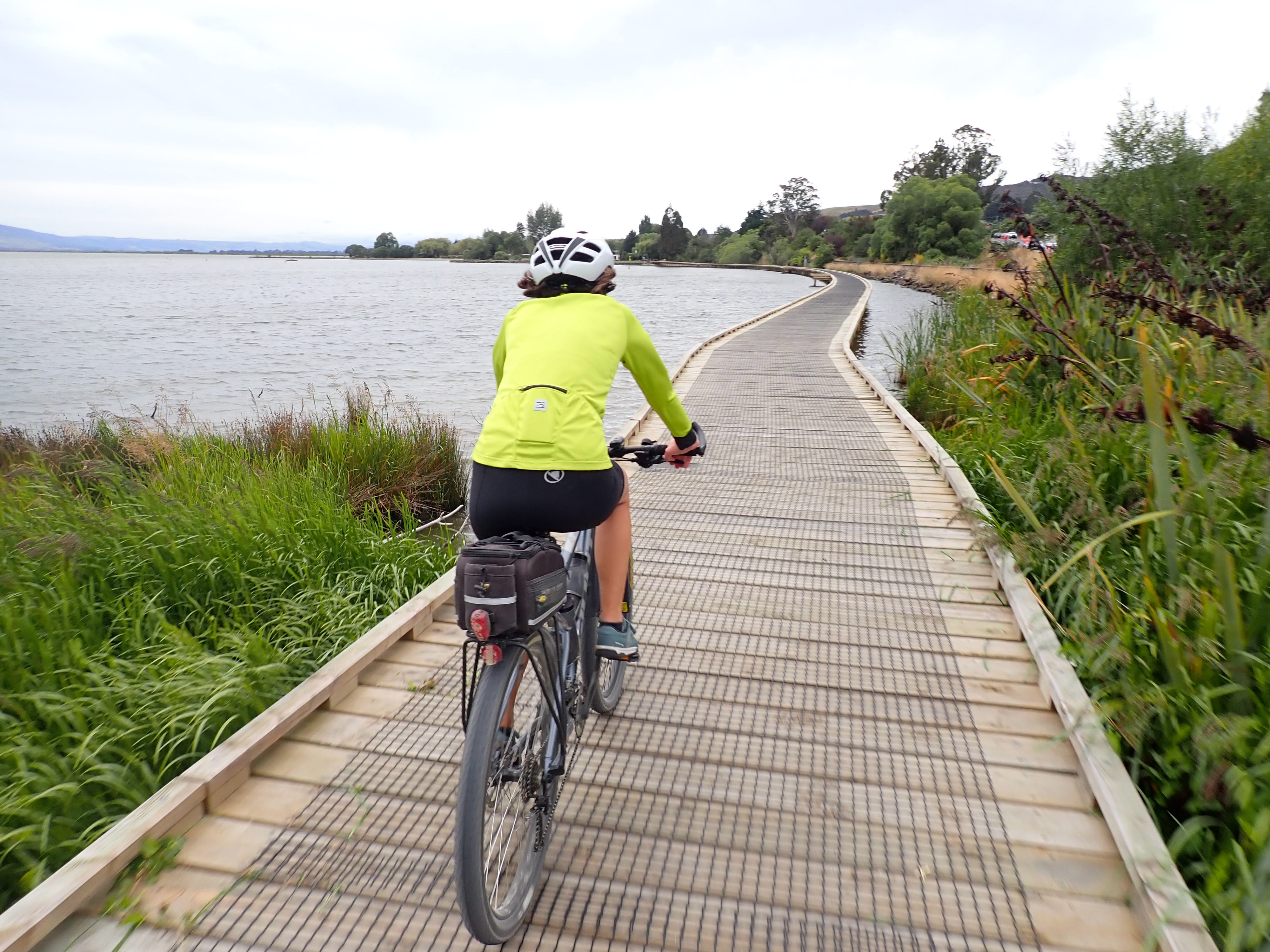
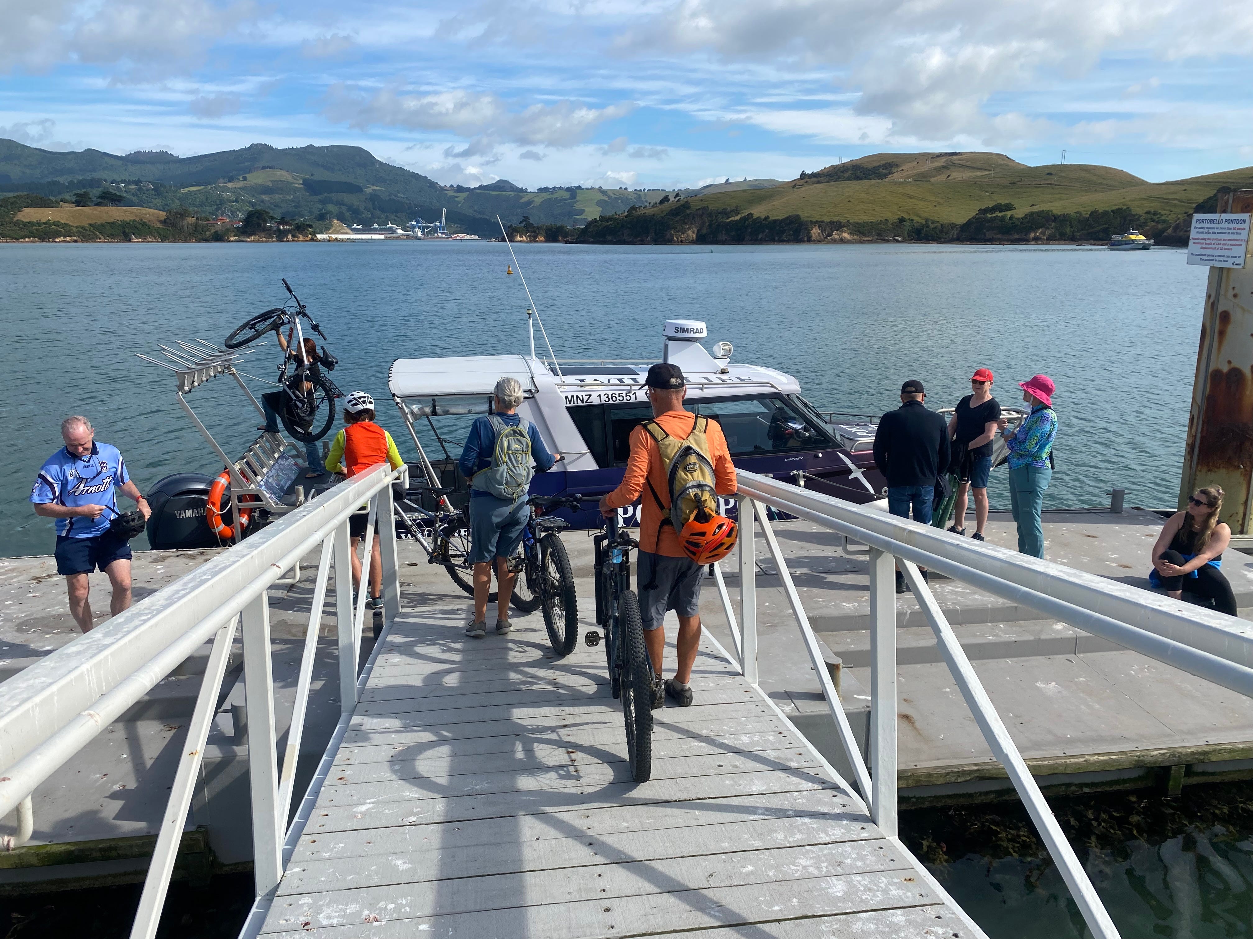
Te Aka Ōtākou consists of two strands (or vines) that wrap around either side of the harbour from Dunedin city: Te Ara Moana (the Ocean Path) goes around the northern edge to Port Chalmers, and Te Awa Ōtākou (the Ocean River) goes along the Otago Peninsula as far as the small settlement of Portobello. Cycle connections through the city and a short boat trip from Port Chalmers to Portobello make for a complete loop.
We started on the peninsula side, cycling to Portobello to catch the boat so we were free to enjoy the rest of our ride without being on a schedule. The trail is an easy sealed path on the sea side of the road, winding around the various bays and settlements along the way. A lot of work went into widening the road and recreating rock sea walls to make space for the path, and there are new boardwalks/bridges in a few places.
We were really impressed with the boat service, run by Port to Port Cruises & Wildlife Tours. It is largely a one-woman operation, run by Rachel McGregor, who organises the bookings, hauls the bikes onboard, skippers the boat, gives a short commentary while crossing the harbour and hands out life jackets to those who are making a longer wildlife tour, before unloading the bikes and setting off again with more passengers. All in ten minutes.
Port Chalmers is a quirky port town, with many old buildings and a smattering of shops and galleries. There were two big cruise ships visiting the day we arrived - most passengers were getting on buses to go elsewhere but some had hired bicycles and were exploring the cycleway too.
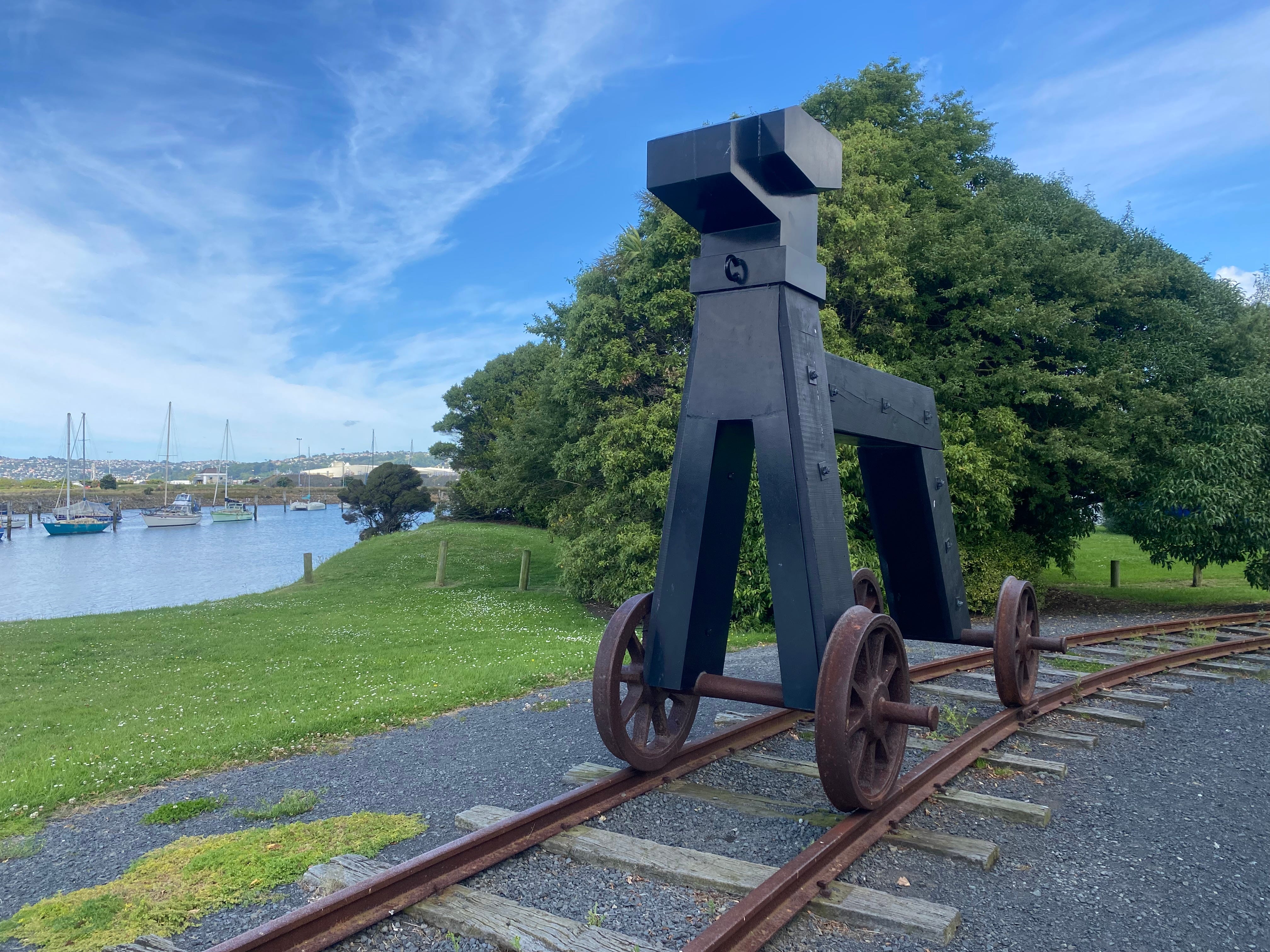
The path back to Dunedin has a different vibe than the peninsula side, travelling alongside the railway line and passing through a mix of residential, business and industrial areas, as well as a marina and several public reserves. There's exercise equipment (and the occasional sculpture) along the way, and it’s undoubtedly a great asset for the local community.
Arriving in the city, the route takes you through a light industrial area (requiring some on-road cycling) before reconnecting with the waterfront and the path back to the Otago Peninsula.
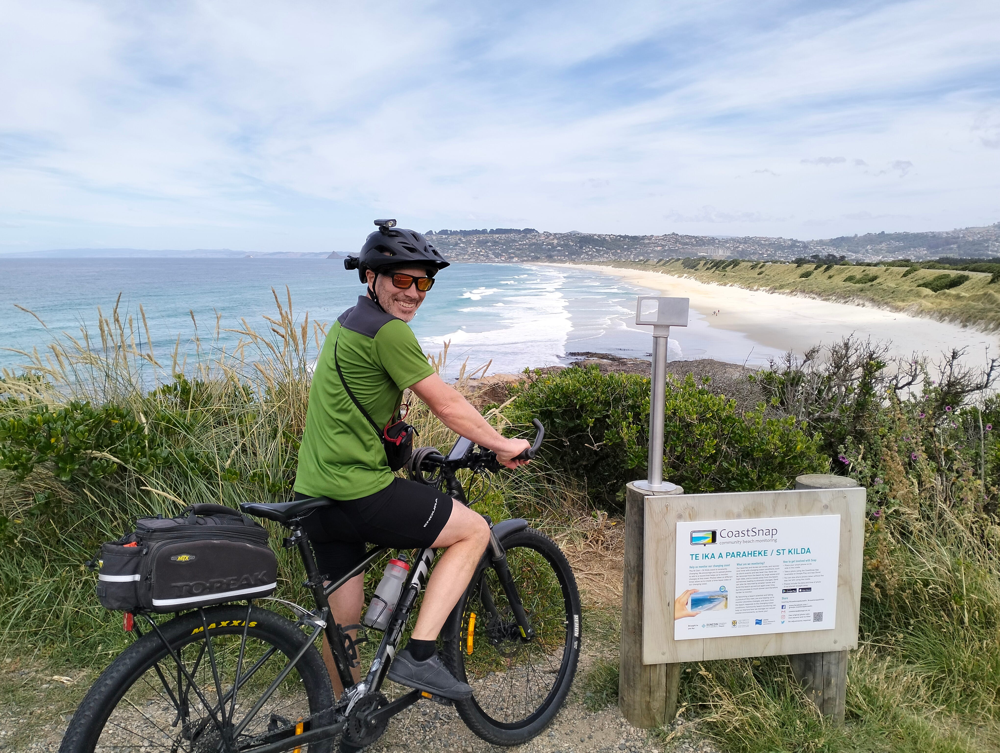
On our way back, we spotted a connecting cycleway to the city’s southern beaches so we decided to see where it went. It took us through to St Kilda, and we ended up having a lovely ride to the lookout at one end of the beach, before doubling back to St Clair Esplanade and the saltwater pool at the other. The National Surf Championships happened to be on that day, adding yet more interest to a relaxing and enjoyable ride.
Taiaroa Head
Our ride to Taiaroa Head took us back along the cycling and walking path to Portobello and then a further 12 kilometres to the southern entrance to the harbour. For most of the way, we cycled on the road but there are a couple of shared pathway sections. It’s a mostly flat ride, apart from a couple of steep hills to climb at the end.
We went early to avoid the tourist traffic visiting the albatross colony. The Royal Albatross Centre is worth a visit and, because of the way it is sited on Taiaroa Head, it’s the only way you’ll get to see the albatross (other than by boat). However, you can look out over the rocks and view seals on the sea side or walk down to a small beach on the harbour side. There are also old gun emplacements nearby you can visit.
Hill ride
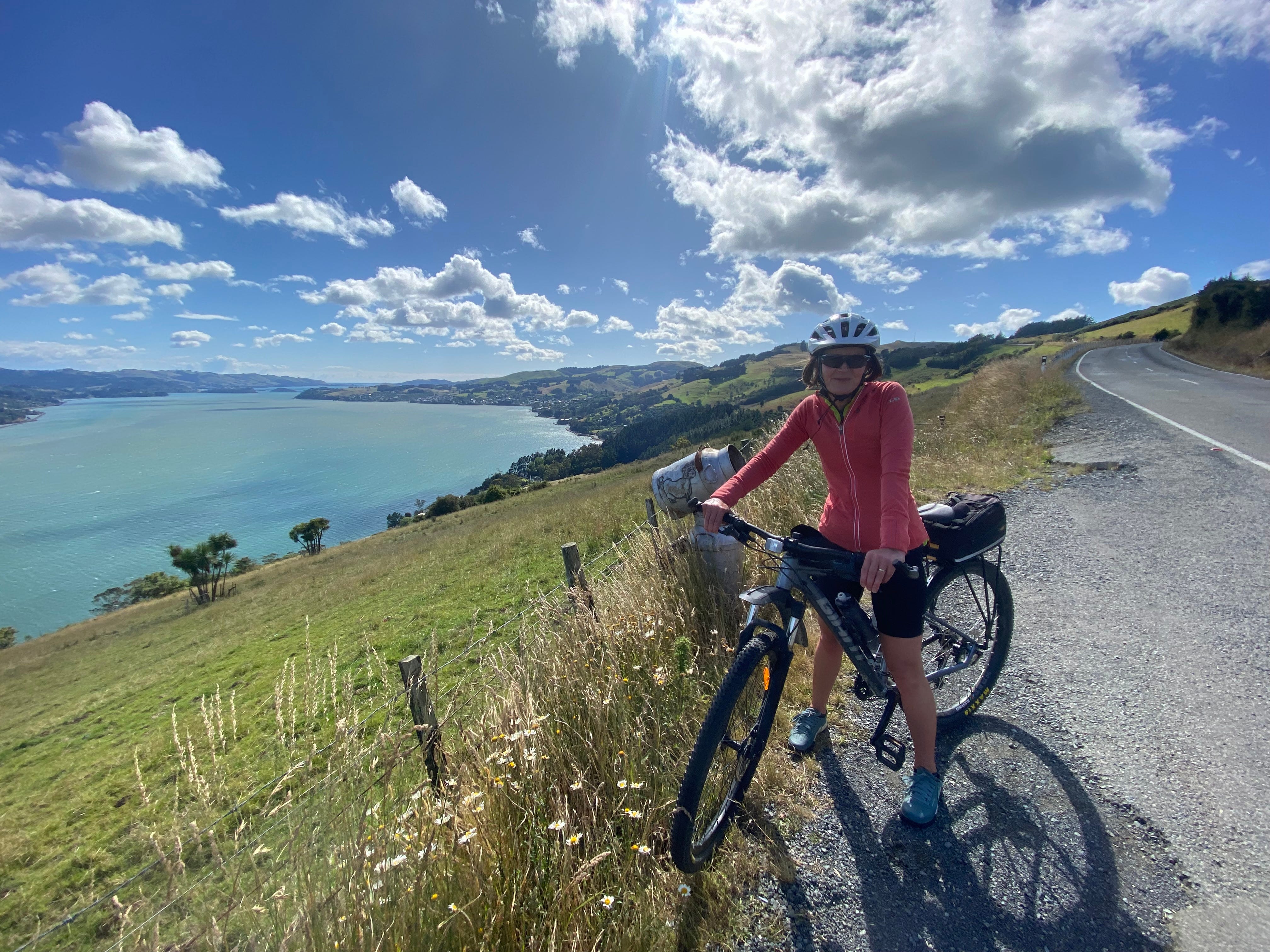
For our final harbour ride, we re-joined the shared path and cycled in the opposite direction, heading along the peninsula road towards Dunedin. From here, we were able to loop around to the hill road (Highcliff Road) that runs along the top of the peninsula and goes all the way back to Portobello. As you might expect, there were stunning views all around.
From Highcliff Road, you can visit Larnach Castle. We made a small detour, thinking we’d be able to at least catch a glimpse of the building and gardens. But, thanks to a combination of fencing and tall trees, it was not to be. You can pay a reduced charge to visit the gardens and café but we chose to bike on, stopping at Portobello for (very good) coffee instead.
The only downside to our ride was a strong headwind when we set off (think Wellington just short of its umbrella-breaking best), making for a very tough ride until we turned in to the hill road. (And of course we got it again once we came off the hill at Portobello and had to ride back around the bays to our start point.) Otherwise, a great ride.
Some non-cycling highlights
As always, we took some time to explore off the bike as well.
Gabriel’s Gully
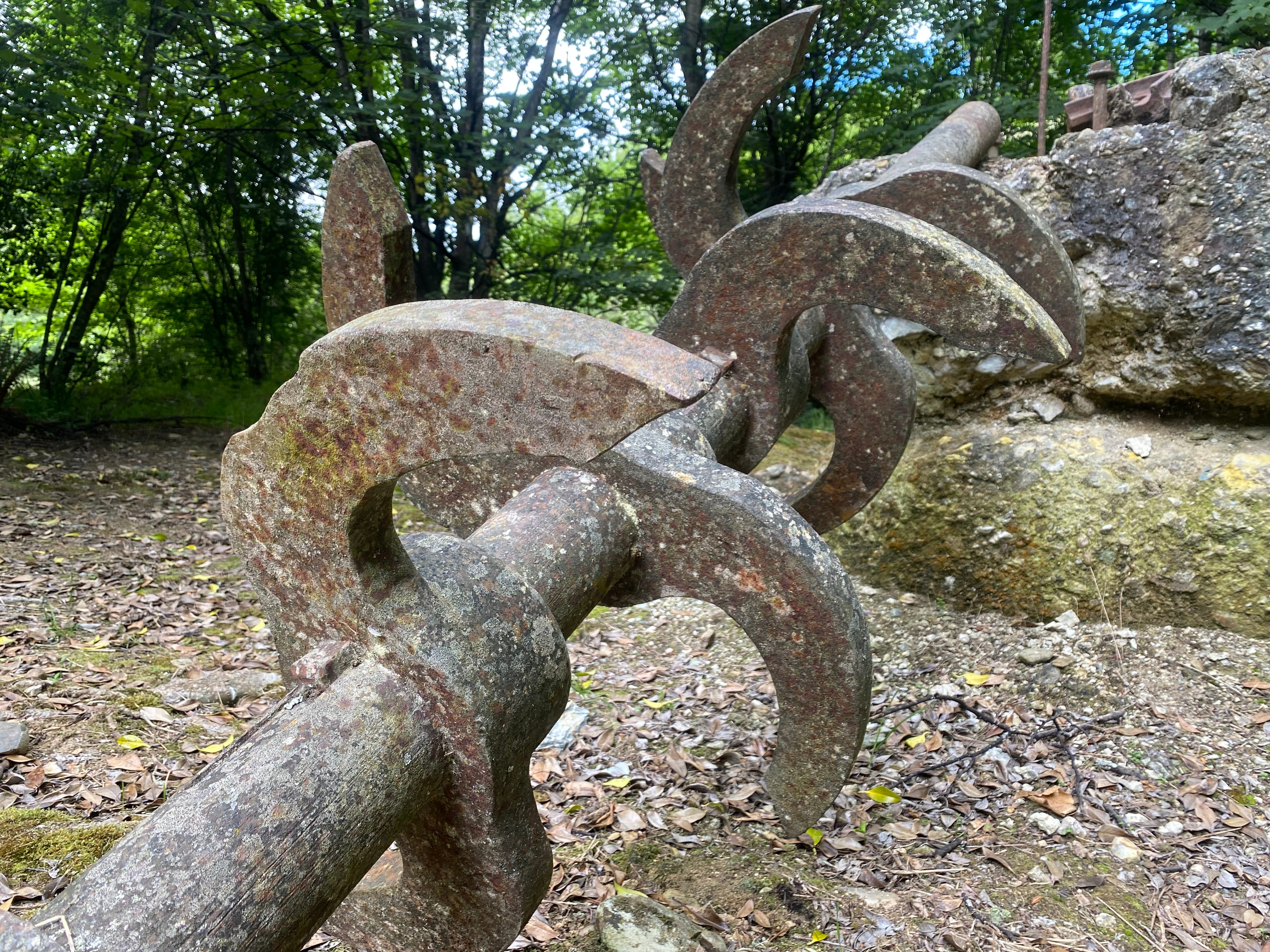
Gabriel’s Gully is close to Lawrence and is the site of New Zealand’s first major gold rush. It’s named after Gabriel Read who discovered gold there in 1861. At its peak, there were over 10,000 people living and working in the area, but activity dwindled by 1921 and mining ended altogether in the 1930s.
The Department of Conservation manages the site and has developed a three-kilometre walking track so you can imagine how it would have been. There are some rusty old remnants of equipment used by the miners, but it’s the physical changes to the land - water race channels, a dam, small caves for storing gunpowder, and a mine entrance - that give a better sense of what went on. Interpretation panels explain what you’re looking at and share stories of life on the goldfield.
Dunedin beaches
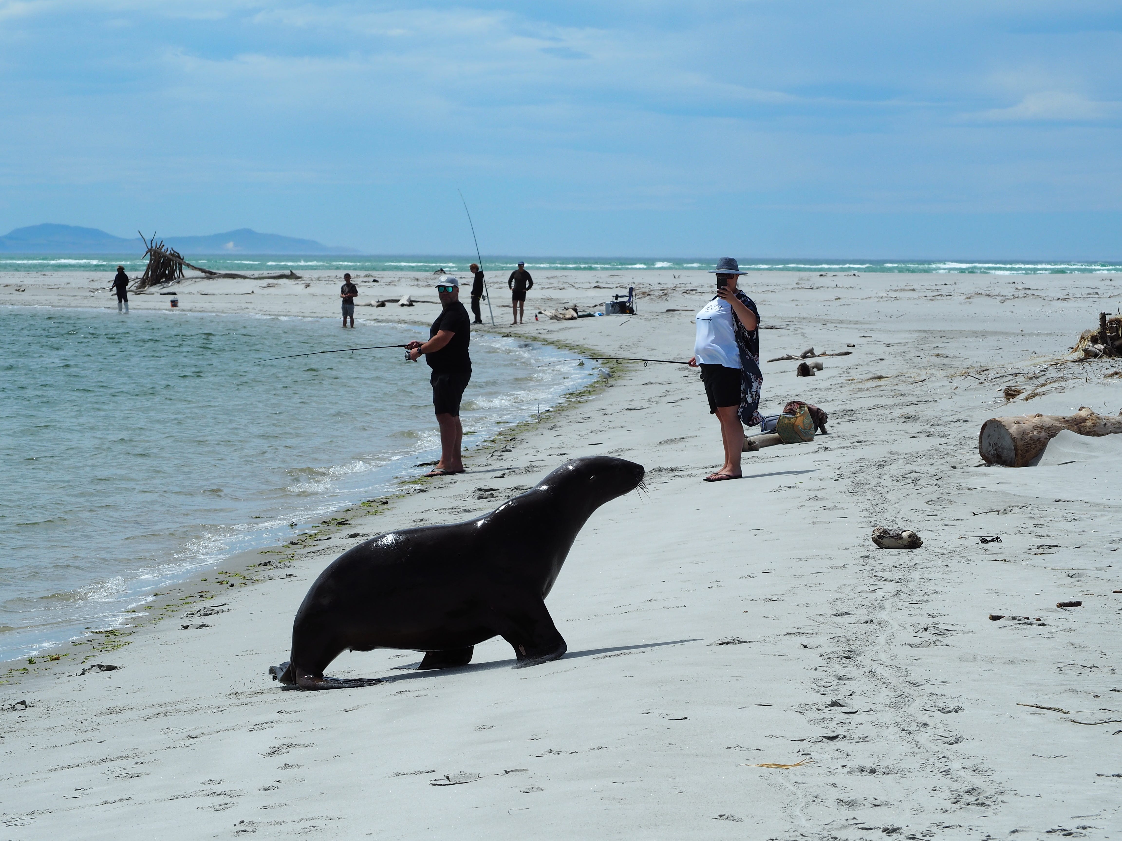
Dunedin is blessed by having many spectacular beaches within close proximity of the city. The water’s cold so they’re not the best for swimming (unless you do like the locals and don a wetsuit). But they are great for walking and spotting wildlife, especially sea lions.
We’ve explored lots of different beaches on previous visits to the area. This time we went to Taieri River Mouth, which we hadn't visited before, and to Aramoana (which we had). Taieri River Mouth is south of the city and is a popular fishing spot, as well as having a long sandy beach. Aramoana is closer to Dunedin, on the northern entrance to Otago Peninsula, and has two beaches to choose from. Chris collected lots of shells here.
At both places, we came across a sea lion as soon as we arrived. And at both places, we gave them a wide berth and admired them from afar. (The sea lion at Taieri River Mouth was causing some frustration to beachgoers by alternately swimming exactly where one family was, and then sunbathing exactly where another was trying to fish. Eventually, it settled in one spot and some sort of equilibrium was reached.)
Love seeing trails growing internationally. Trails benefit society in many ways Those trails must have amazing views.