


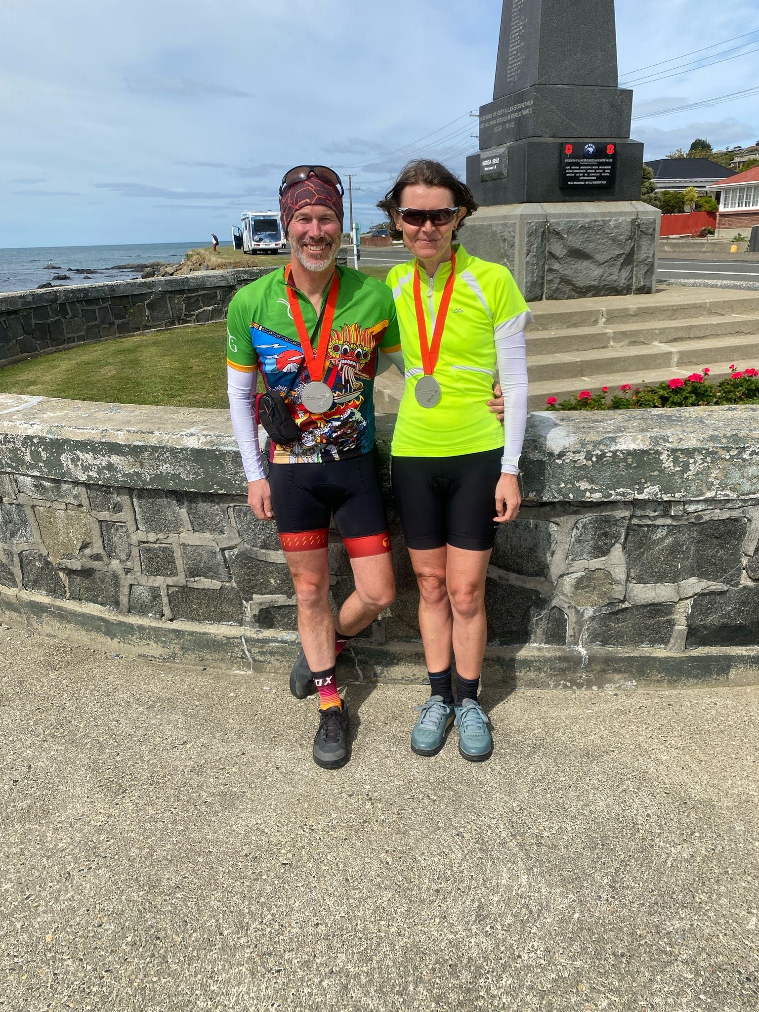
We made it to Bluff!
Our South Island Tour Aotearoa comes to an end

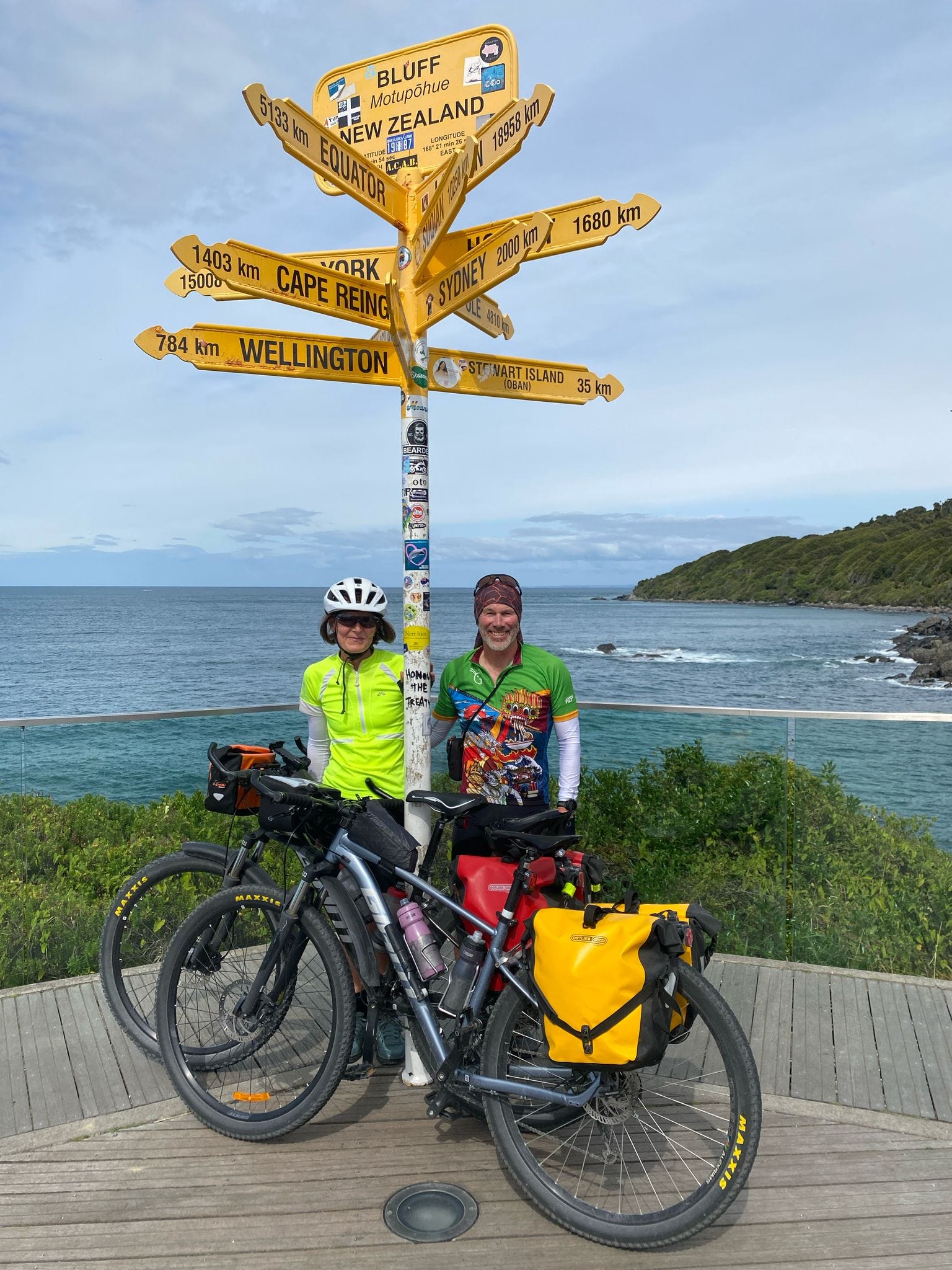
After 20 days on the road (18 cycling), Chris and I rolled into Bluff. It's been an amazing few weeks - great weather, fantastic scenery and lovely people along the way. But we are tired and ready to stop now.
The last few days have been tough - with some big climbs, long rides and a day of strong head winds. Thankfully, our final day was relatively calm (and flat) so we enjoyed a relaxing ride into Bluff in almost perfect cycling conditions. And we had some familiar faces to meet us at Stirling Point (my mum and dad).

Wānaka to Queenstown
After the brutally steep climb over the Haast Pass I was a bit anxious about going over the Crown Range from Wānaka to Queenstown. We have elevation profiles in our guidebook and GPX maps, but it's still hard to judge how steep the climbs really are - we’ve had some saddles that have turned out to be no big deal, and other small hills that have been surprisingly tough.
Mostly, the Crown Range was not too steep, with a gradual rise out of Wanaka and through the Cardrona Valley. It wasn't really until the final few kilometres that we had to use our lowest gears. I found it easier than the Haast Pass, but Chris was feeling a little under the weather so found it more gruelling.
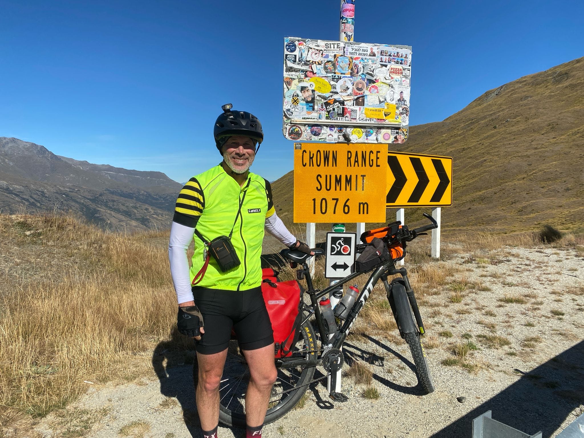
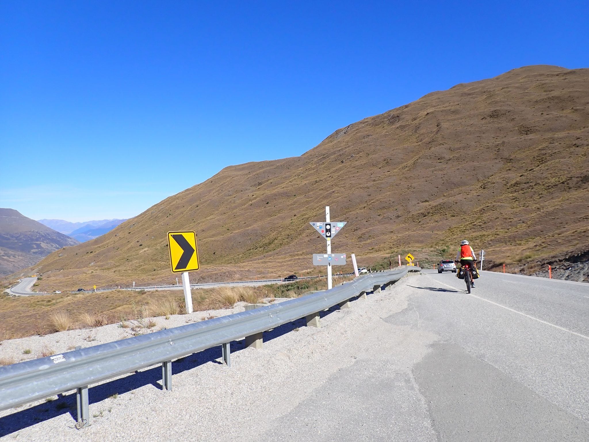
We’d left Wānaka early but there was a lot of traffic by the time we got to the summit, and we had to time our descent carefully because the lack of shoulder meant we had no option but to take the lane. We had to turn across the traffic before we fully descended, so that was just a little bit stressful too.
Once we turned off the main road, we were on a lovely quiet gravel road that led to a not-so-lovely four wheel drive track (Tobin’s Track) to Arrowtown. The downhill was steep and bumpy (great for mountain bikers but not me) but it was a good shortcut to Arrowtown.
After lunch, we carried on to Queenstown on three of the trails that are part of the Queenstown Trail network. First, we followed the Arrow River Bridges Trail (along the Arrow River), then connected to the Twin Rivers Trail (cycling mainly along the Kawarau River and crossing over the Shotover River). Finally, we took the Frankton Track around the edge of the lake and into Queenstown.
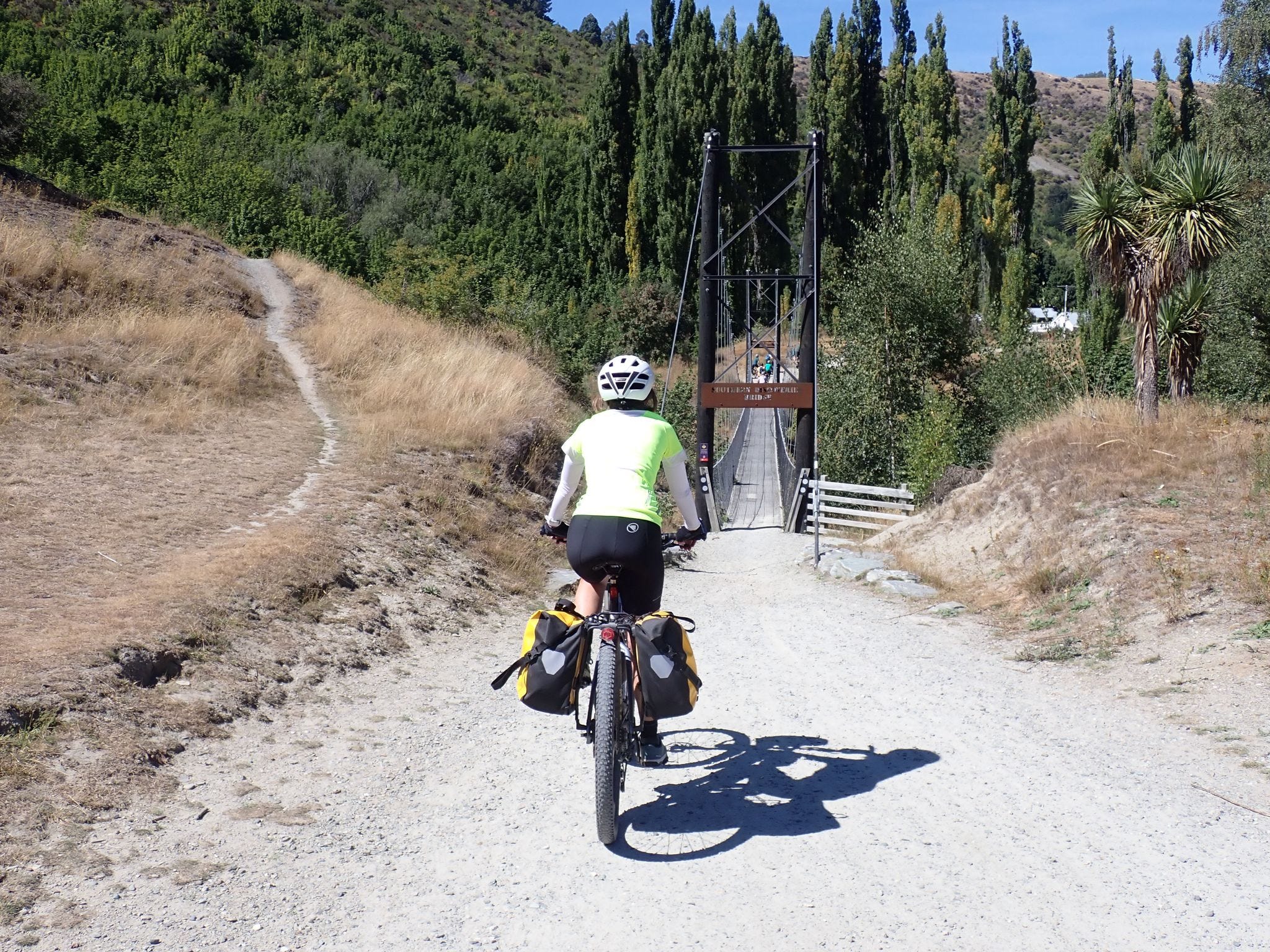
They are all grade 2 or 3 trails (easy to intermediate) and have Great Ride status. We've cycled some of them before and really enjoyed them, especially the Arrow River Bridges Trail, which provides great views of the mountains and is spectacular when the autumn colours are out. This time, we were probably a bit hot and tired to fully enjoy them and, after a few hours winding up, down and around on gravel tracks, we were happy to get to our accommodation.
Queenstown itself offers spectacular scenery, with its lakeside setting and imposing mountains. Unfortunately, it's become a very busy place, with people everywhere and clogged-up traffic. (Wānaka is much more relaxing and definitely the pick of the two lake towns.)
Queenstown to Mossburn
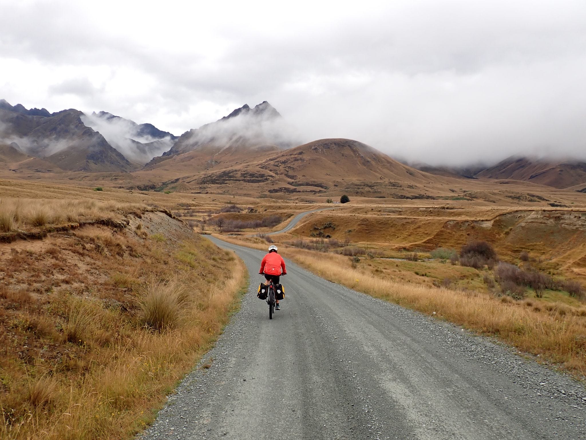
The next morning we were up early to catch a boat across the lake to Walter Peak station. The Tour Aotearoa route follows the Around the Mountains Cycle Trail from there through stunning high country to Mavora Lakes, and then on to Mossburn.
We were a bit unlucky with the weather, with rain and low cloud obscuring the views for the first hour and a half. And cycling on wet weather made for slow progress. But as we approached Von Hill, the cloud lifted, the views improved and we started to dry out.
I’ve written about cycling around the mountains on this route before (and there are some great photos in that post). Last time, we cycled to Mavora Lakes on one day, and then got dropped back at a spot called Centre Hill another day, skipping a 29 kilometre stretch of lumpy gravel in the middle. But we wouldn't be cycling the Tour Aotearoa from one end of the country to the other if we missed bits out. So this time, we did the lumpy gravel bit too, and then carried on to Mossburn for good measure.
This was our longest cycling day, at 105 kilometres, with about six hours cycling. The whole day was on gravel, which was mostly ok, except for the lumpy bit in the middle. Much of that was on a long straight road with no places to stop or points of interest along the way, and some parts were heavily corrugated, which made for an uncomfortable ride.
However, the ride through to Mavora Lakes was great (once the rain stopped), and we were happy to make it up Von Hill, which requires yet another steep climb for about two kilometres.
From Centre Hill, the route flattens out, and it's an easy ride winding along the Oreti River through farmland to Mossburn. I was starting to feel a little under the weather myself by then (I actually thought I might fall asleep while cycling) so we took it easy and loaded up on jet planes to get us to the end.
Mossburn is just a tiny town with a few shops and services supporting the rural community. But there's a pub of course, and we enjoyed one of the best meals of our trip there,. Even better, we had an entire accommodation complex to ourselves for the night. Bliss.
Mossburn to Bluff
Some cyclists will go from Mossburn to Bluff (137 kilometres) in one day. With the end of the tour in sight, that's a tempting thing to do. But we decided to split it into two days, and I am very glad we did.
The Tour Aotearoa continues along the Around the Mountains Cycle Trail for 13 kilometres and then heads south all the way to Bluff on the Southland Traverse route, using rural back roads.
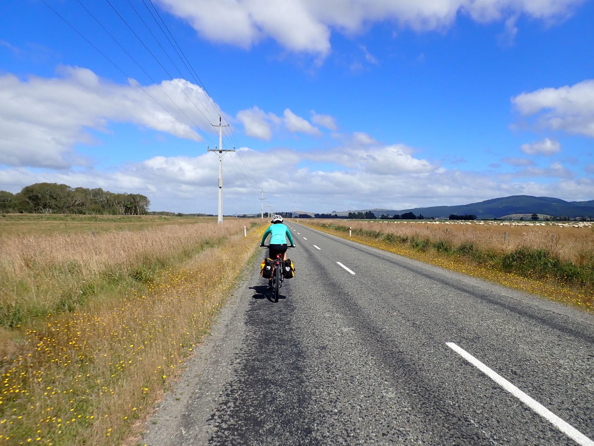
On the first day, we had plenty of time so decided to detour off the route to Lumsden (a small town) for coffee, and then later Dipton (barely a village) for a picnic lunch. It was a beautiful sunny and calm morning when we set out and we had a relaxing ride. We cycled through farmland (mainly sheep and dairy) on quiet roads. There were a few rolling hills around us but our ride was predominantly downhill.
However, by late morning the wind had started to come up, and unfortunately we were heading almost directly into it - for 55 kilometres. What we thought would be an easy ride soon turned into an uncomfortable grind. The roads were long and straight, which I find a lot harder than hills because you don't move much in the saddle while riding. When we finally got to Winton, I wasn't sure I would be able to sit down, let alone start cycling again the next morning.
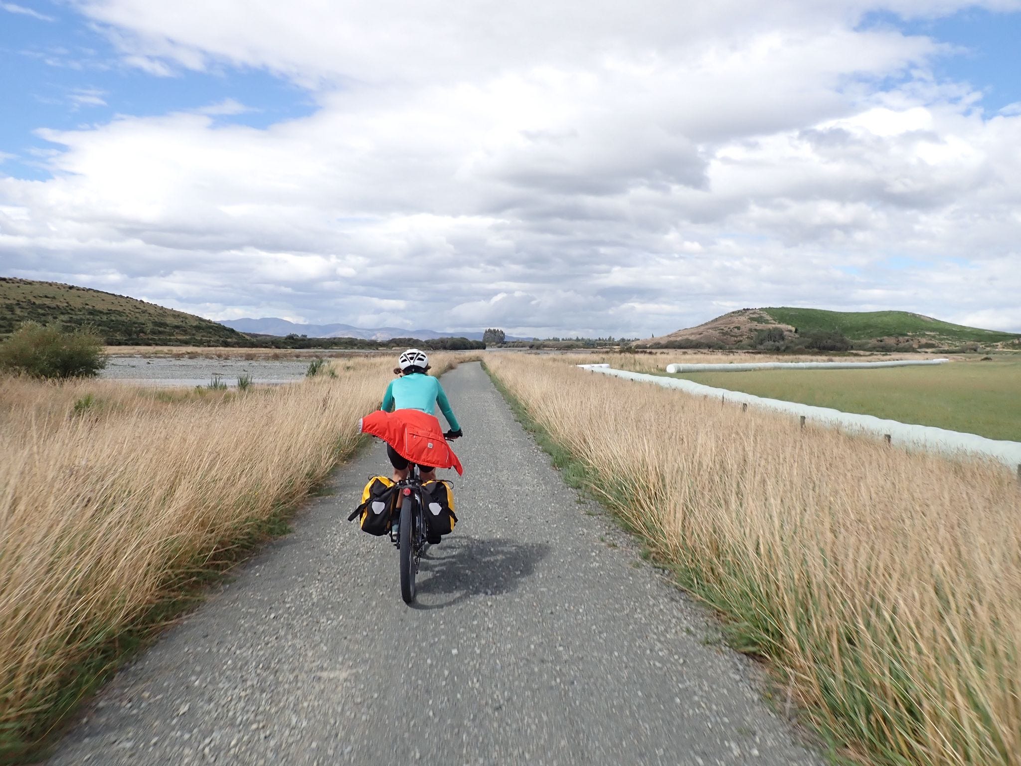
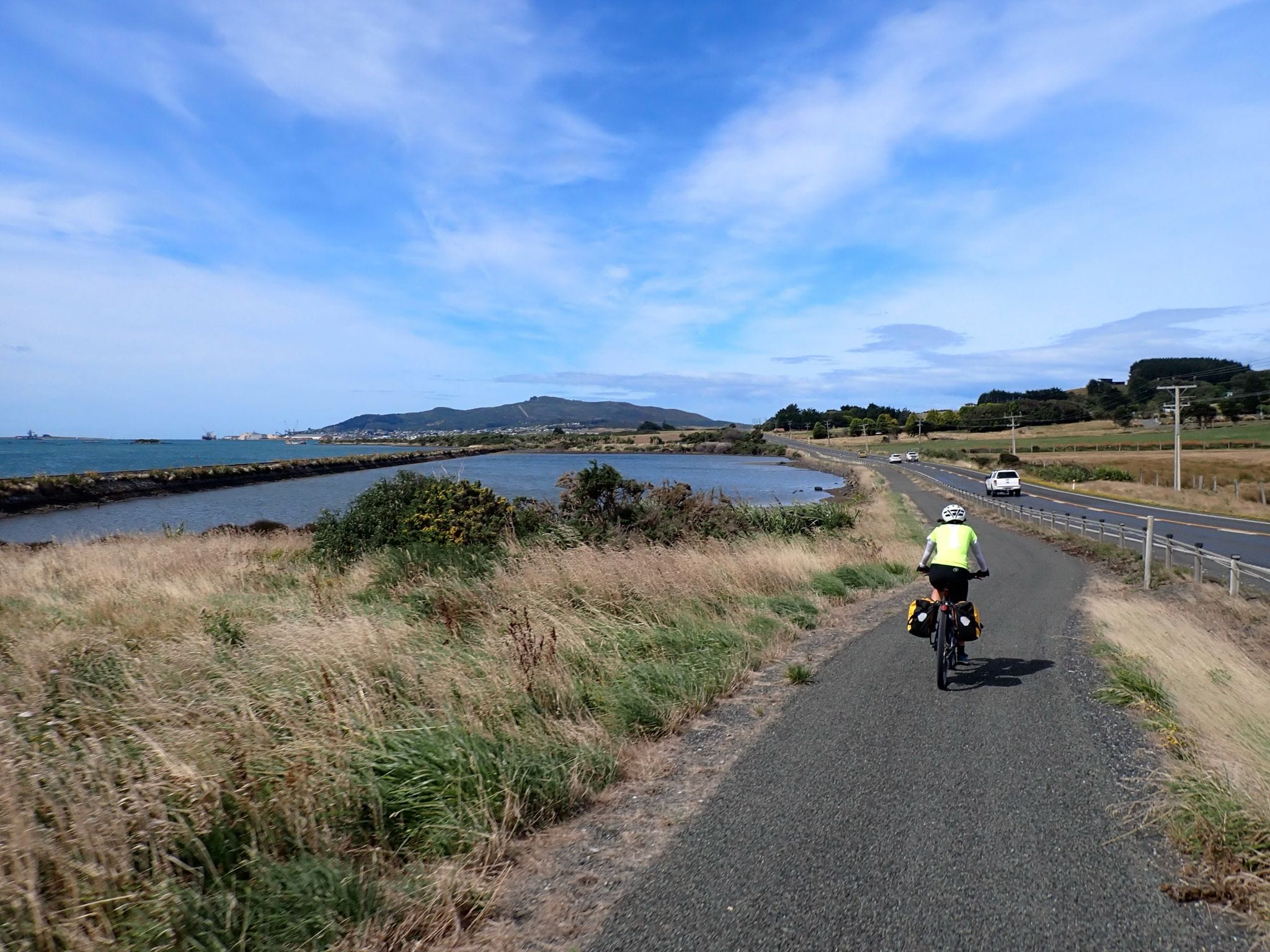
So, I was very happy that today's final ride was a good one. We had a slight tail wind initially as we continued along more straight roads through more farmland. Before long we were on a gravel cycle trail skirting around the edge of Invercargill (a small city) and along the estuary. It was a lovely ride away from the traffic.
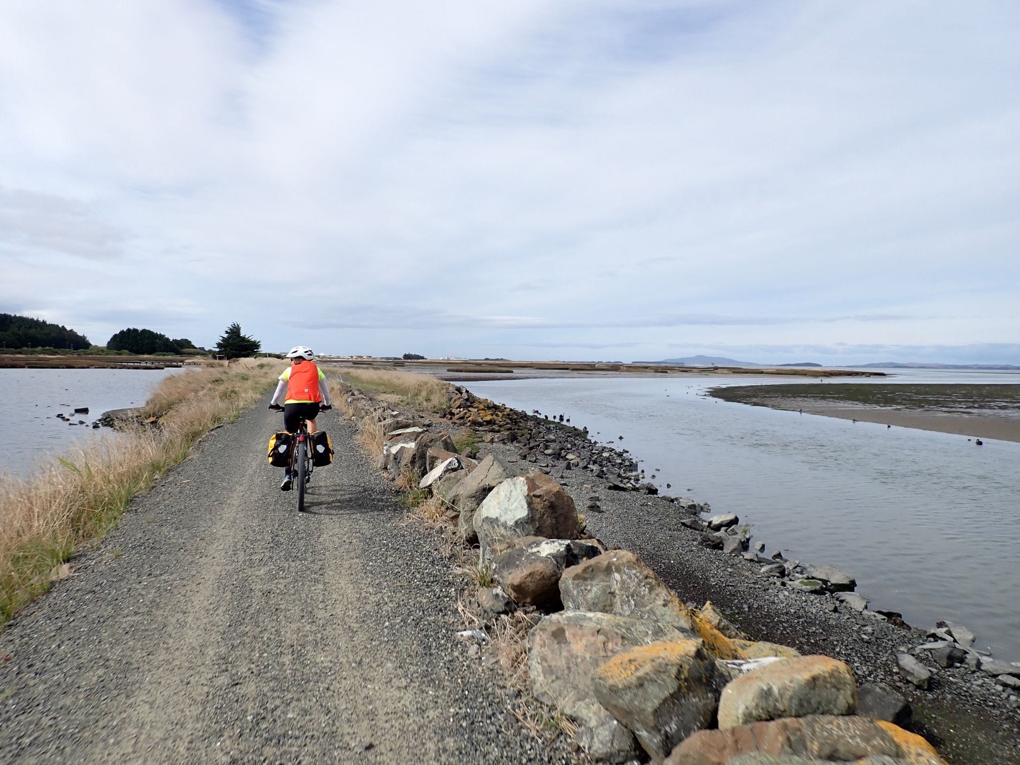
The cycle trail eventually joins the main road to Bluff and continues alongside it. We had a brief period of head wind again but we could see Bluff getting closer, which kept us motivated.
As you approach Bluff, the road turns away from the wind and follows the harbour around to the town and to the end of the Tour Aotearoa route at Stirling Point. It's a lovely scenic end to the tour.
And then we stopped cycling. We took lots of photos. We picked up some finisher medals from the local post office. And we celebrated with some mini bottles of sparkling wine and a picnic lunch. And drove back to Invercargill for a rest.
Congratulations 👏👏. Thank you so much for sharing the journey. Was almost like being there-from the comfort of my lounge😂. The days of keeping dry until so close to the end reminded me of Timber Trail on NI.
Glad that you felt ready to hang up your helmets at the end. Job done ✅. I wonder how much of that is mental, knowing that the end is nigh? If another week was in the programme, I’m sure you could have pushed through.
Anyway, you have created some wonderful, amazing memories. Your organisational skills are second to none. Congratulations again. Enjoy the feeling of achievement and the comfort of your own bed xx
Congratulations Angela and Chris! What an amazing achievement. Thanks for sharing these posts with us